
Beskrivelse
![]()
![]()
![]()

![]()
![]()
![]()
![]()
![]()
![]()
![]()
![]()
![]()
![]()
![]()
![]()

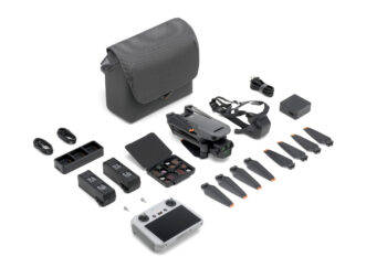
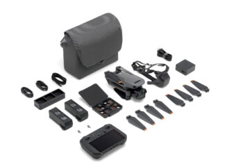
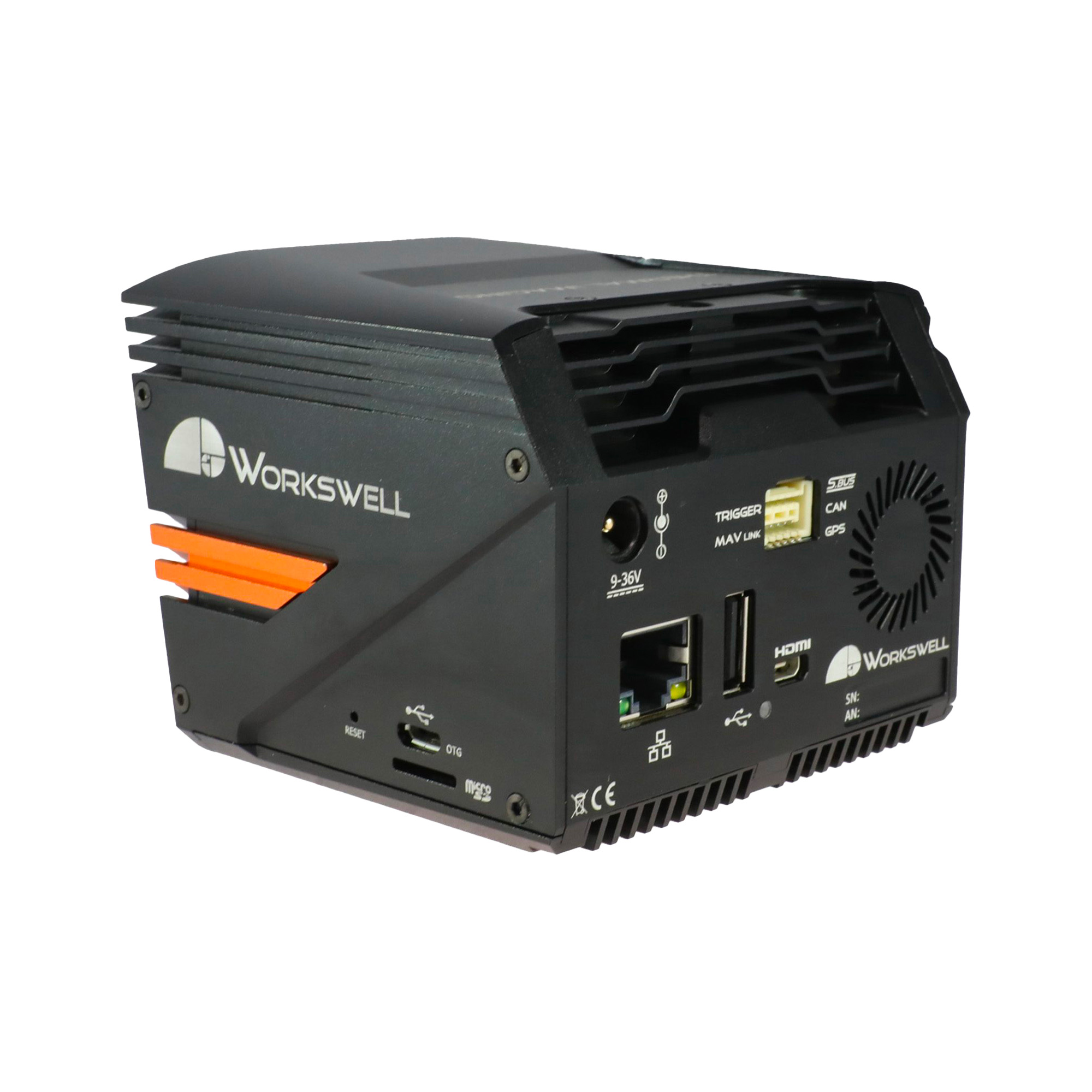
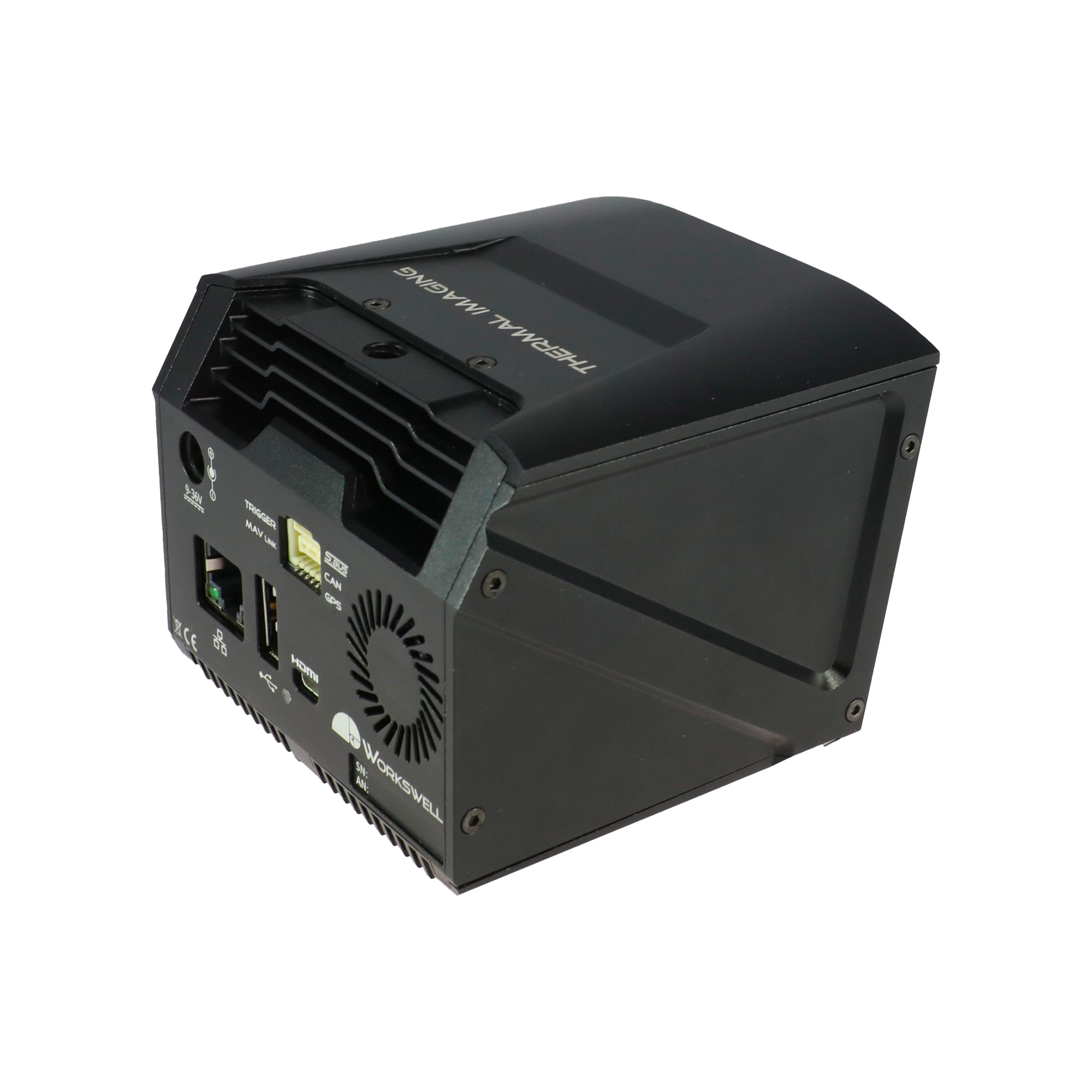
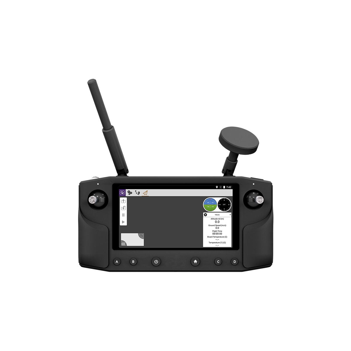
Ground Control Station
Herelink HD
Display: 5.46” Touch screen, 1080p
Frequency Band: 2.4 GHz ISM
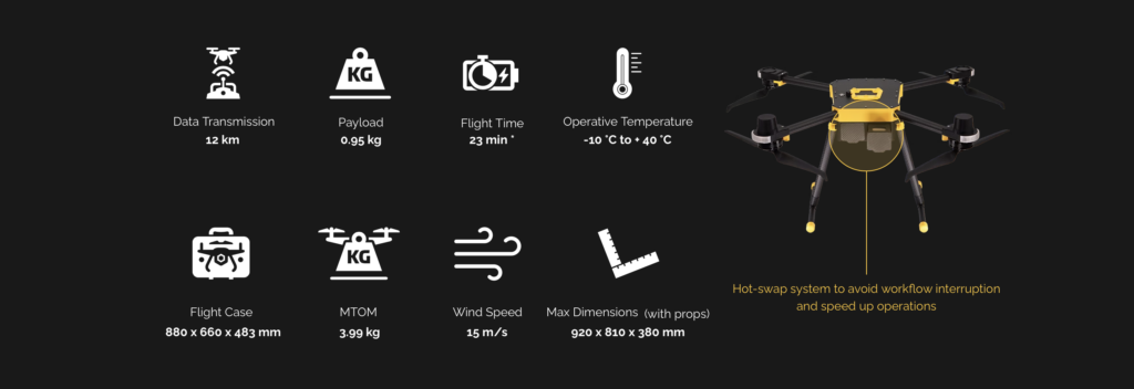
Range: Up to 12 km (CE), Up to 20 km (FCC)
Telemetry: 2.4 GHz digital link, MAVlink protocol with AES-128 encryption
Connections: Micro USB for charging, debugging and firmware upgrade; OTG supported
Wireless Communication: Bluetooth/Wi-Fi 5 GHz/GPS
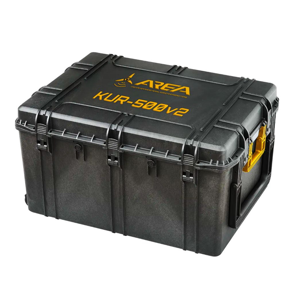
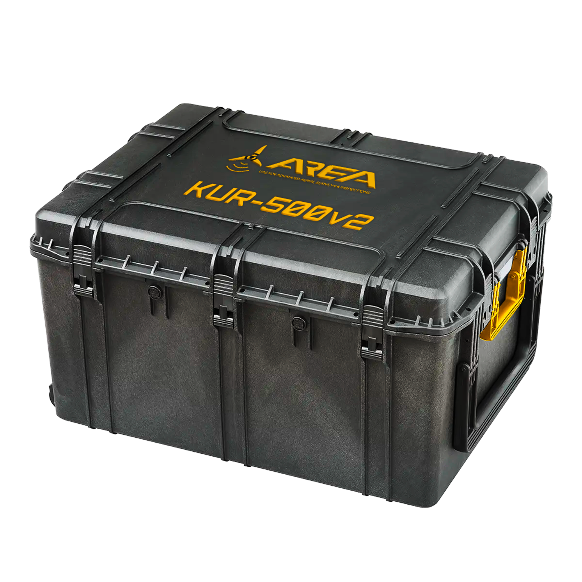
Flight Case:
Width × Height × Depth: 880 x 660 x 483 mm
Empty Mass: 14,78 kg
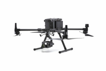
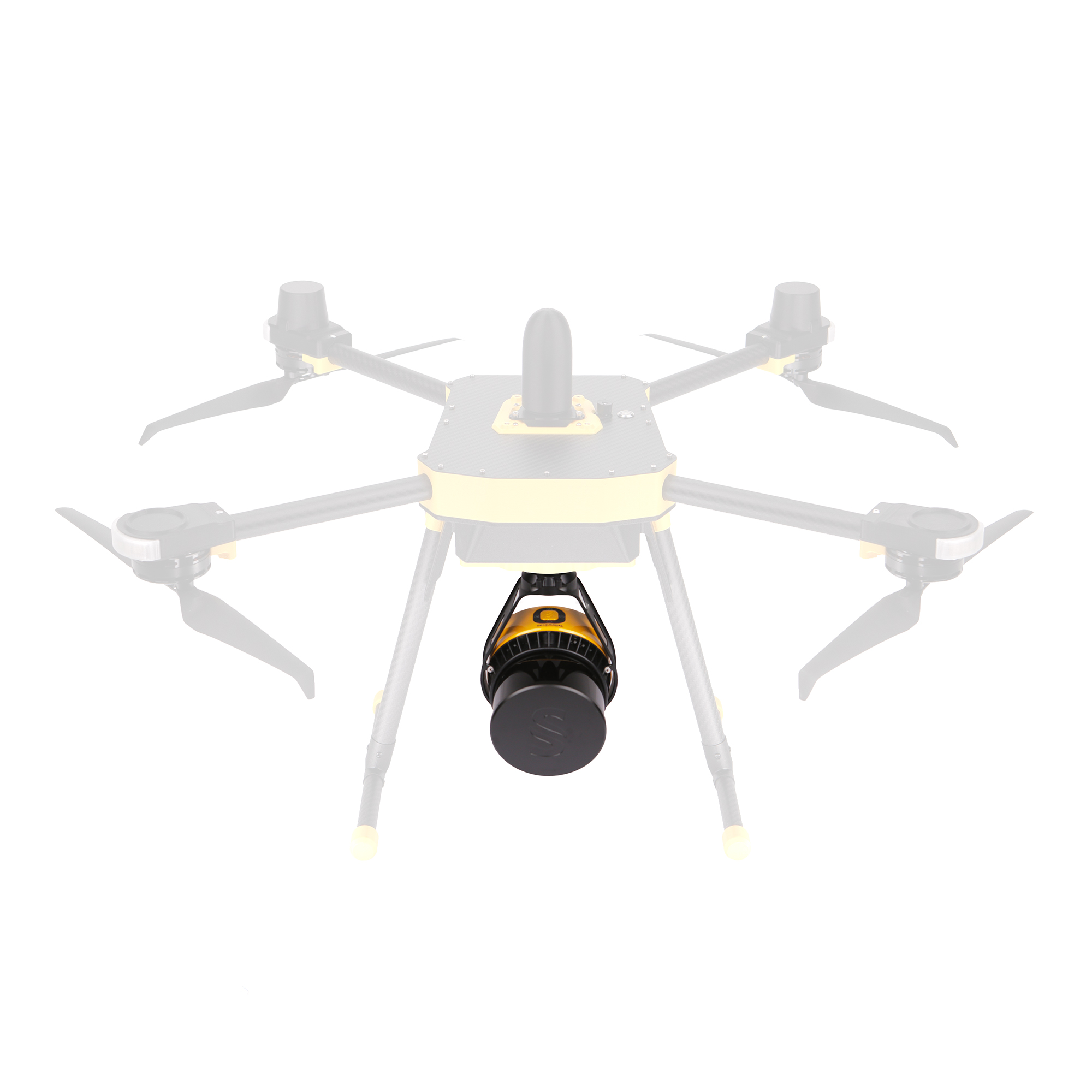
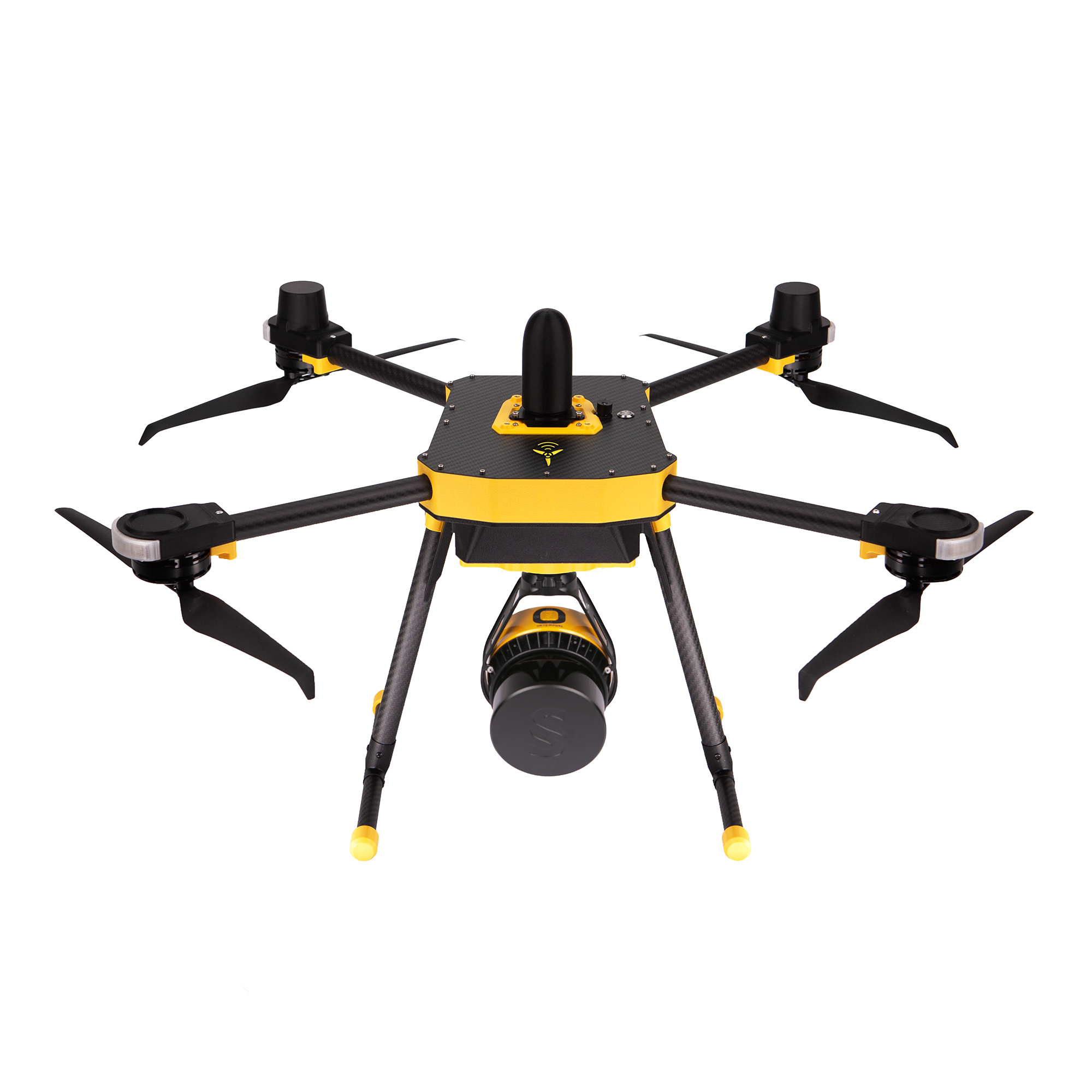
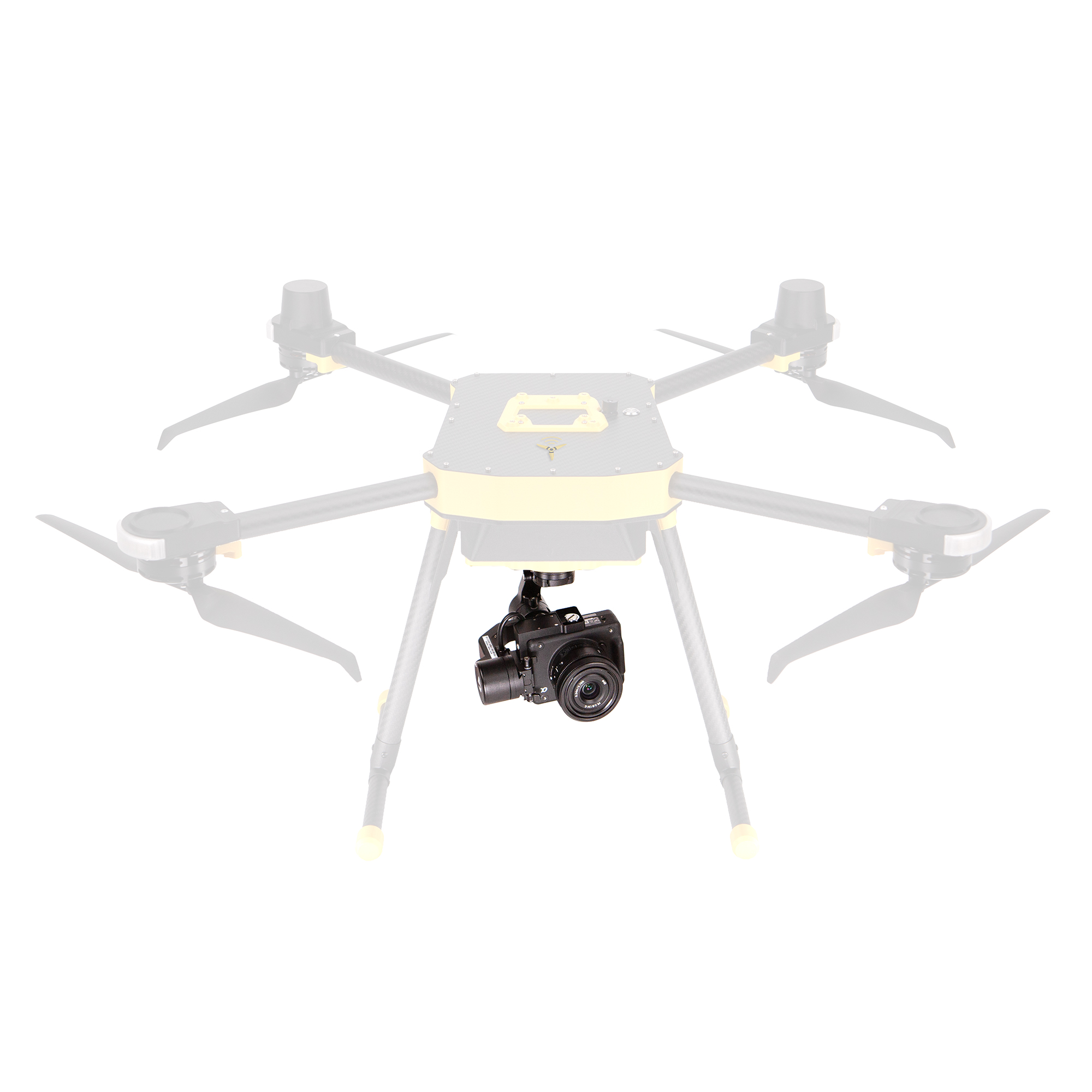
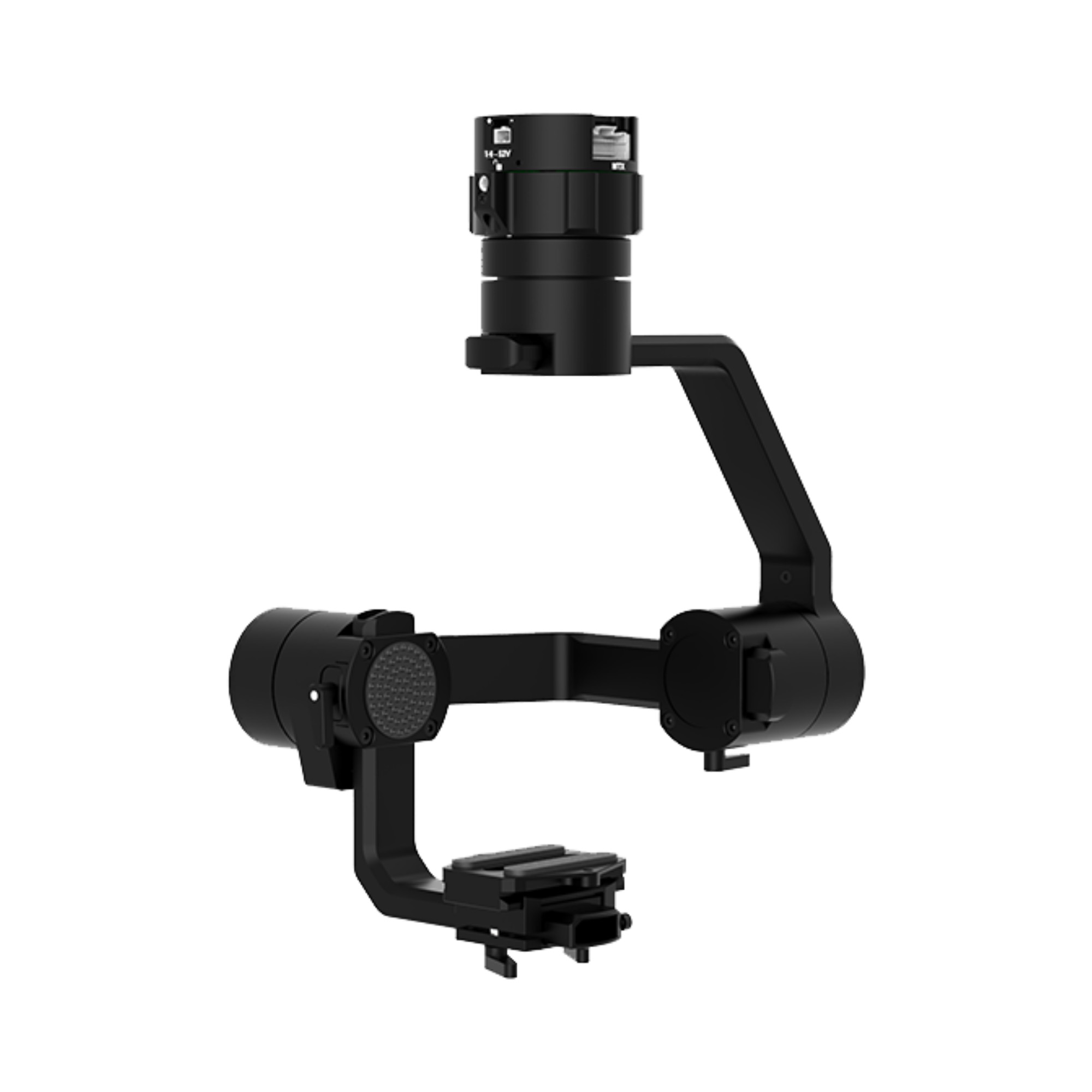
Gimbal

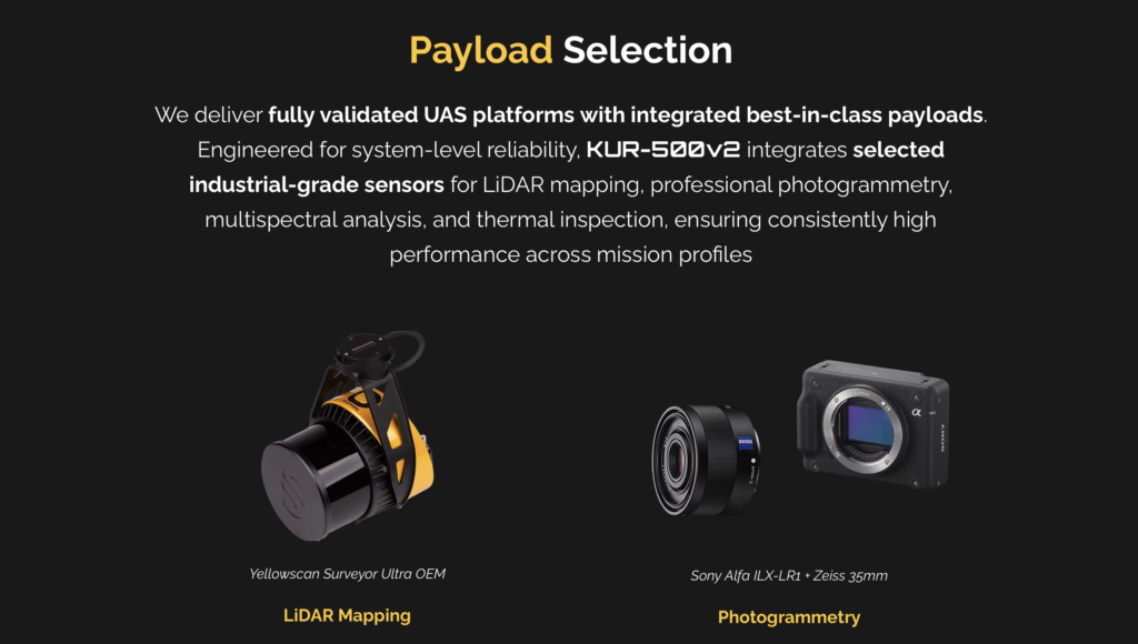
PayLoad Selection
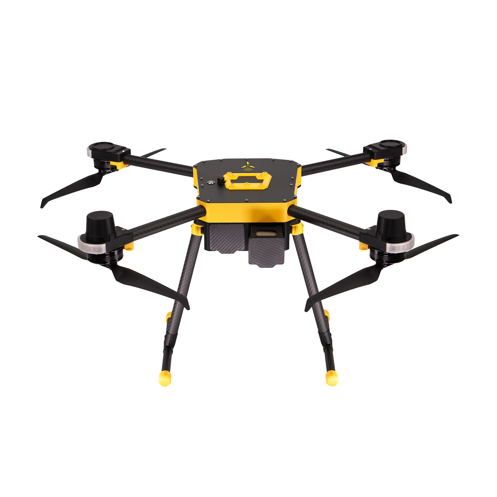
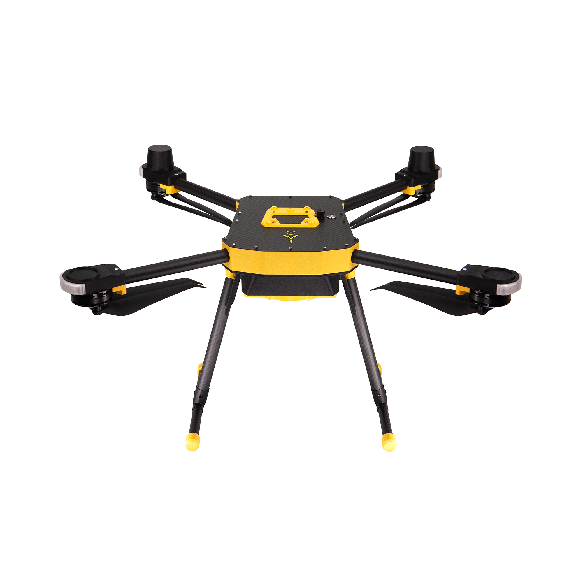
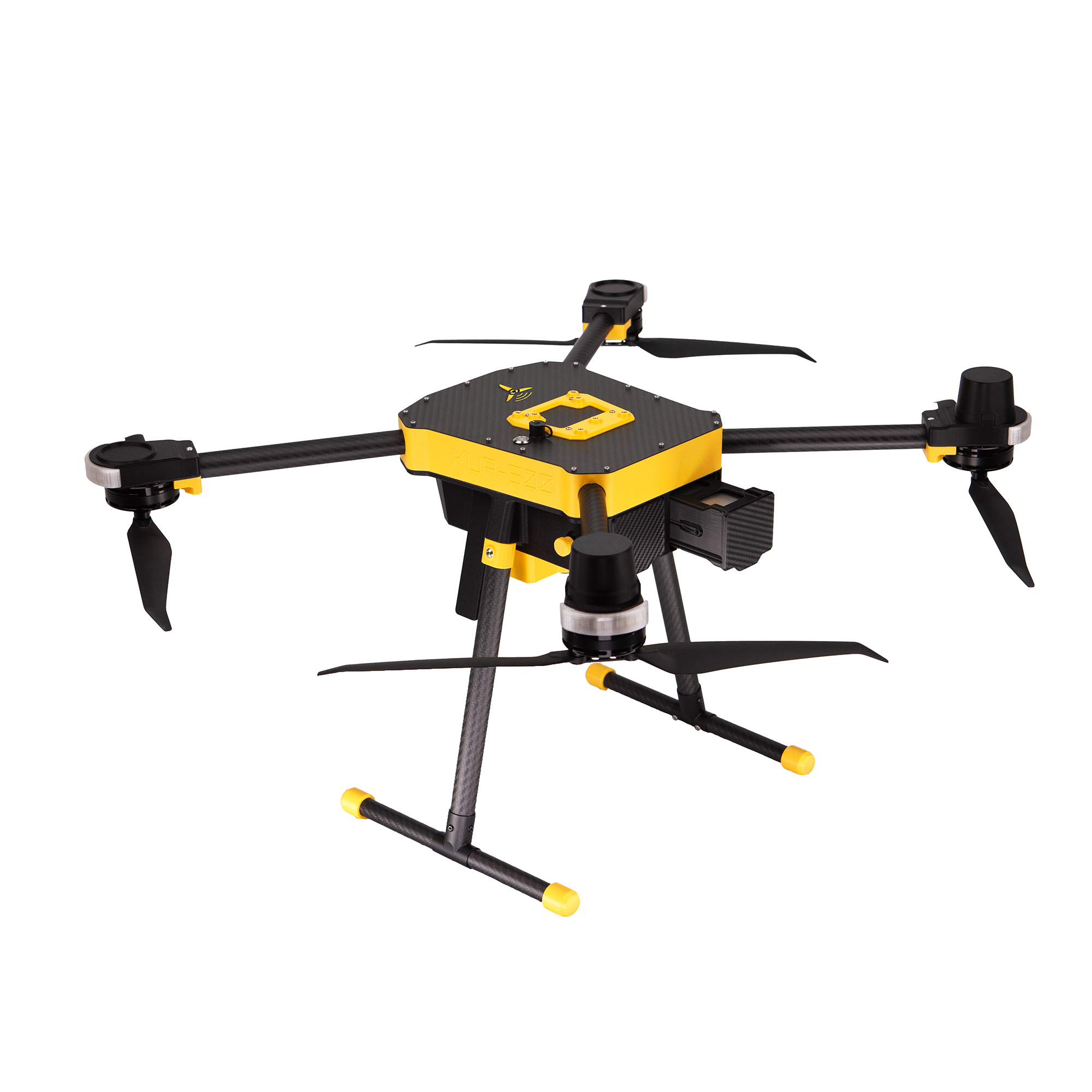
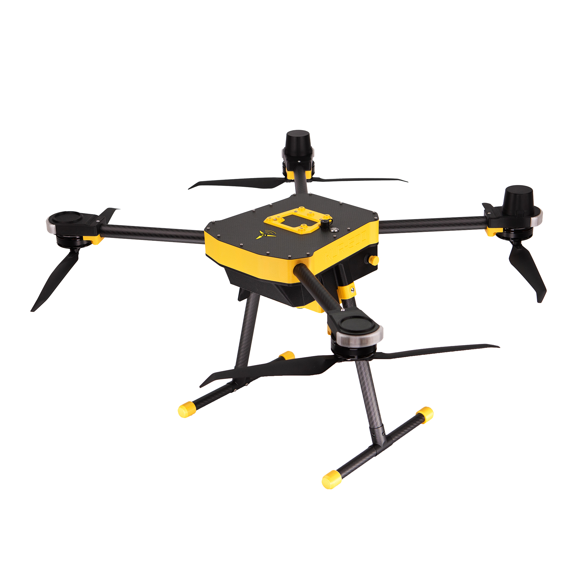
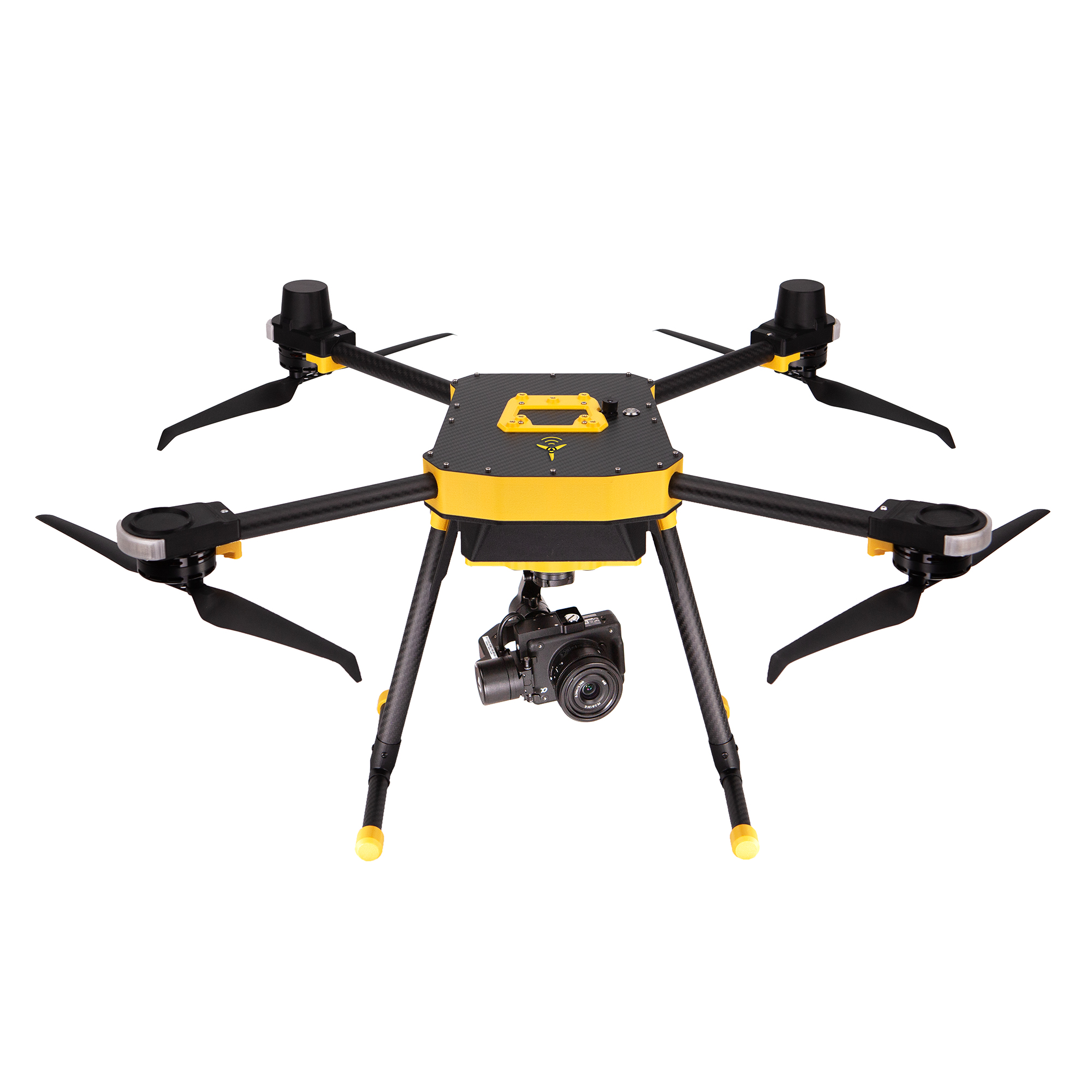
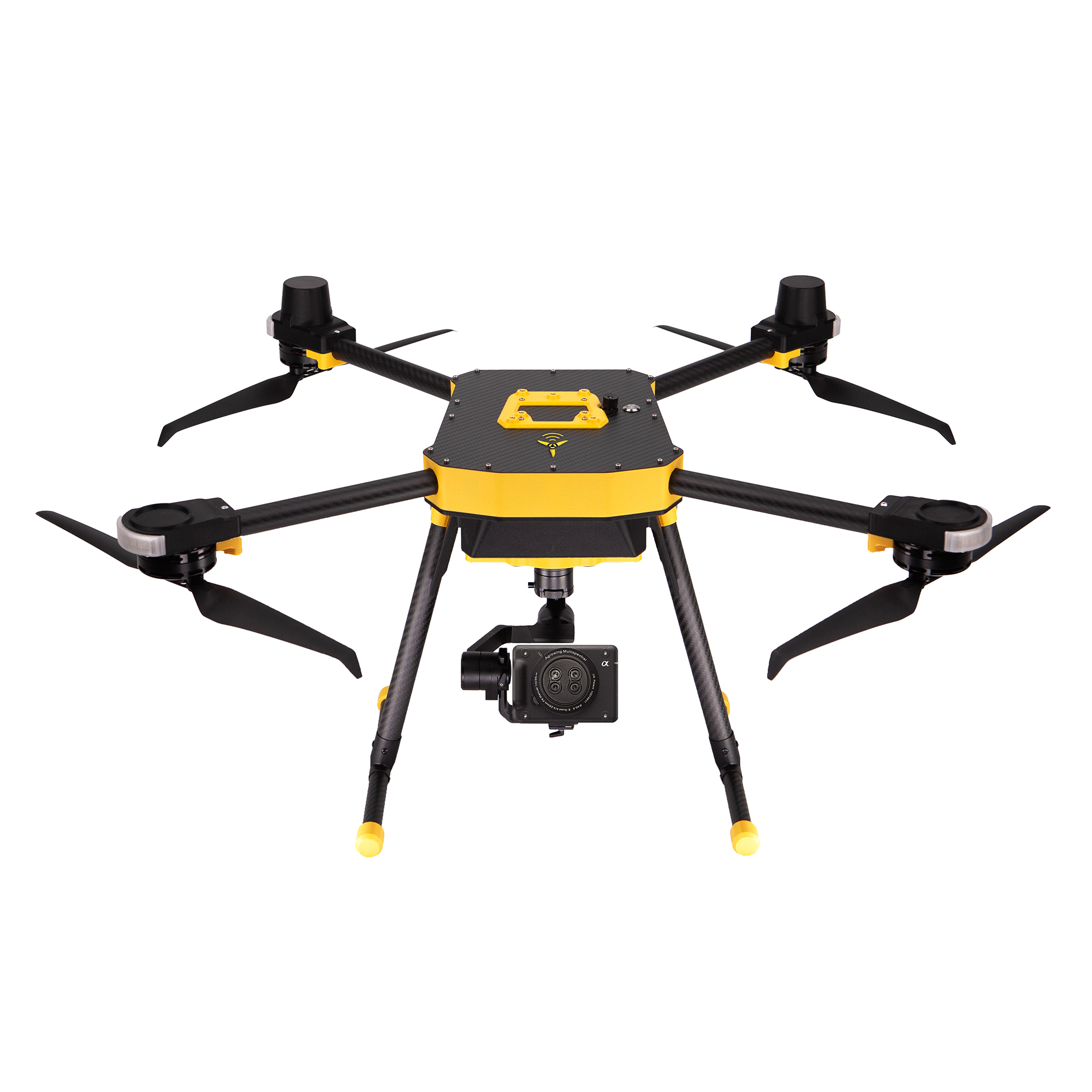
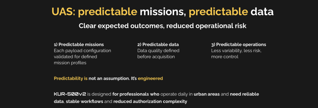
Area KUR-500v2 delivers fully validated UAS platforms with integrated best-in-class payloads.
Engineered for system-level reliability, KUR-500v2 integrates selected industrial-grade sensors for LiDAR mapping, professional photogrammetry, multispectral analysis, and thermal inspection, ensuring consistently high performance across mission profiles.
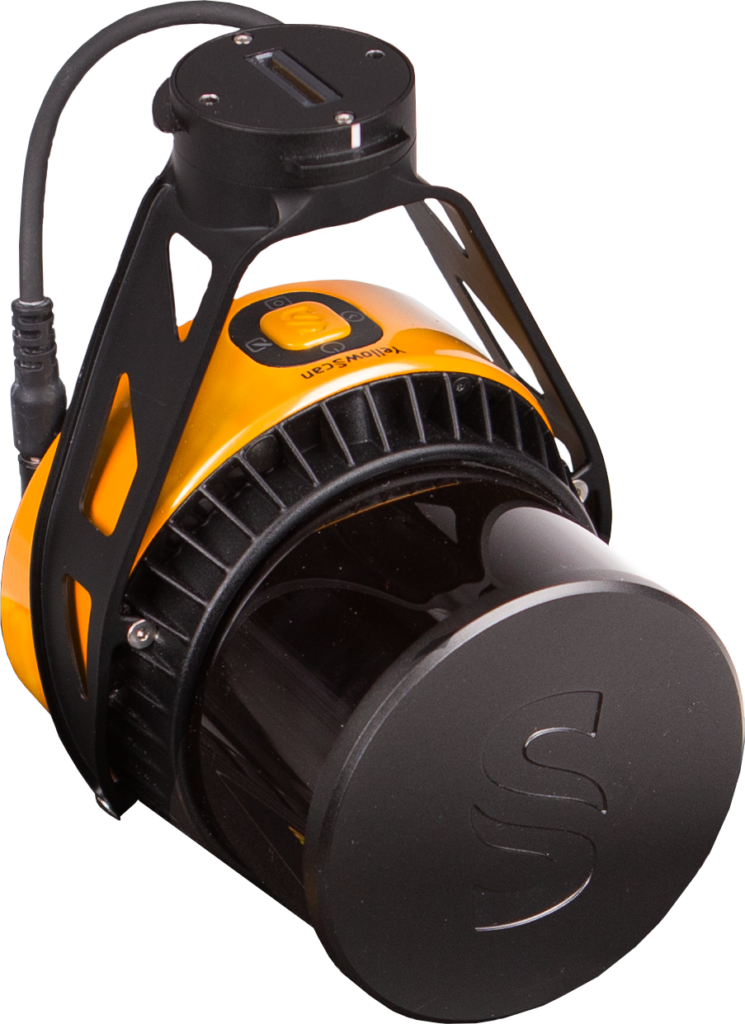
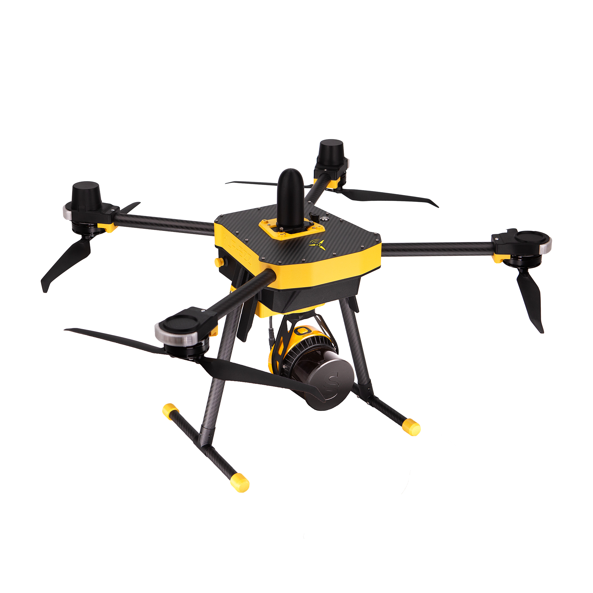
LiDAR Mapping
Yellowscan Surveyor Ultra OEM
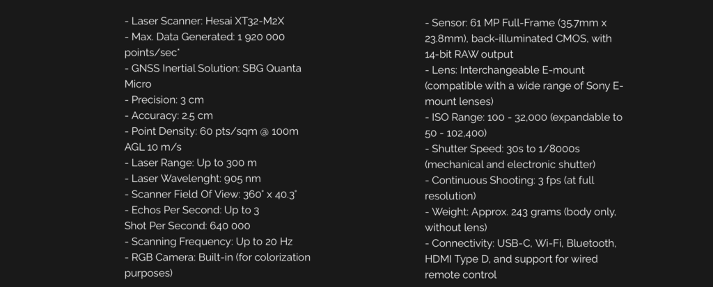
Laser scanner : Hesam XT32-M2X
Max Data Generated: 1 920 000 points/sec
GNSS Intertial Solution: SBG Quanta Micro
Precision: 3 cm
Accuracy: 2.5 cm
Point Density: 60 pys/sqm @ 100 m
AGL: 10 m/s
Laser Range: Up to 300 m
Laser Wavelength: 905 nm
Scanner Field Of View: 360° x 40.3
Echos Per Second: Up to 3
Shots Per Second: 640 000
Scanning Frequency: Up yo 20 Hz
RGB Camera: Built- in (for colorization purposes)
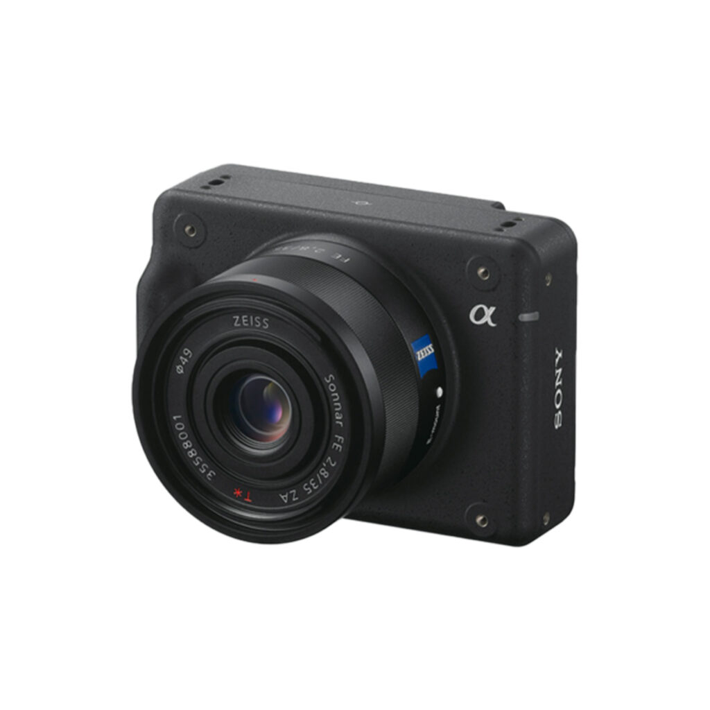
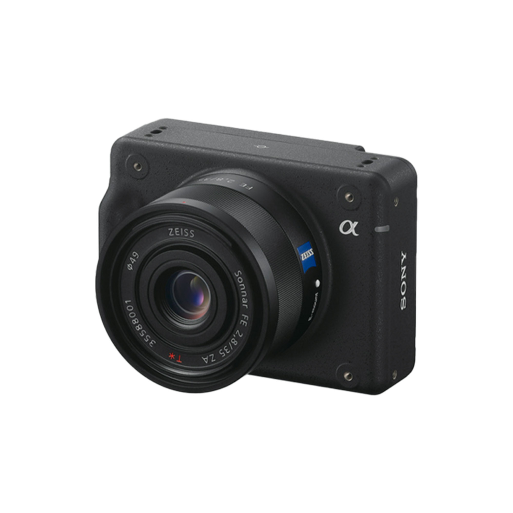
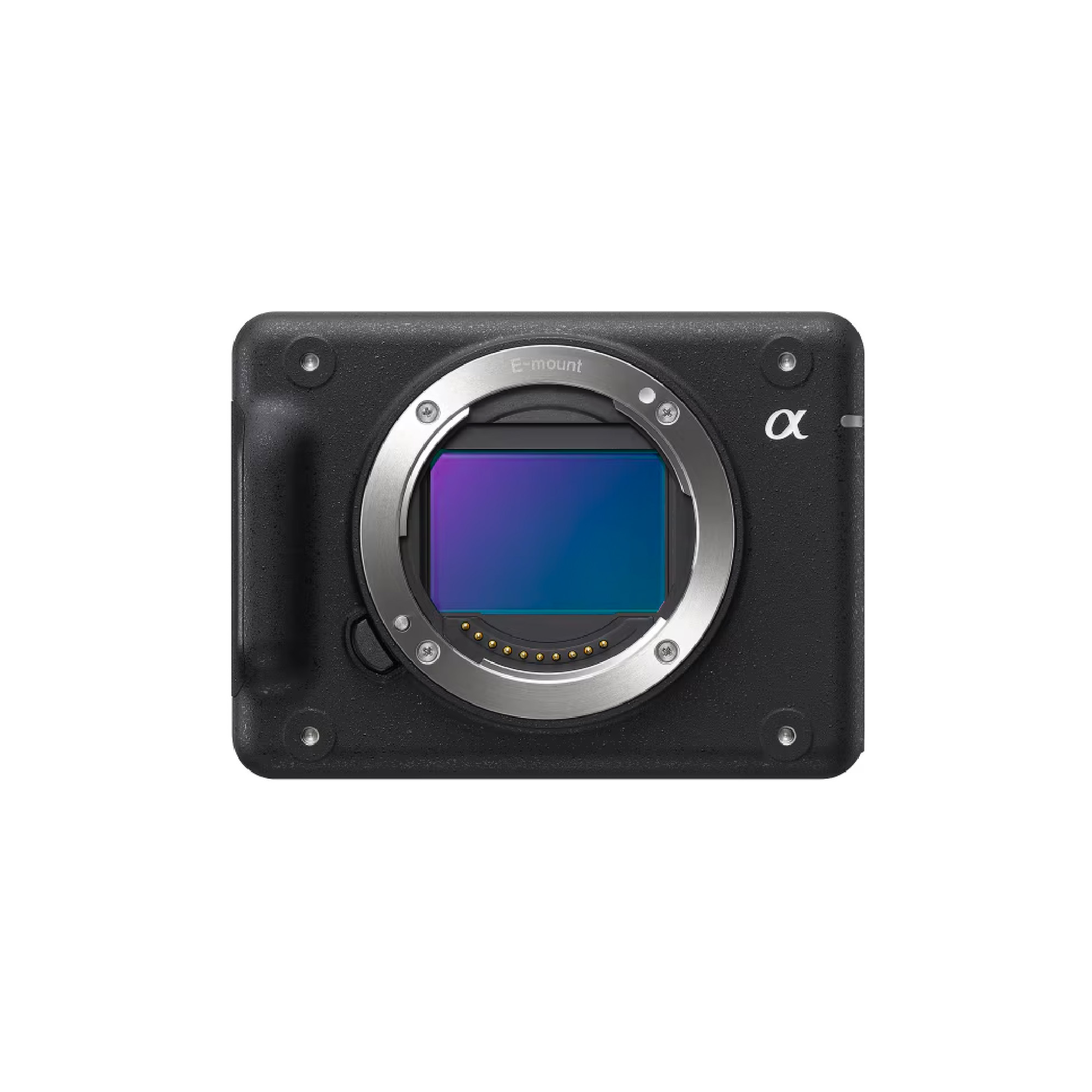
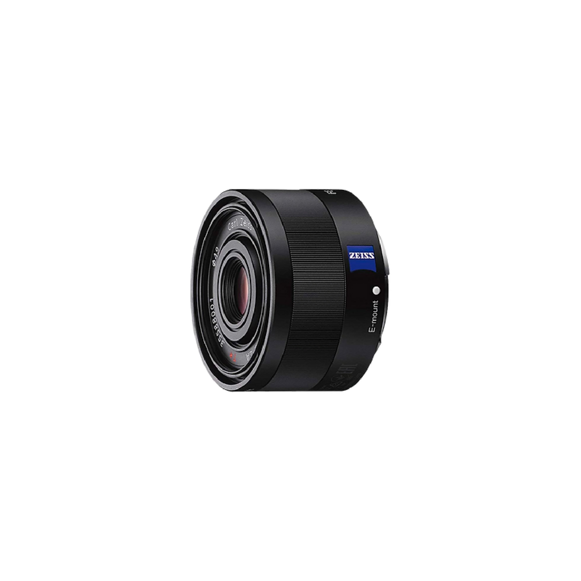
Photogrammetry
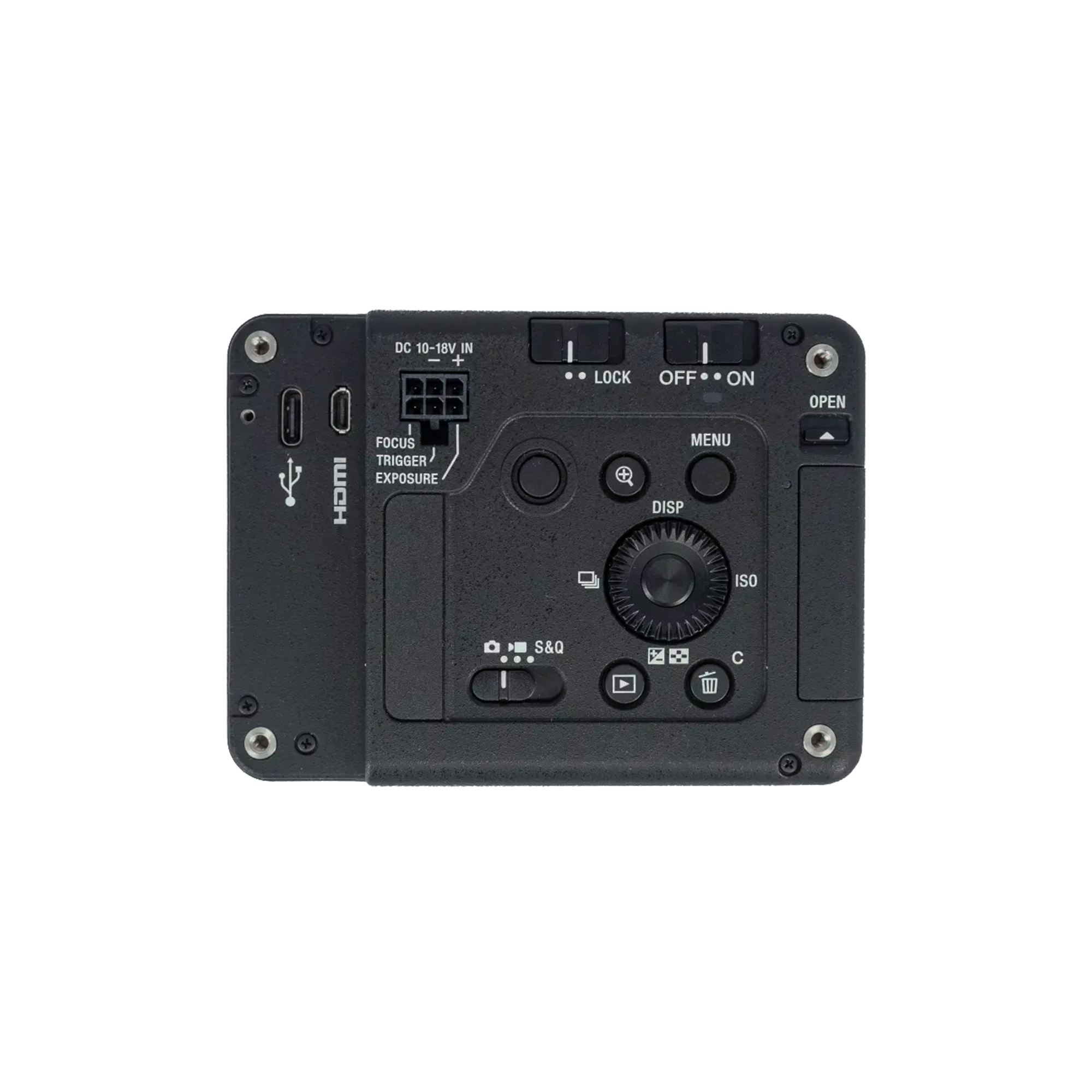
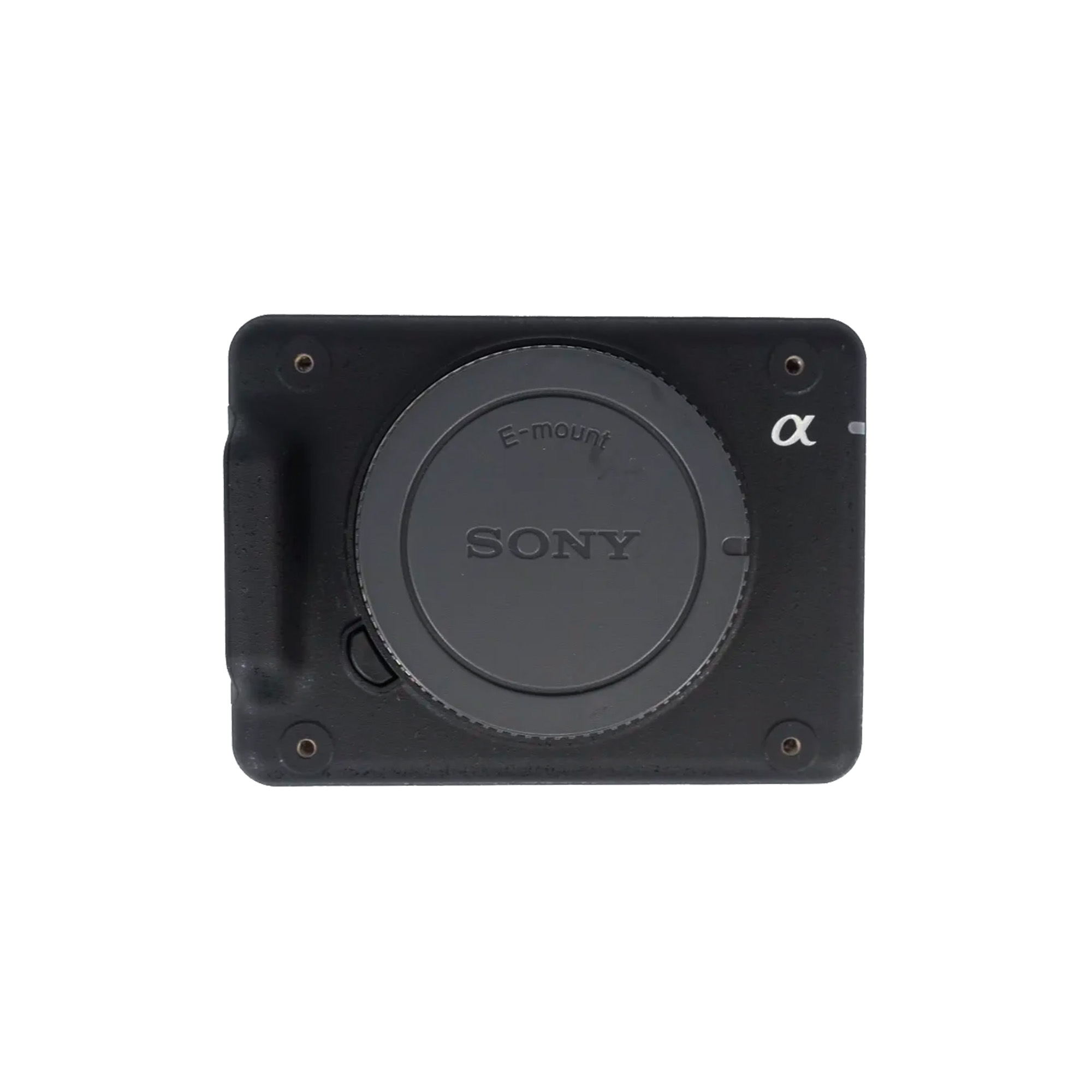
Sony Alfa ILX-LR1 + Zeiss 35 mm
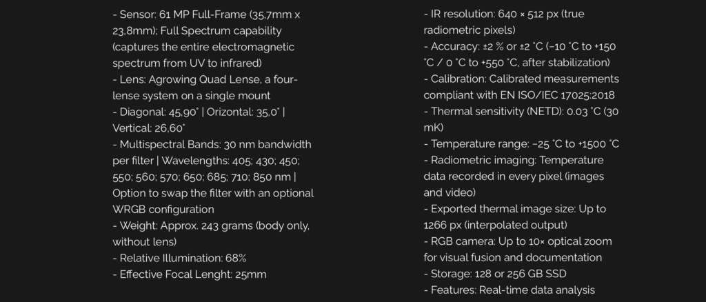
Sensor: 61 MP Full-Frame (35.7mm x 23.8 mm), back illuminated CMOS, with 14-bit RAW output
Lens: Interchangeable E-mount (compatible with a wide range of Sony E-mount lenses)
ISO Range: 100- 32 000 (expandeble to 50 – 102 400)
Shutter Speed: 30 s to 1/800s (mechanical and electronic shutter)
Contiuous Shooting: 3 fps (at full resolution)
Weight: Approx 243 grams (body only, without lens)
Connectivity: USB- C, Wi-Fi, Bluetooth, HDMI Type D, and support for wired remote control
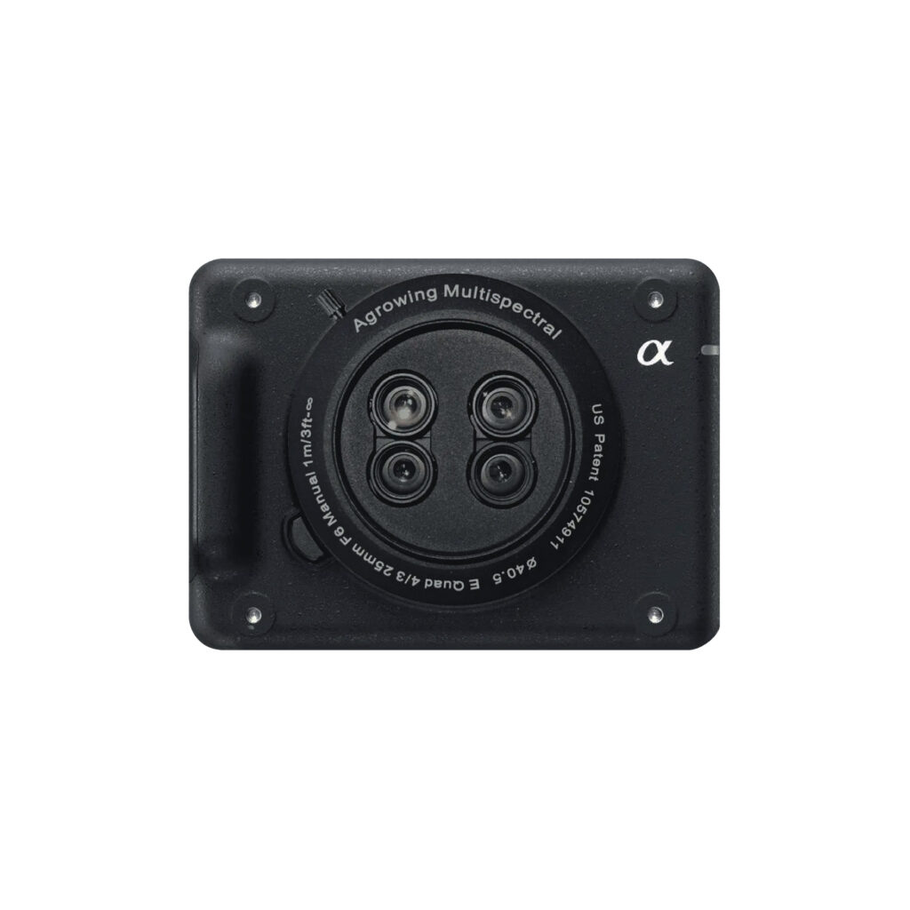
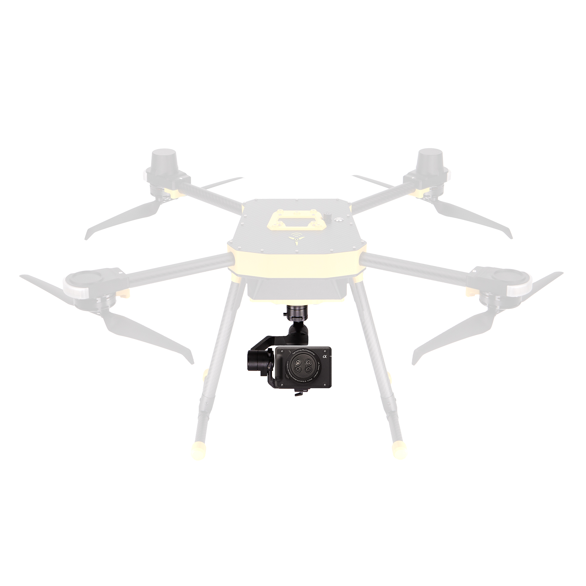
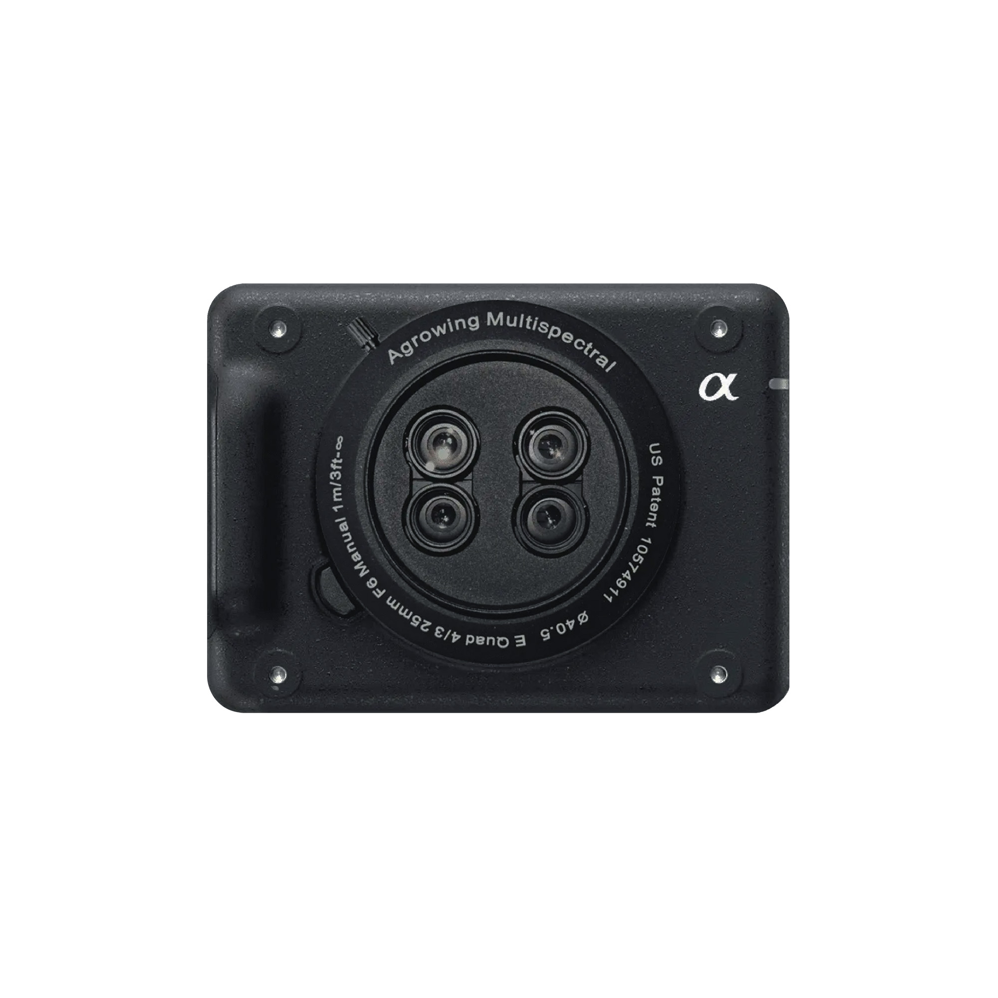
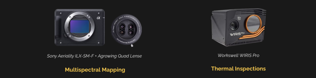
Multispectral Mapping
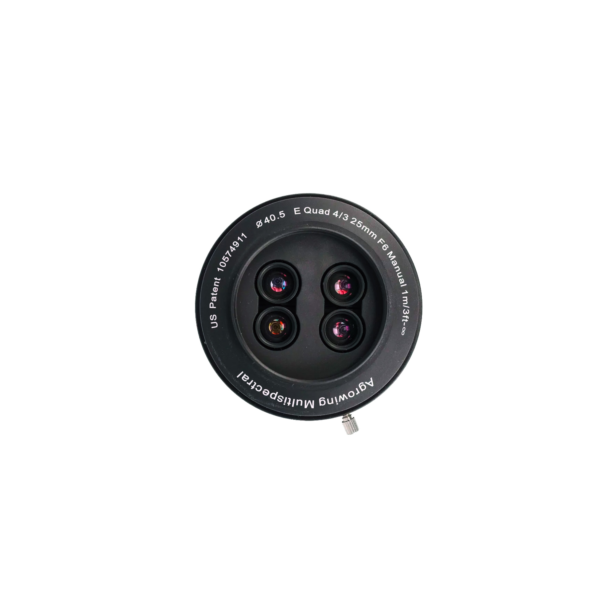
Sony Aeriality ILX-SM-F + Agrowing Quad Lense
Sensor: 61 MP Full-Frame (35.7 mm x 23.8 mm)
Full Spectrum capability (captures the entire electromagnetic spectrum from UV to infrared)
Lens: Agrowing Quad Lense, a four-lense system on a single mount
Diagonal: 45,90° | Orizontal: 35,0° | Vertical: 26,60°
Multispectral Bands: 30 nm bandwidth per filter | Wavelengths: 405; 430; 450; 550; 560; 570; 650; 685; 710; 850 nm | Option to swap the filter with an optional WRGB configuration
Weight: Approx. 243 grams (body only, without lens)
Relative Illumination: 68%
Effective Focal Lenght: 25mm

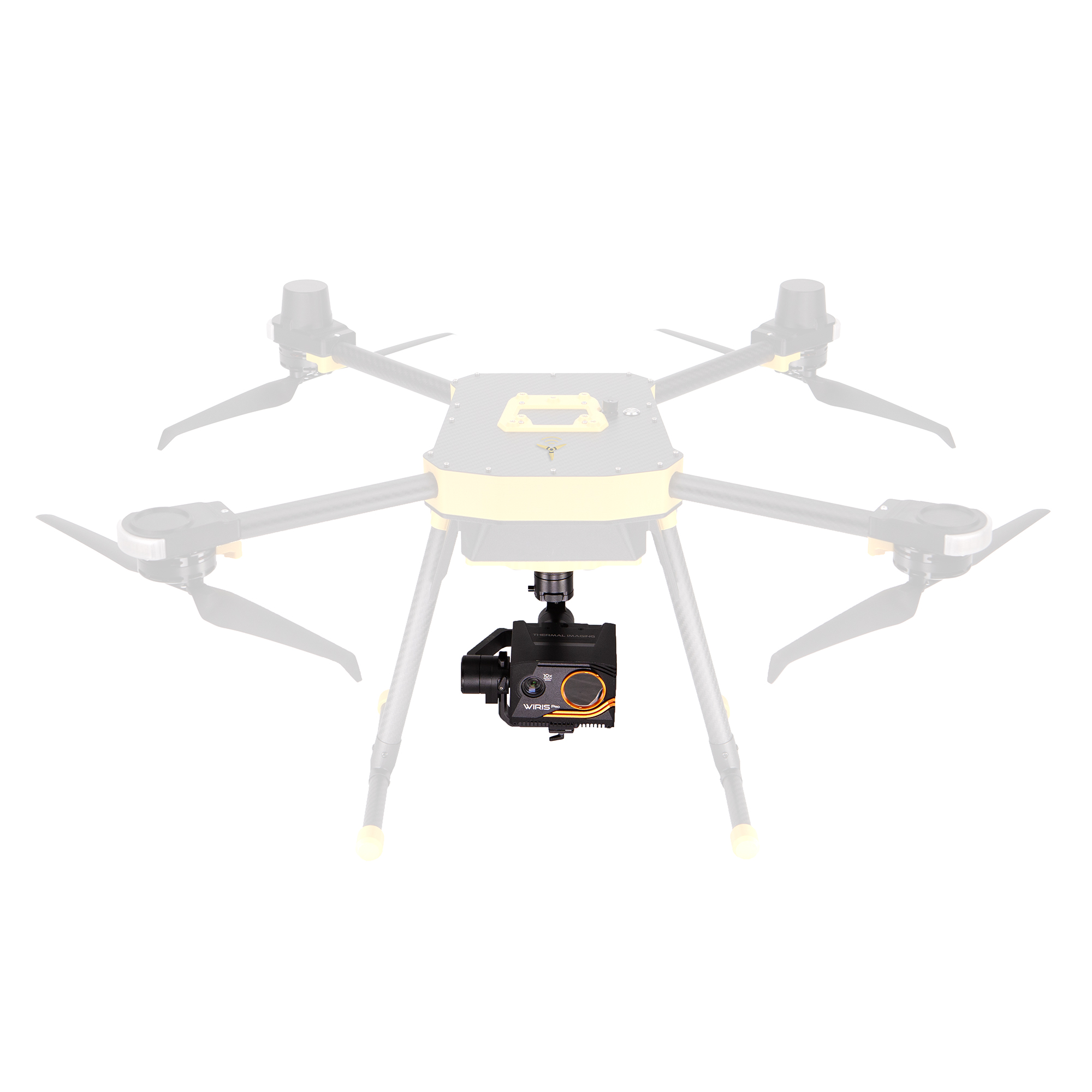
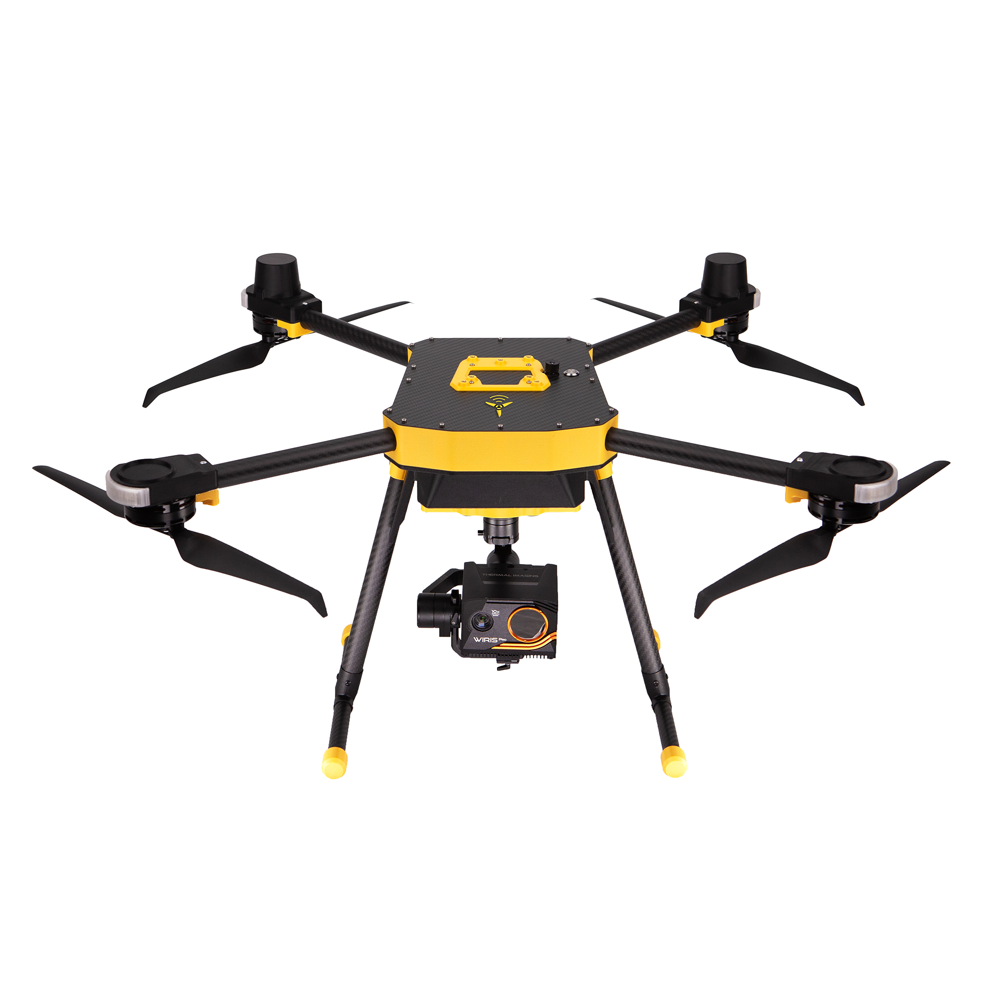
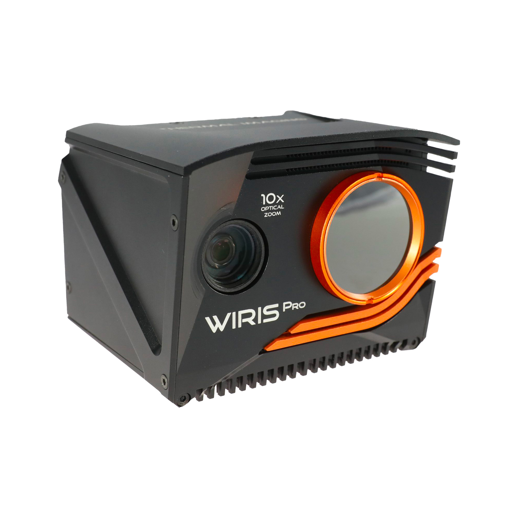
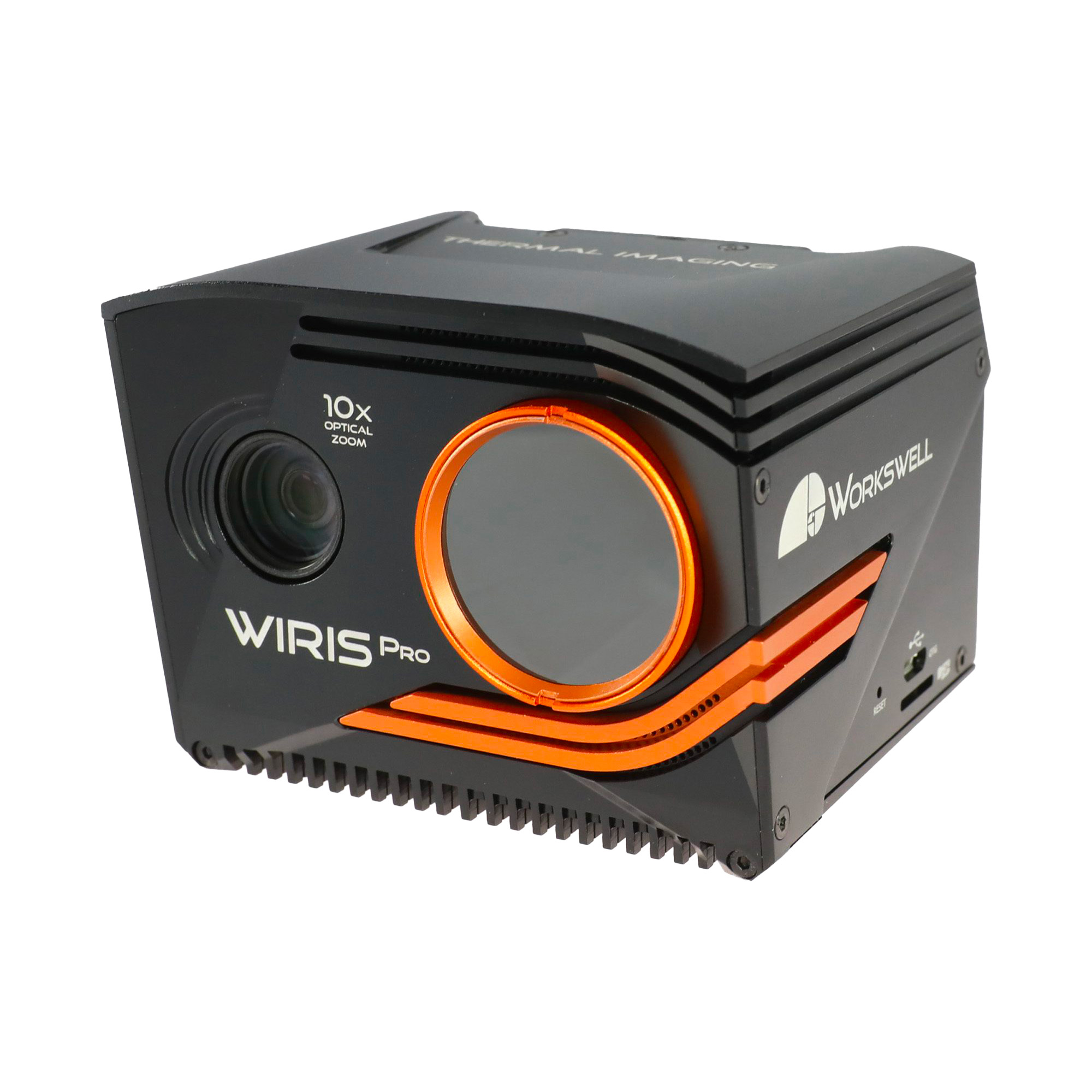
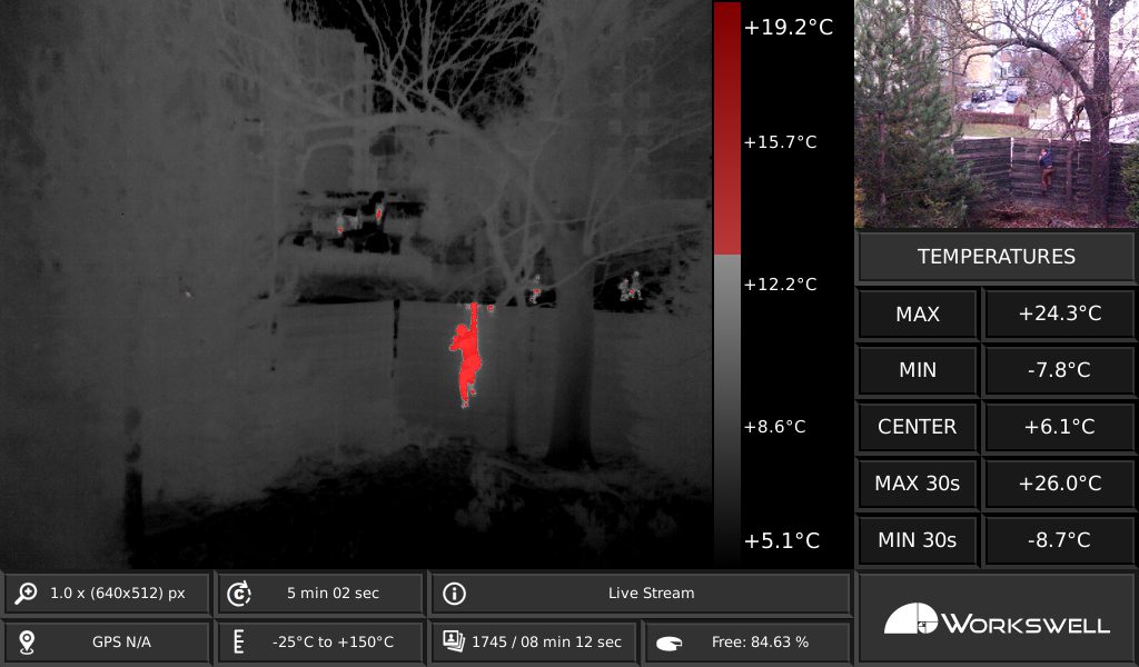
Thermal Inspections
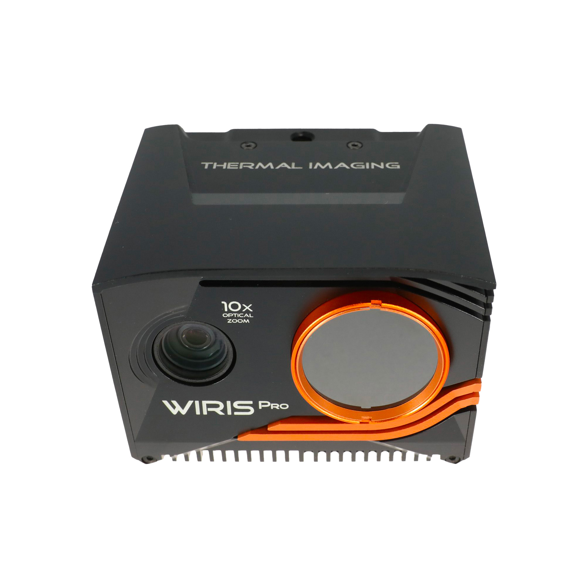
Workswell WIRIS Pro
IR resolution: 640 × 512 px (true radiometric pixels)
Accuracy: ±2 % or ±2 °C (−10 °C to +150 °C / 0 °C to +550 °C, after stabilization)
Calibration: Calibrated measurements compliant with EN ISO/IEC 17025:2018
Thermal sensitivity (NETD): 0.03 °C (30 mK)
Temperature range: −25 °C to +1500 °C
Radiometric imaging: Temperature data recorded in every pixel (images and video)
Exported thermal image size: Up to 1266 px (interpolated output)
RGB camera: Up to 10× optical zoom for visual fusion and documentation
Storage: 128 or 256 GB SSD
Features: Real-time data analysis
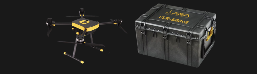
Included in the box:
- 1 KUR-500v2
- 1 Ground Control Station
- 1 Battery pack
- 1 Transport case
- Logbook
Specifications
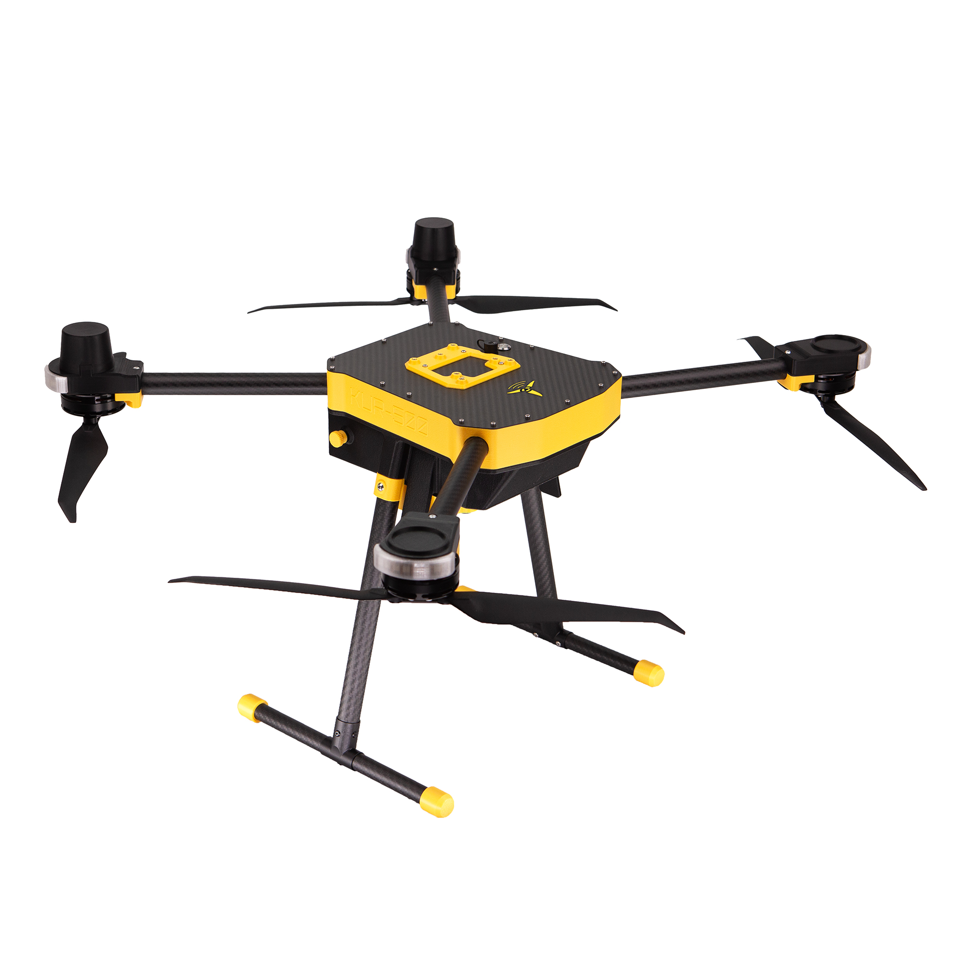
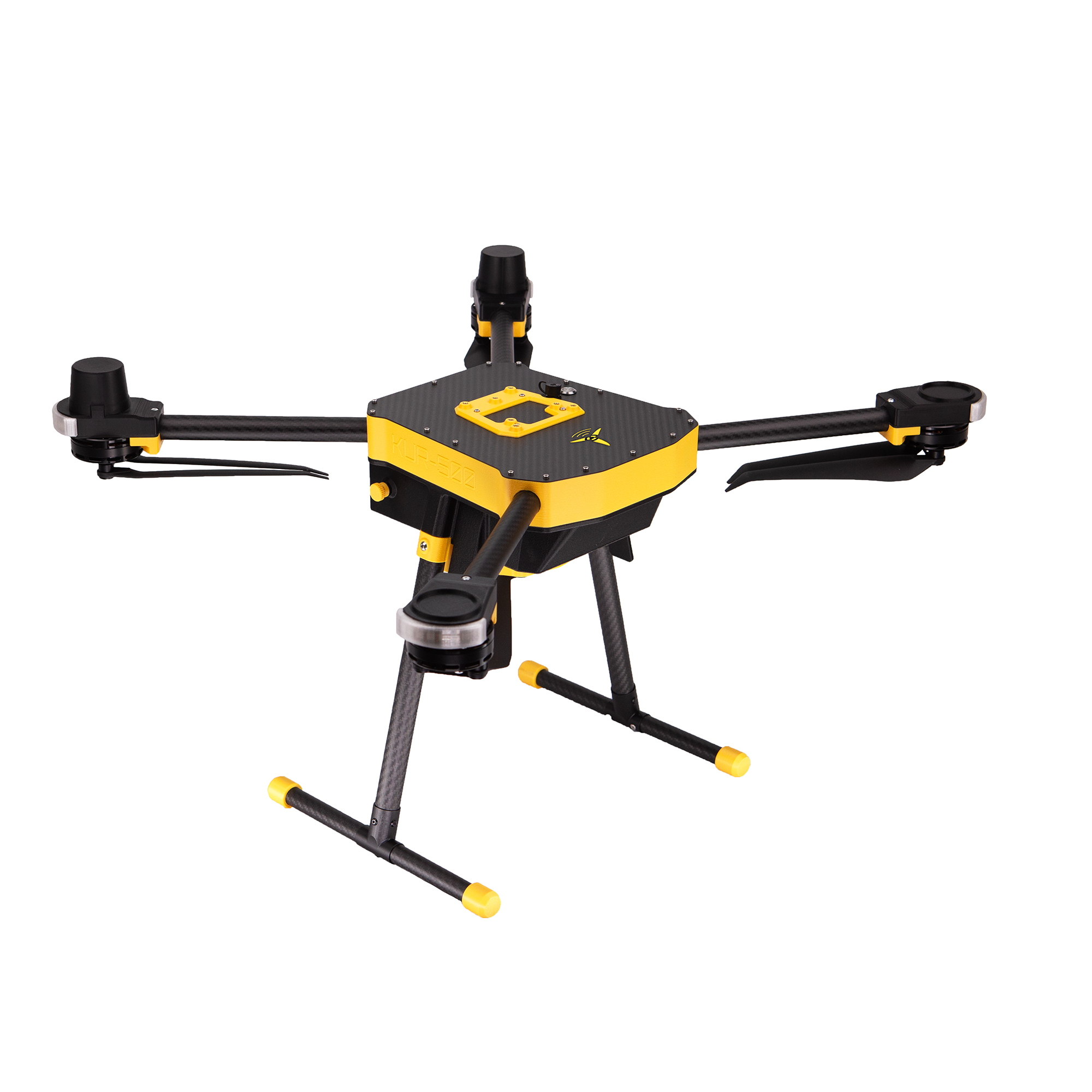
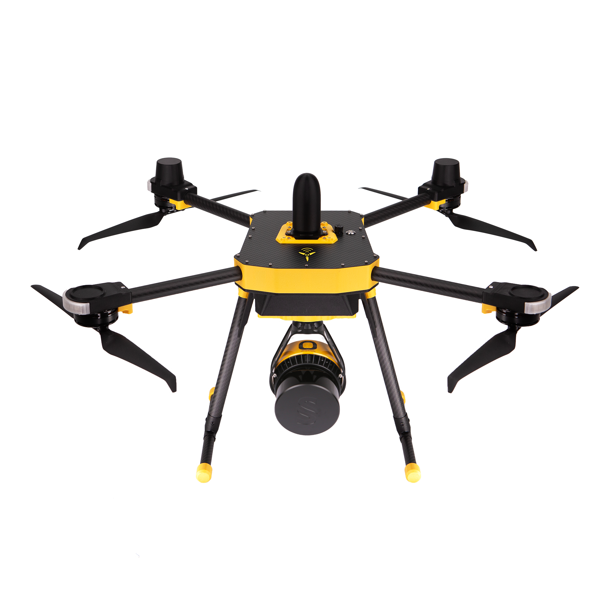
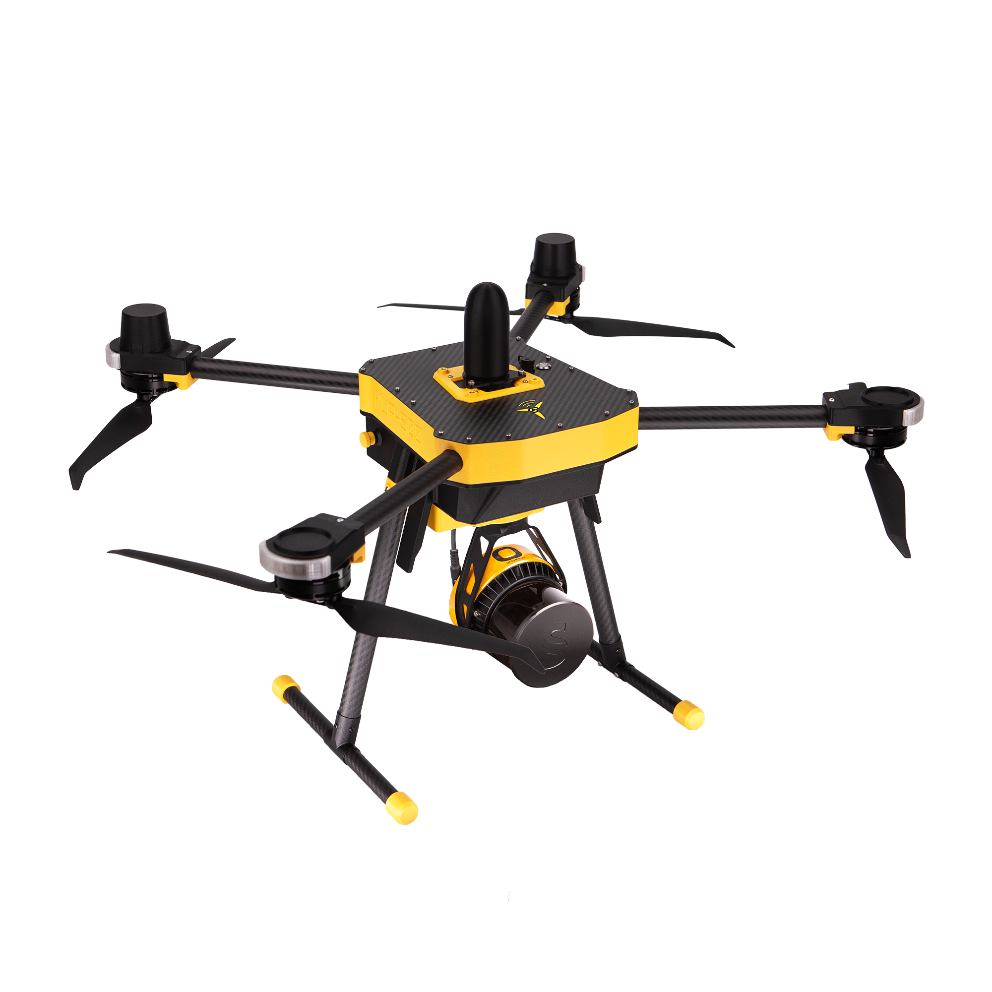
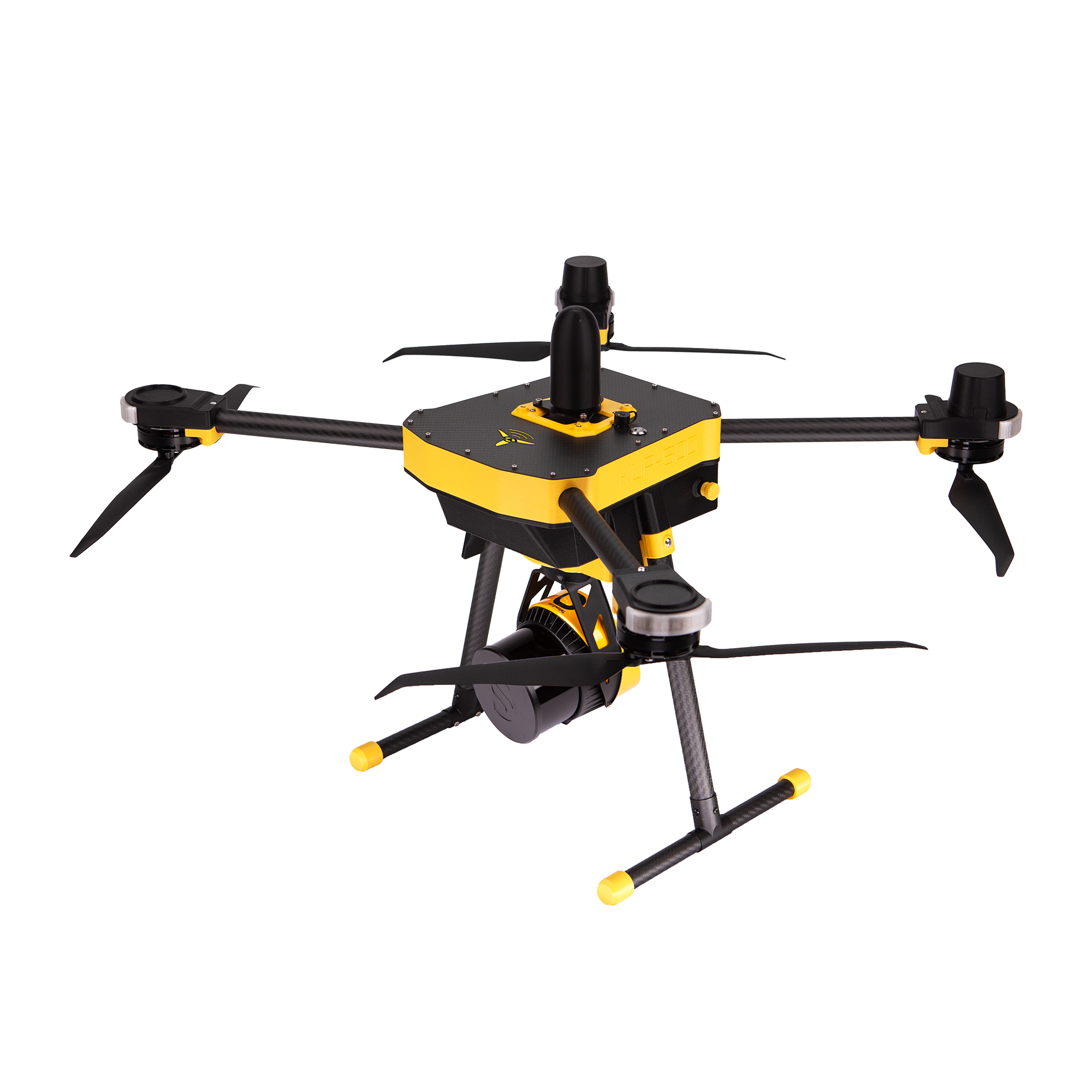
Dimensions
- Width x length x height (propellers tip to tip): 920 x 810 x 380 mm
- Diagonal wheelbase (motor to motor): 660 mm
Weights
- Dronemass (no payload): 3.04 kg
- Max payload: < 0.95 kg
- Maximum take off mass (MTOM): < 3.99 kg
Propellers
- Two- Blade Carbon Reinforced Nylon Folding Propellers: Ø15
- Propeller Pitch: 4.8
Motors
- Type: Brushless DC
- KV: 440
Batteries (2 required to fly)
- Type: 6S LiHV
- Noninal Voltage (per battery): 22.8 V
- Rated Capacity (per battery) : 4500 mAh
- Max Discharge Current: 70C
Flight Performance:
- Flight time (max payload): 23 min
- Wind resistance: 15 m/s
- Operative temperature: -10 ° to 40 °