What are you looking for?
kr 51 800 eks. MVA
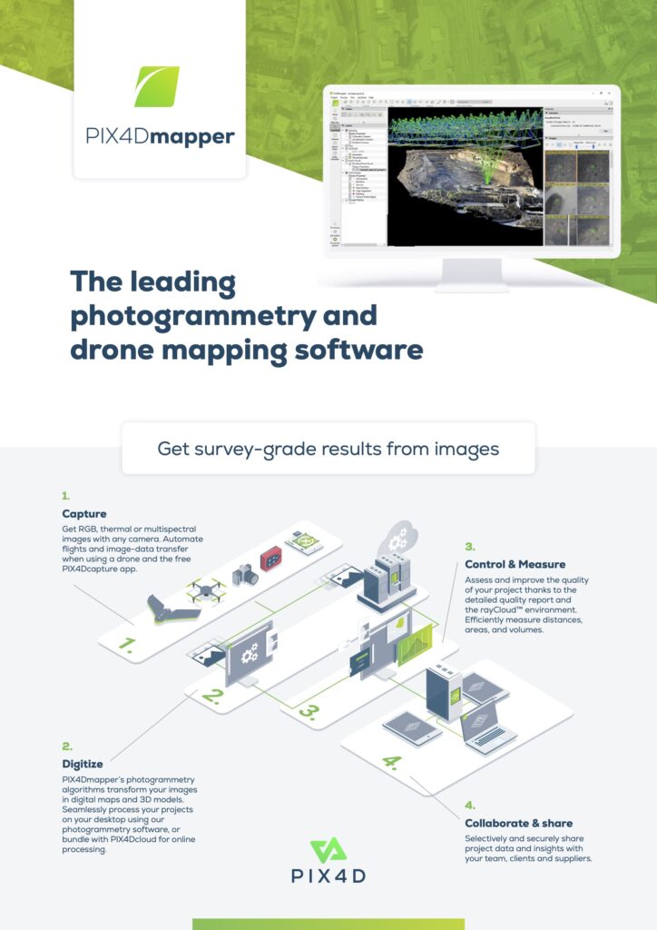
Den ledende programvaren for fotogrammetri og drone kartlegging