


Beskrivelse
DJI Terra Educational
Make the World Your Digital Asset
Accurate, Intelligent, and Efficient 3D Reconstruction Software
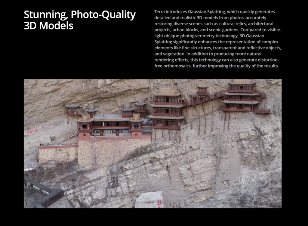
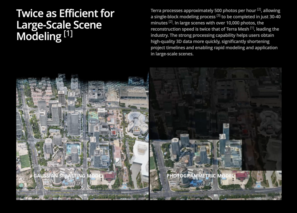
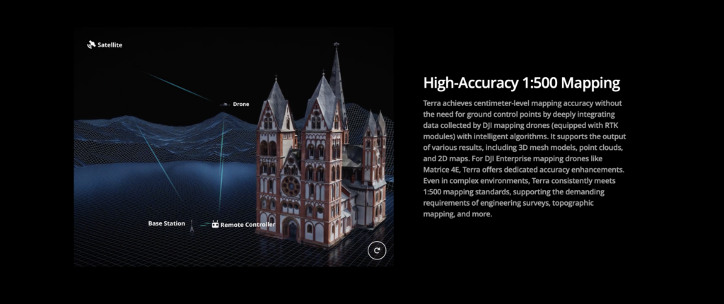
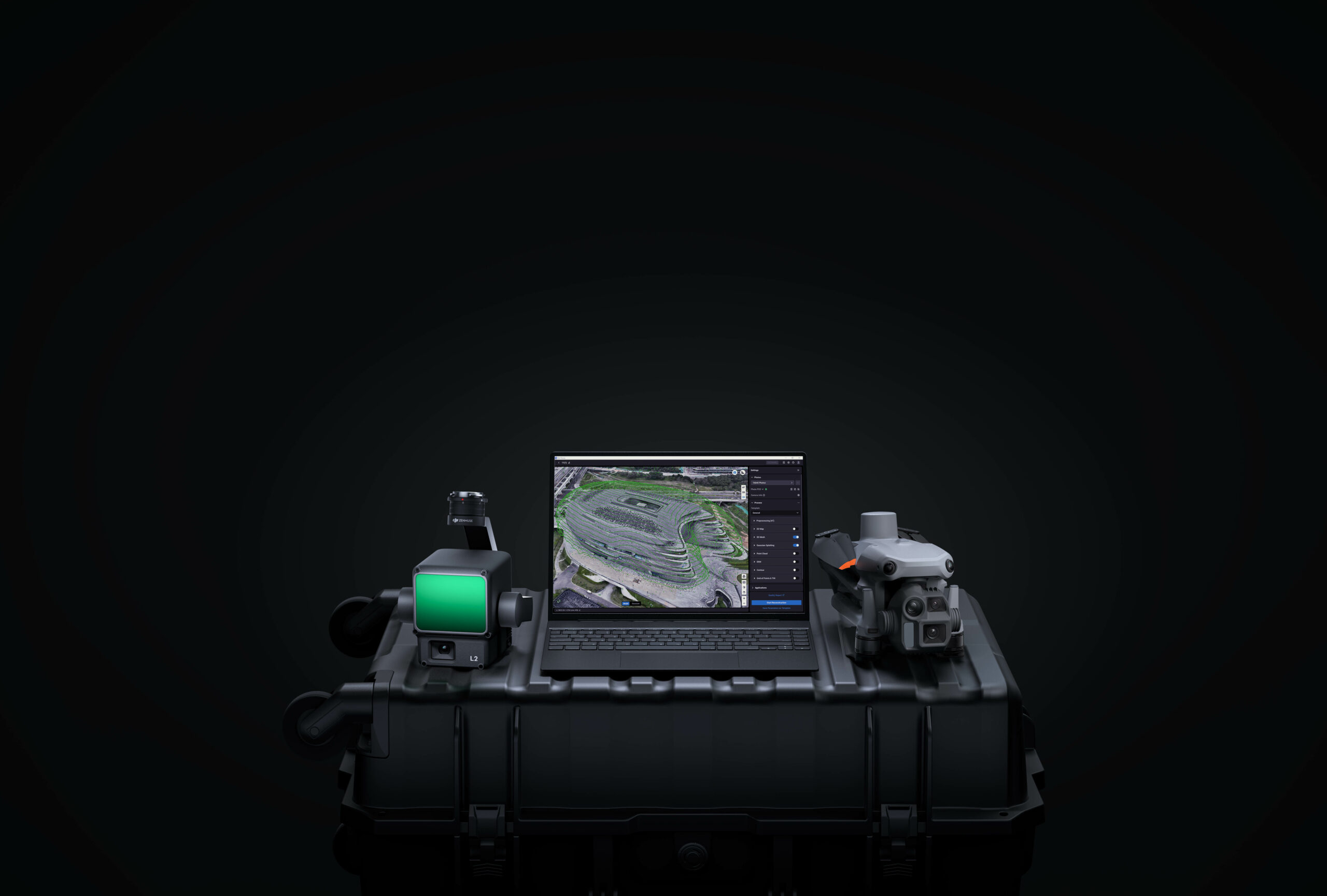
DJI Terra is 3D modeling software equipped with next-generation reconstruction technologies, including 3D Gaussian Splatting. It supports accurate and efficient 2D and 3D reconstruction from visible light imagery, and processes data collected by DJI LiDAR. When integrated with DJI drones, Terra delivers a unified hardware and software solution for data acquisition, processing, and application, streamlining aerial surveying workflows for greater efficiency and accuracy.
Product Highlights
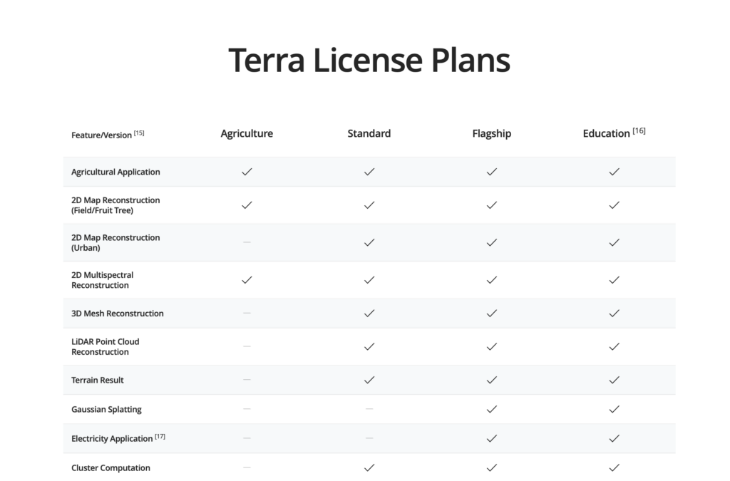
- Educational Permanent License: A permanent license tailored for academic use, providing unlimited access for the institution.
- 10 Control Devices: Allows the software to be used on up to 10 separate devices, making it an ideal solution for classroom instruction, lab settings, and research teams.
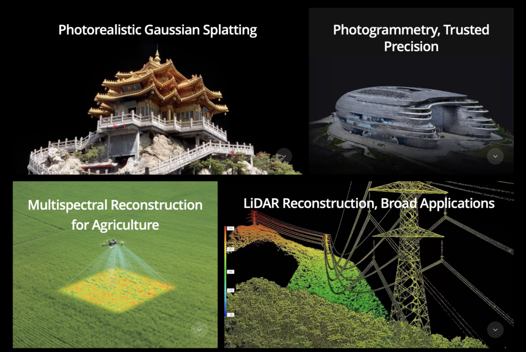
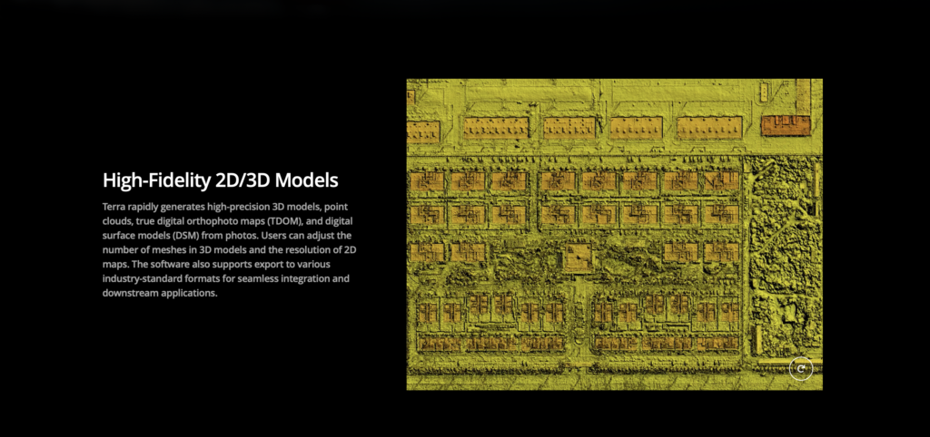
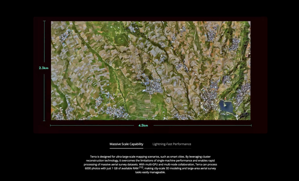
- Comprehensive 3D Modeling & Mapping: DJI Terra is a robust software that utilizes photogrammetry and next-generation reconstruction technologies, including 3D Gaussian Splatting, to transform real-world environments captured by DJI drones into high-precision digital assets.
Key Features & Capabilities
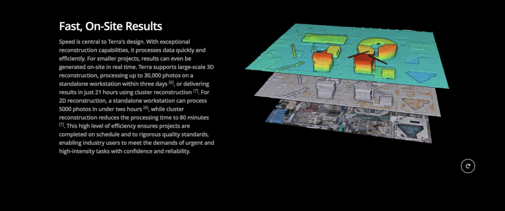
- High-Precision Reconstruction:
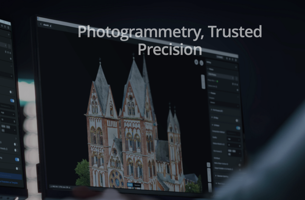
- Photogrammetry: Rapidly generates high-precision 2D Orthophoto Maps (TDOM) and detailed 3D Models (including point clouds and DSMs) from visible light imagery.
- 3D Gaussian Splatting (Flagship Feature): Quickly generates stunningly detailed and realistic 3D models with enhanced representation of complex elements like fine structures and vegetation.
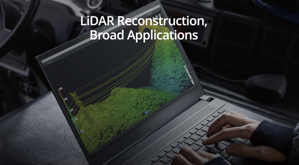
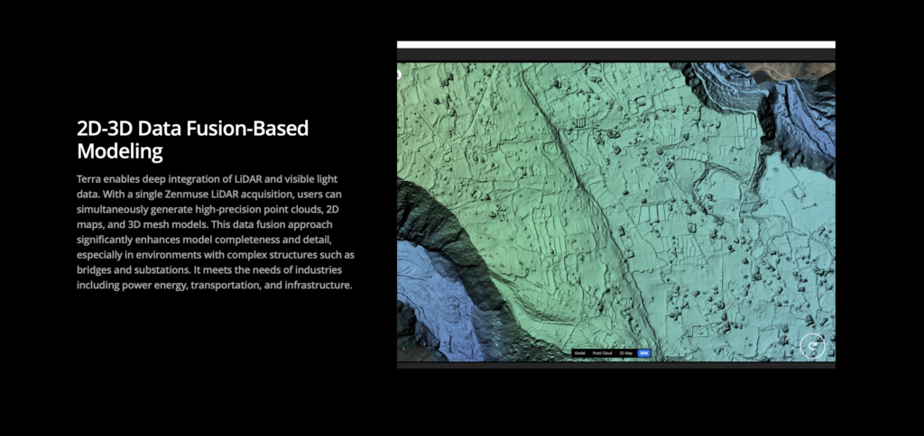
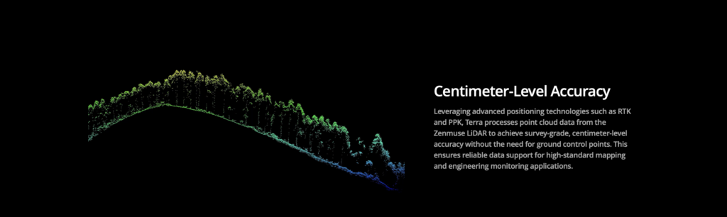
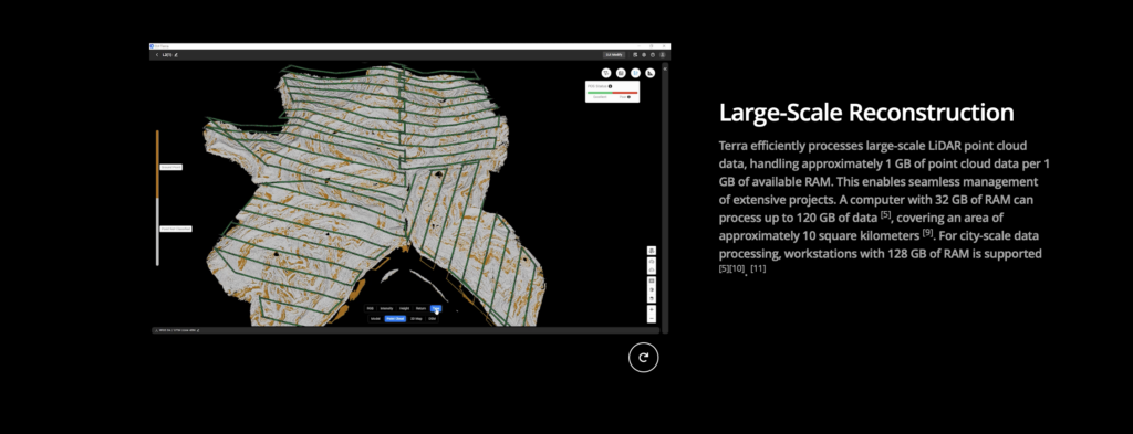
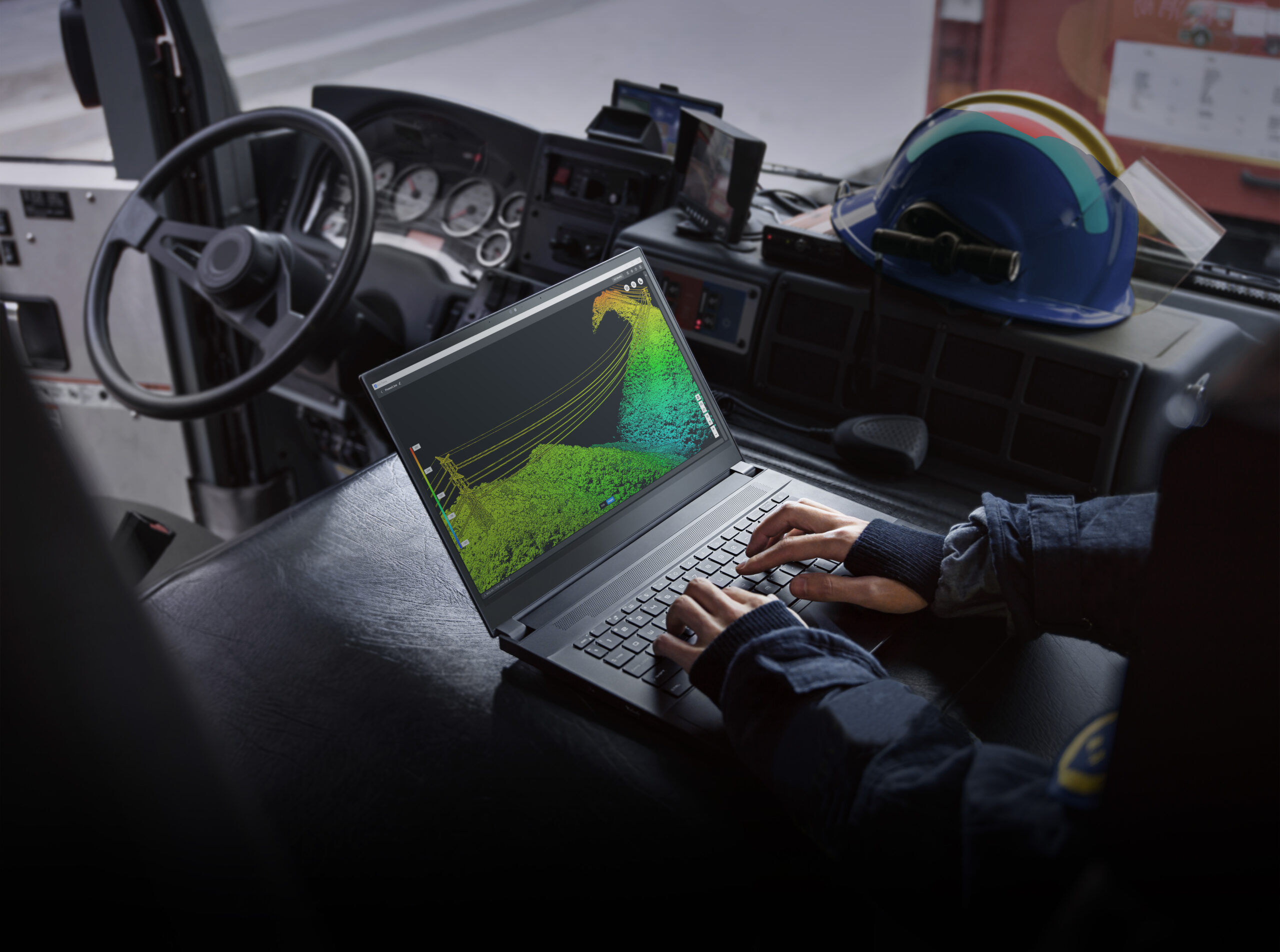
- LiDAR Reconstruction: Supports deep integration and processing of data collected by DJI LiDAR payloads (e.g., Zenmuse L2) to generate highly accurate true-color point clouds and 3D mesh models.
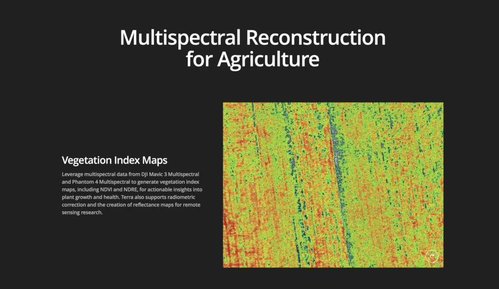
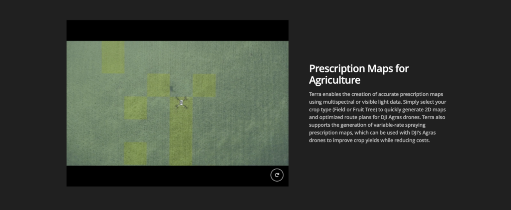
- Multispectral Reconstruction: Leverages multispectral data from compatible drones (e.g., DJI Mavic 3 Multispectral) to generate vegetation index maps like NDVI and NDRE for research in agriculture and remote sensing.
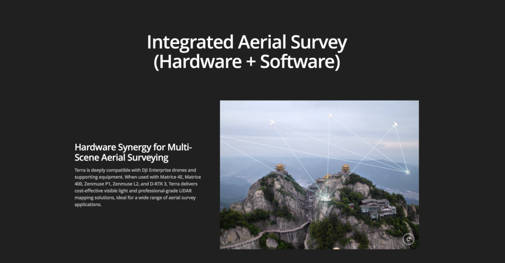
- Seamless Hardware-Software Integration: Designed to work flawlessly with a range of DJI Enterprise drones and payloads (e.g., Matrice series, Zenmuse P1, Zenmuse L2), streamlining the entire aerial surveying workflow.
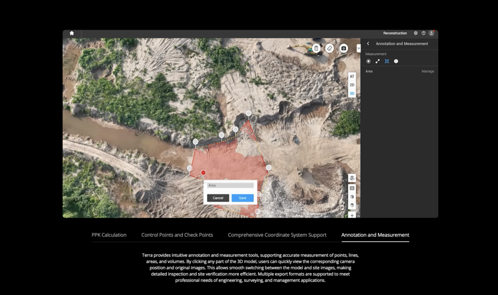
- Data Analysis Tools: Provides tools for easy measurement of coordinates, distances, areas, and volumes within the reconstructed models.
- Authorization Flexibility: Supports both online and offline authorization modes.
This package is a complete solution, enabling students and researchers to master the latest drone mapping and spatial analysis techniques for various applications, including Surveying & Mapping, Smart City Planning, Agriculture, Forestry, and Infrastructure Inspection.