

Beskrivelse
DJI’s First Dock With Battery Swapping
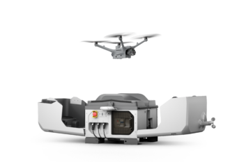
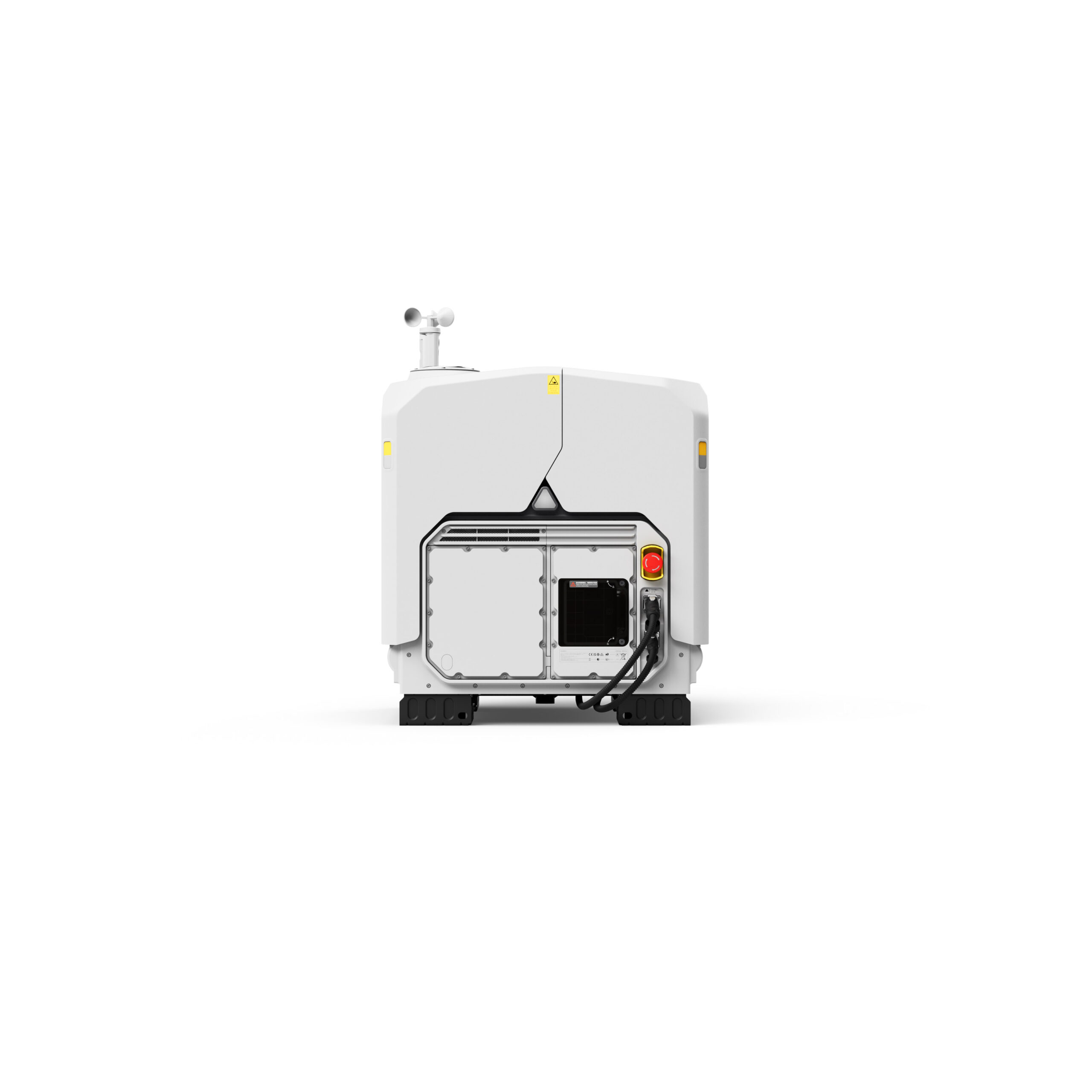
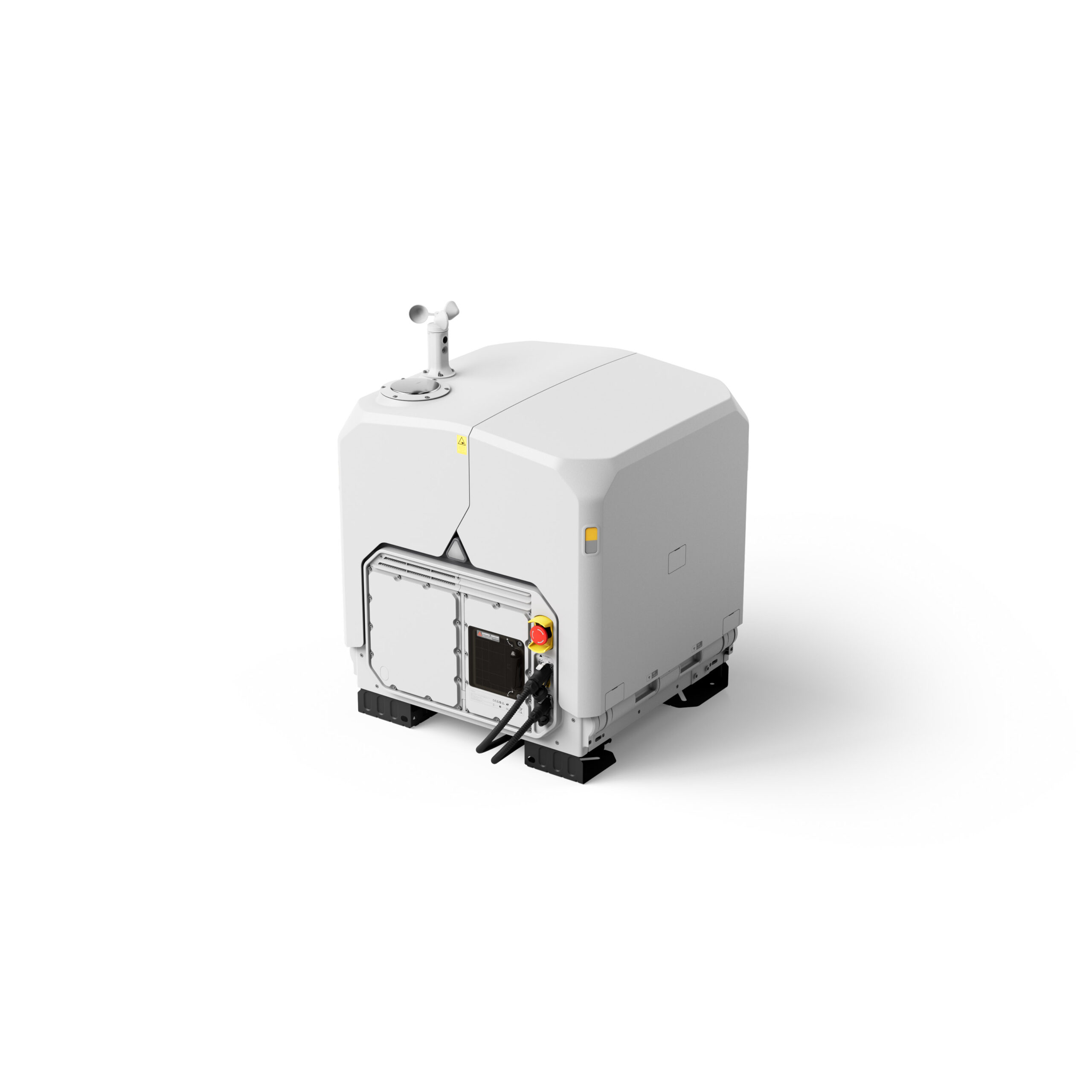
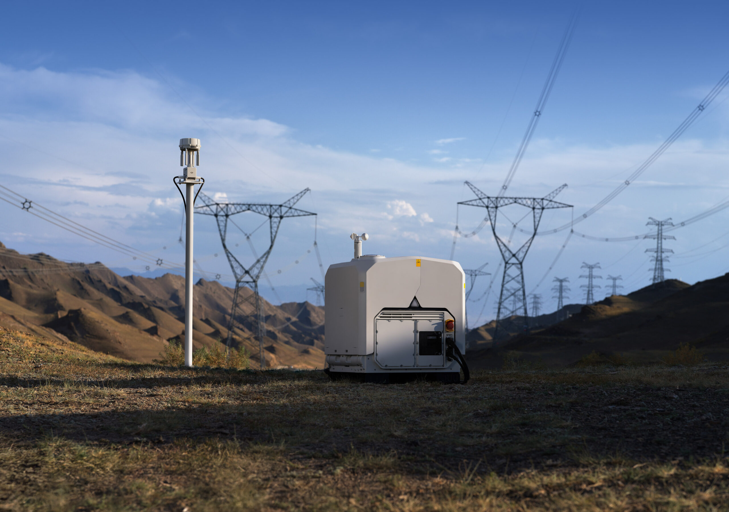
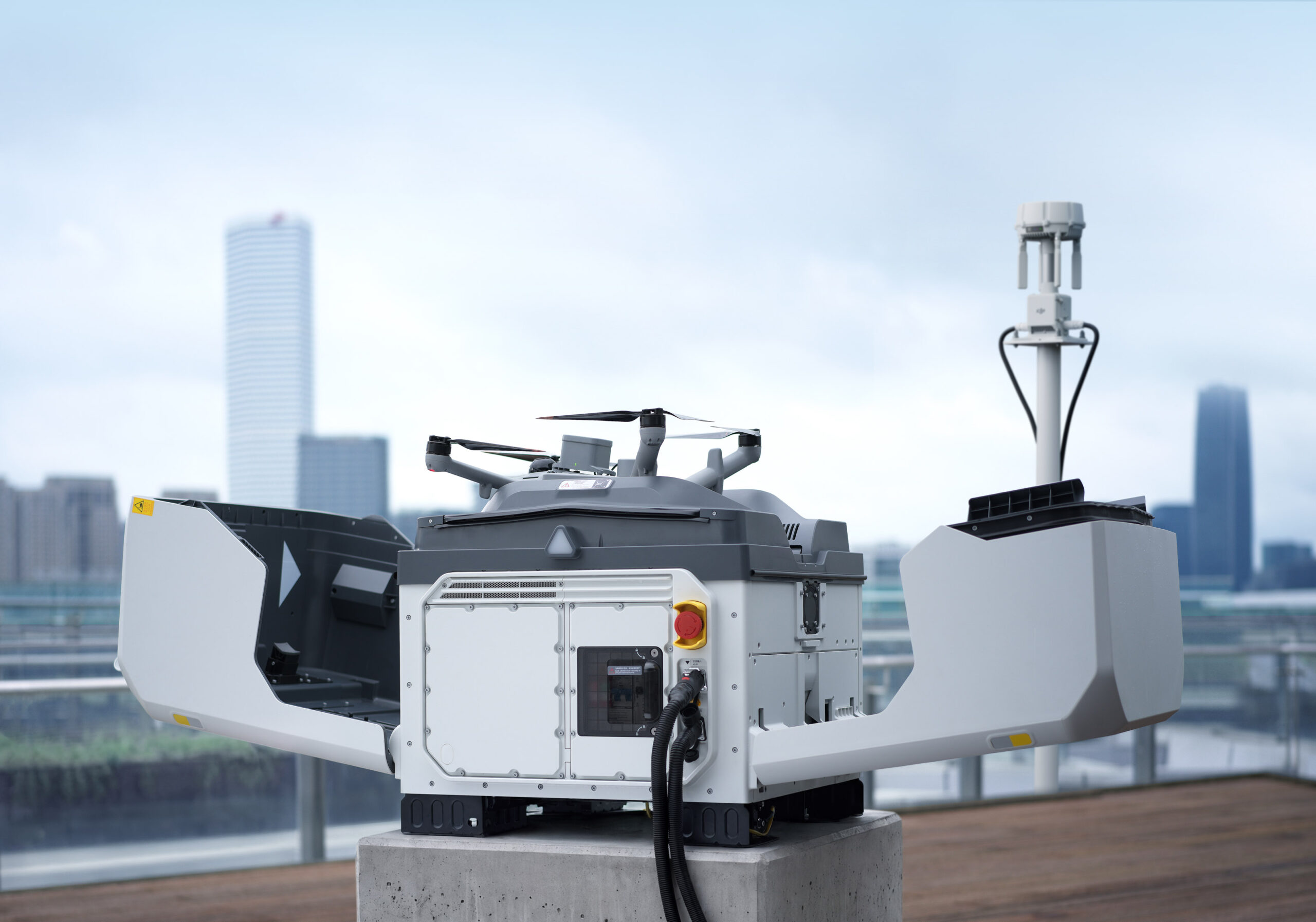
DJI Dock 4
Allways there, allways ready
Overview
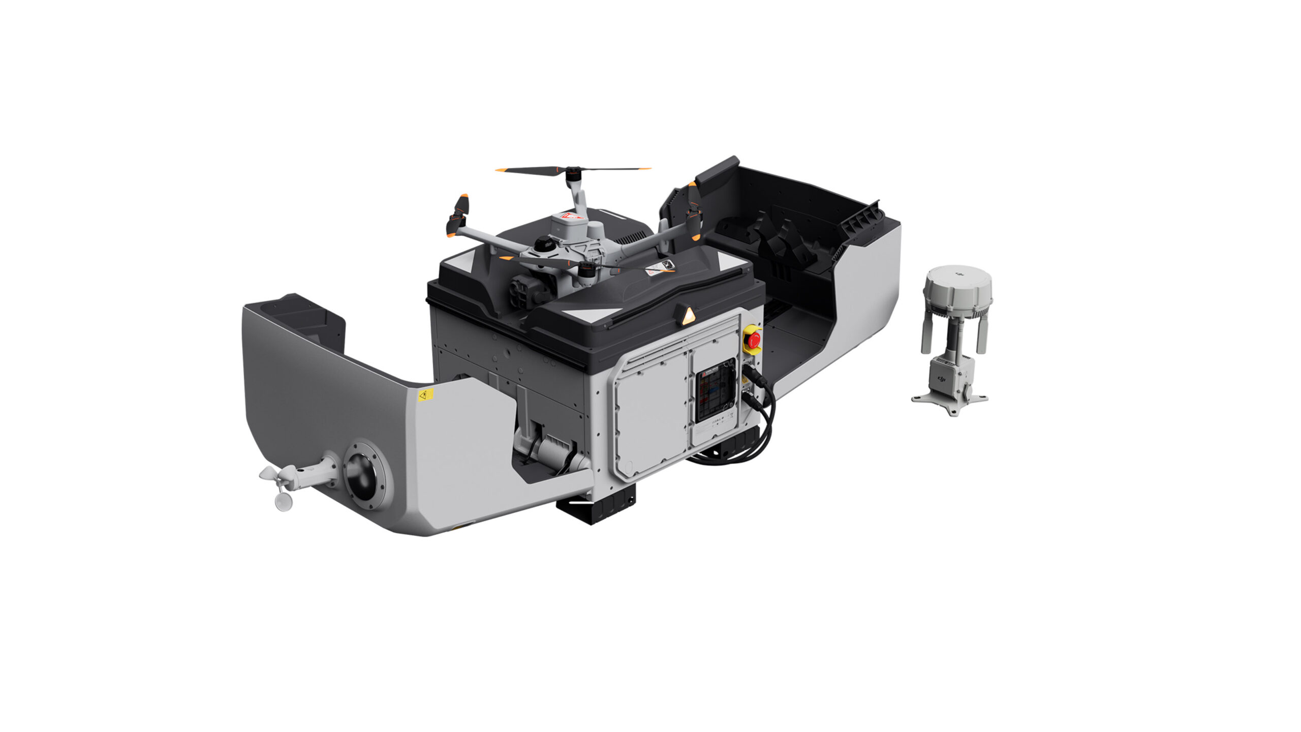
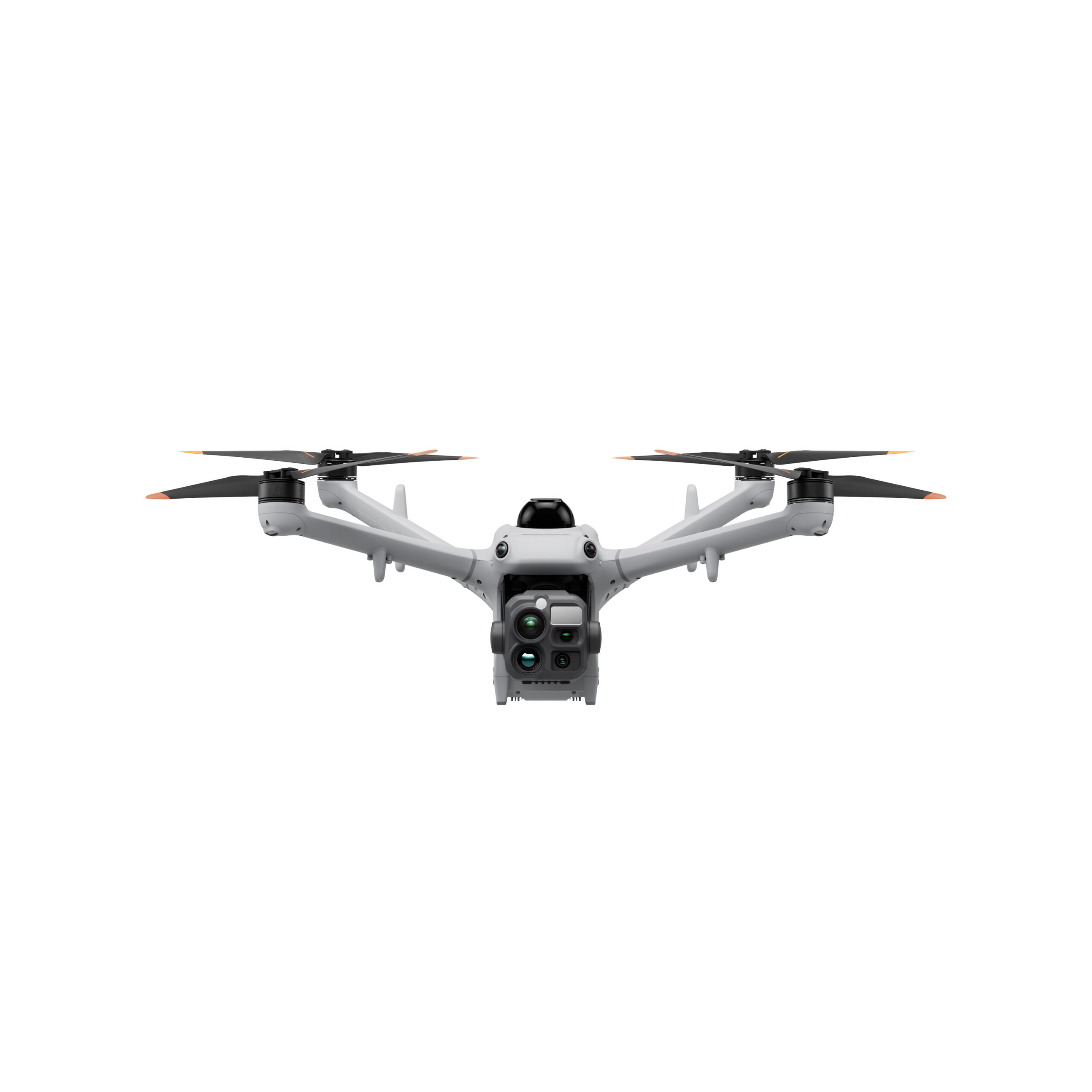
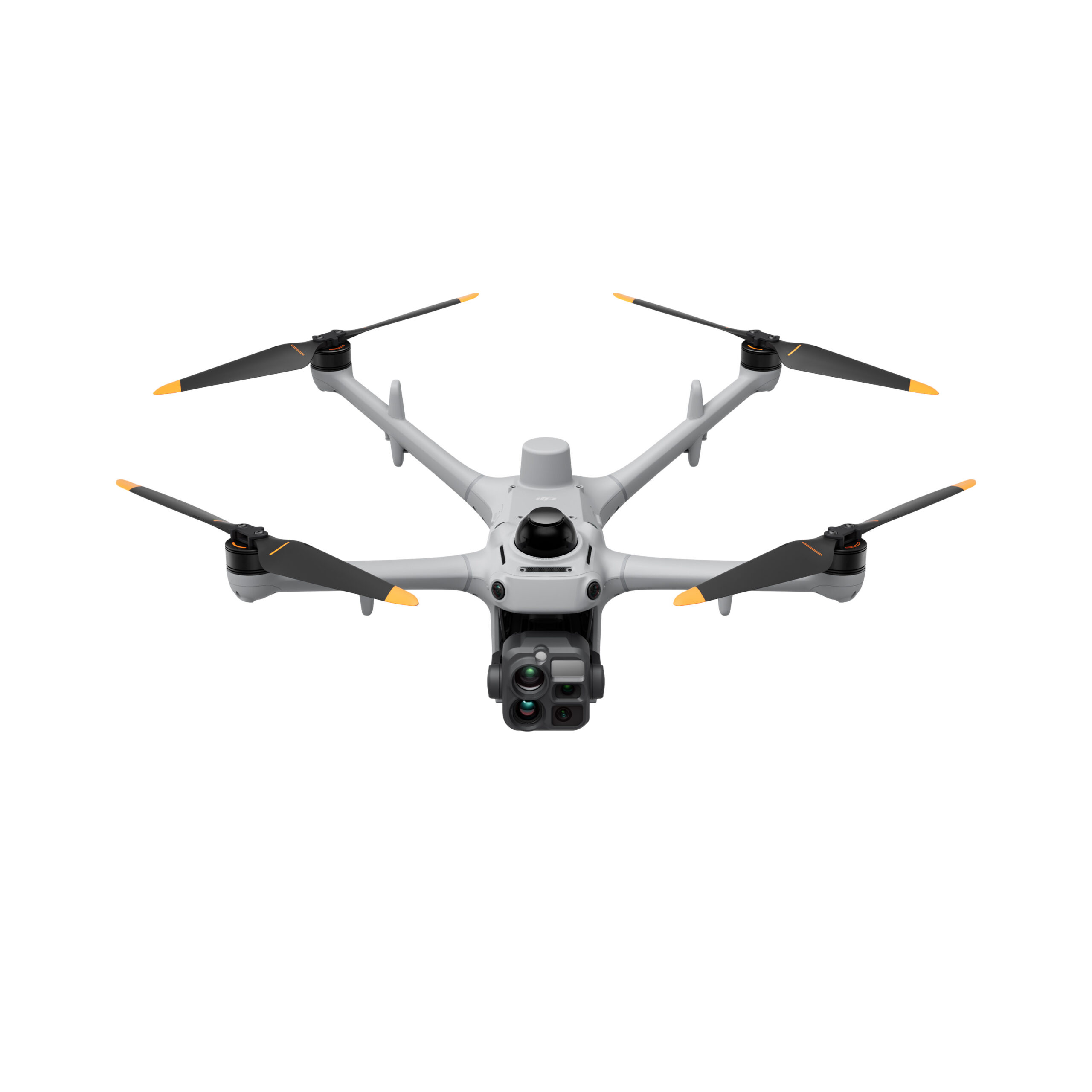
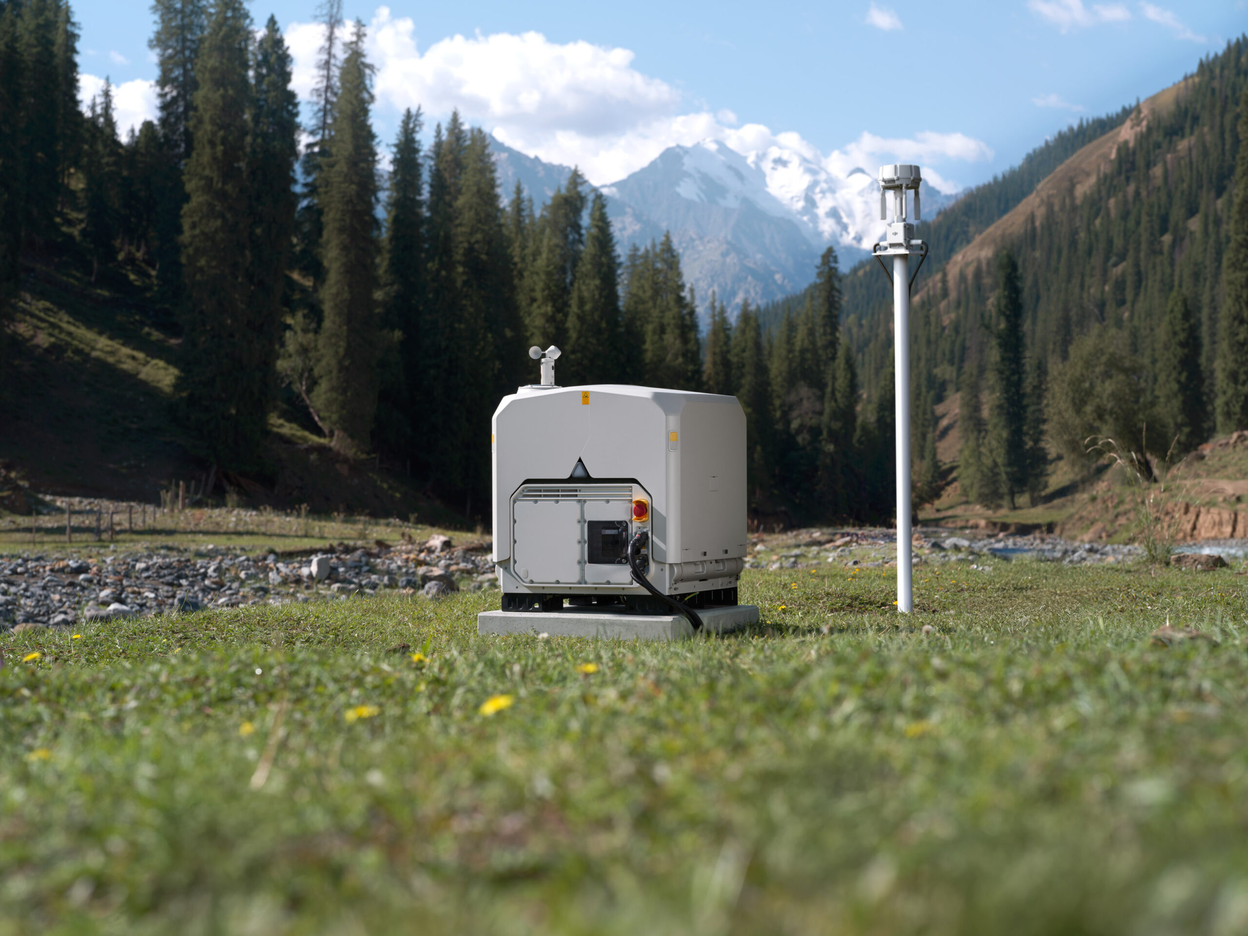
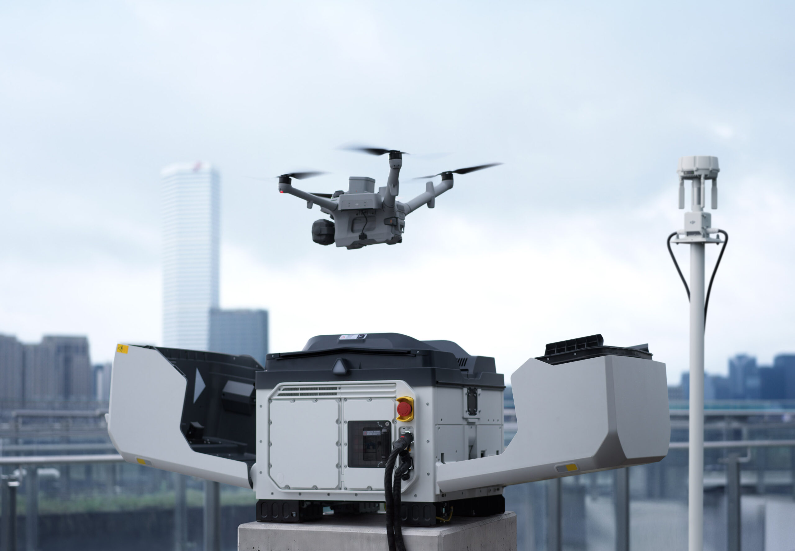
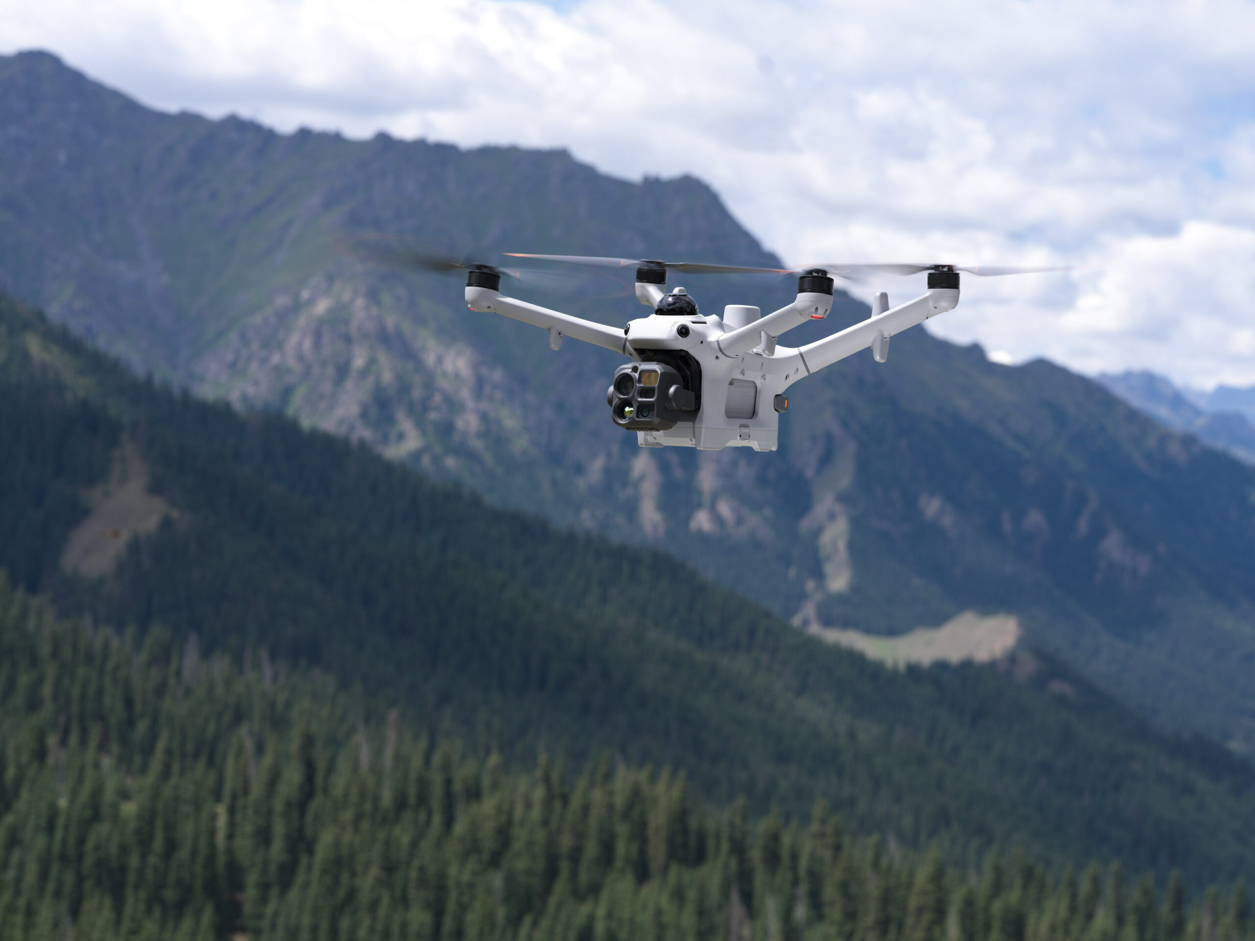
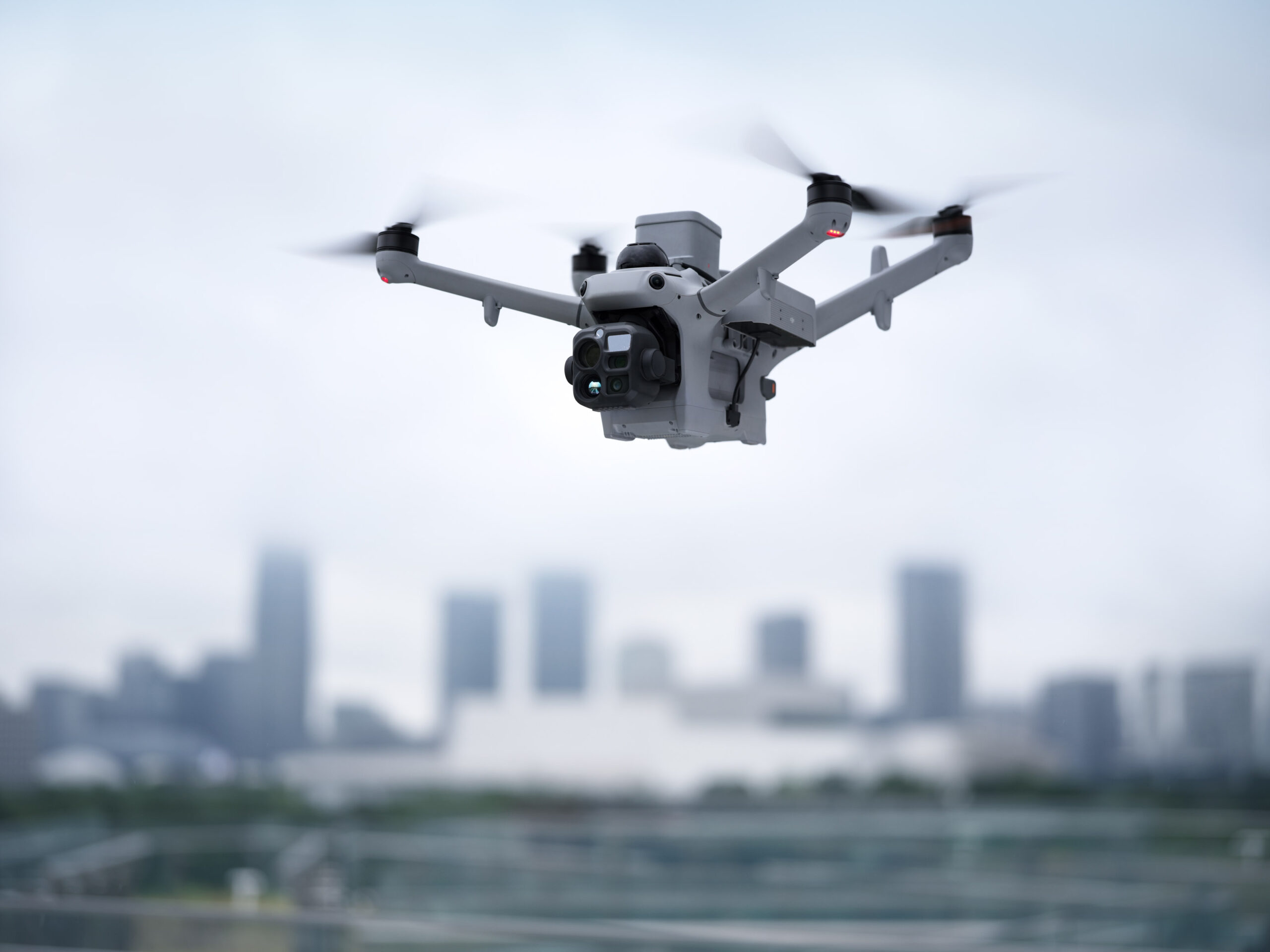
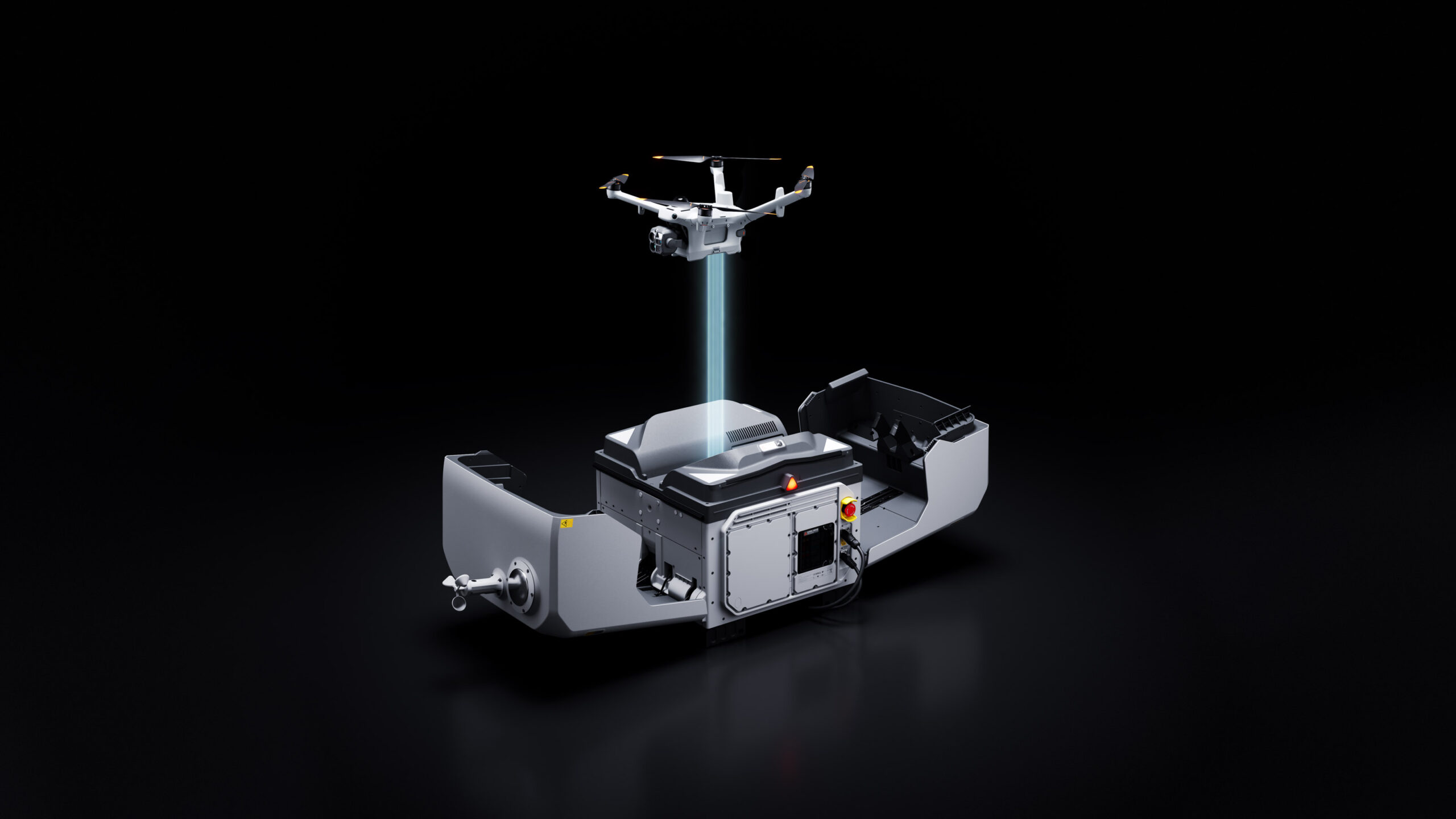
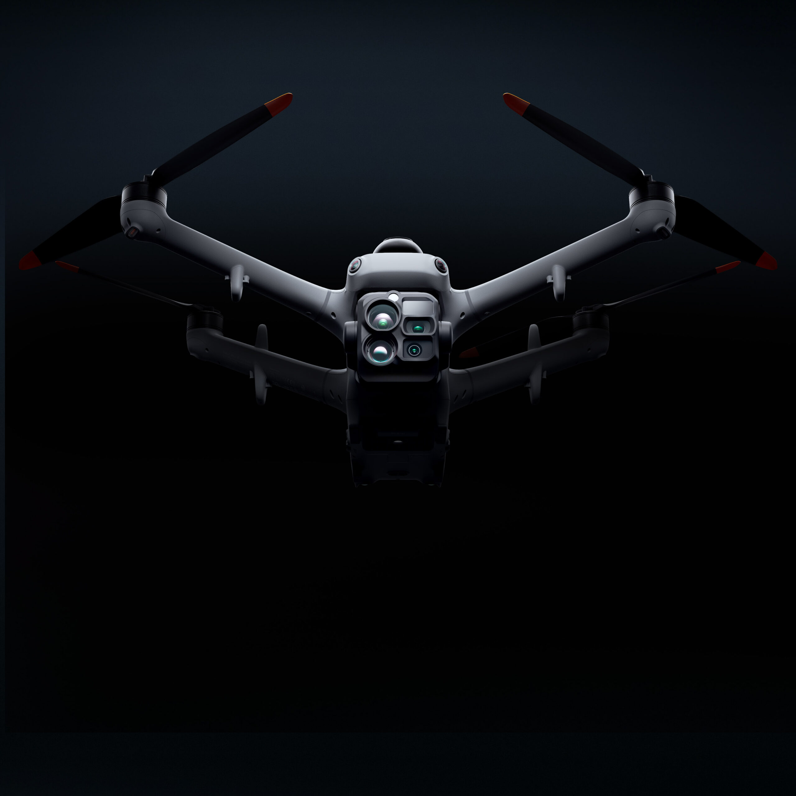
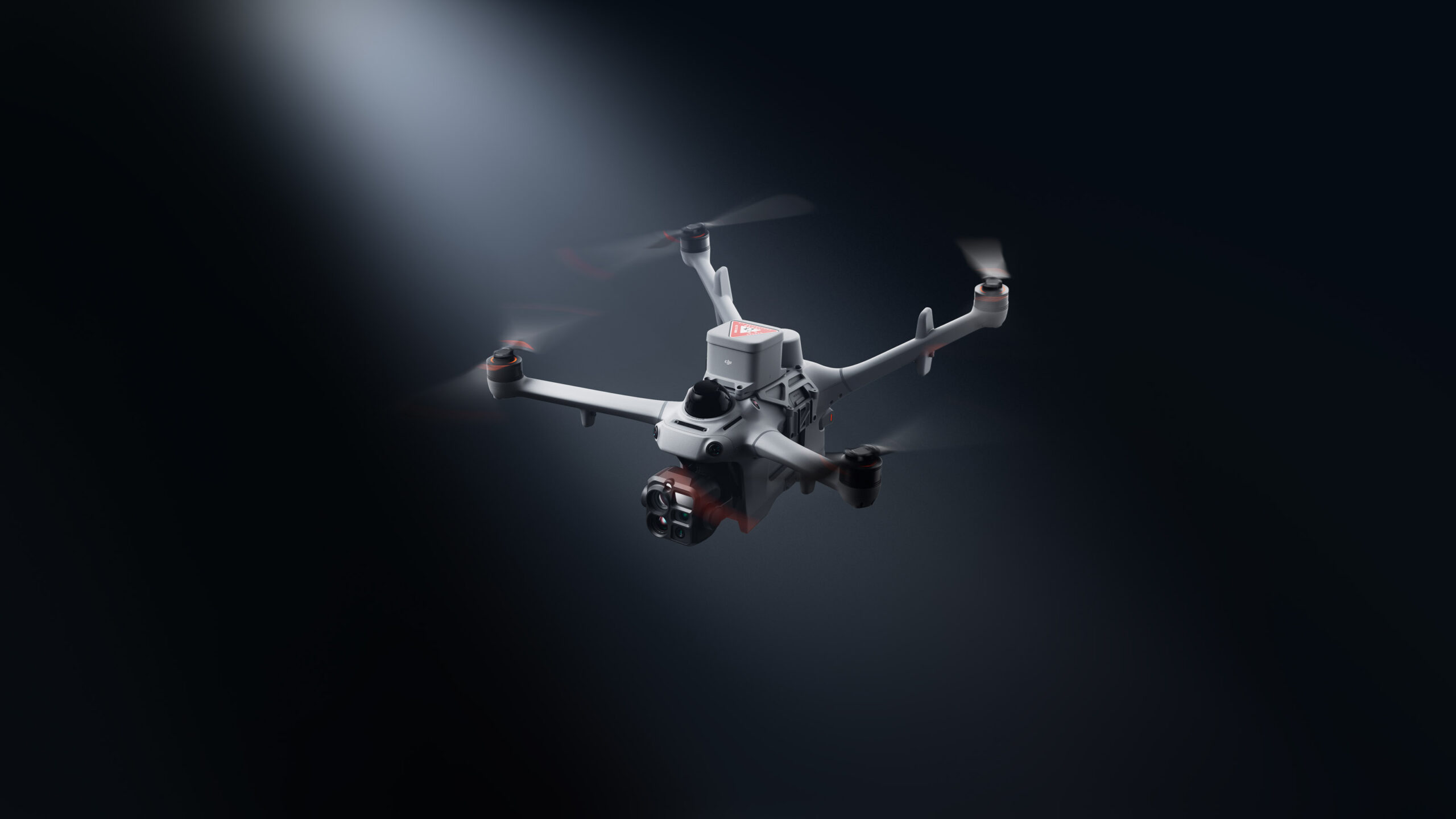
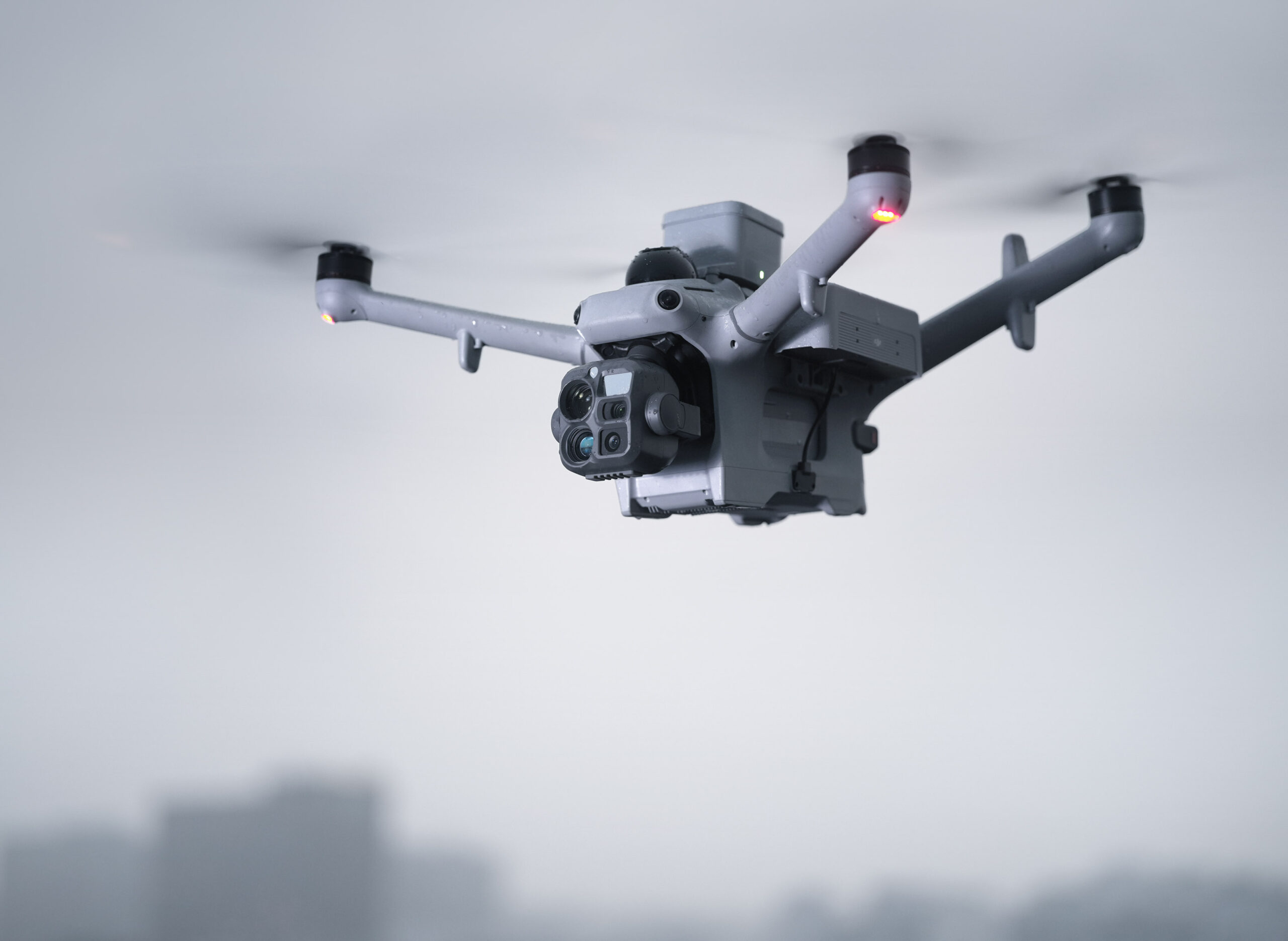
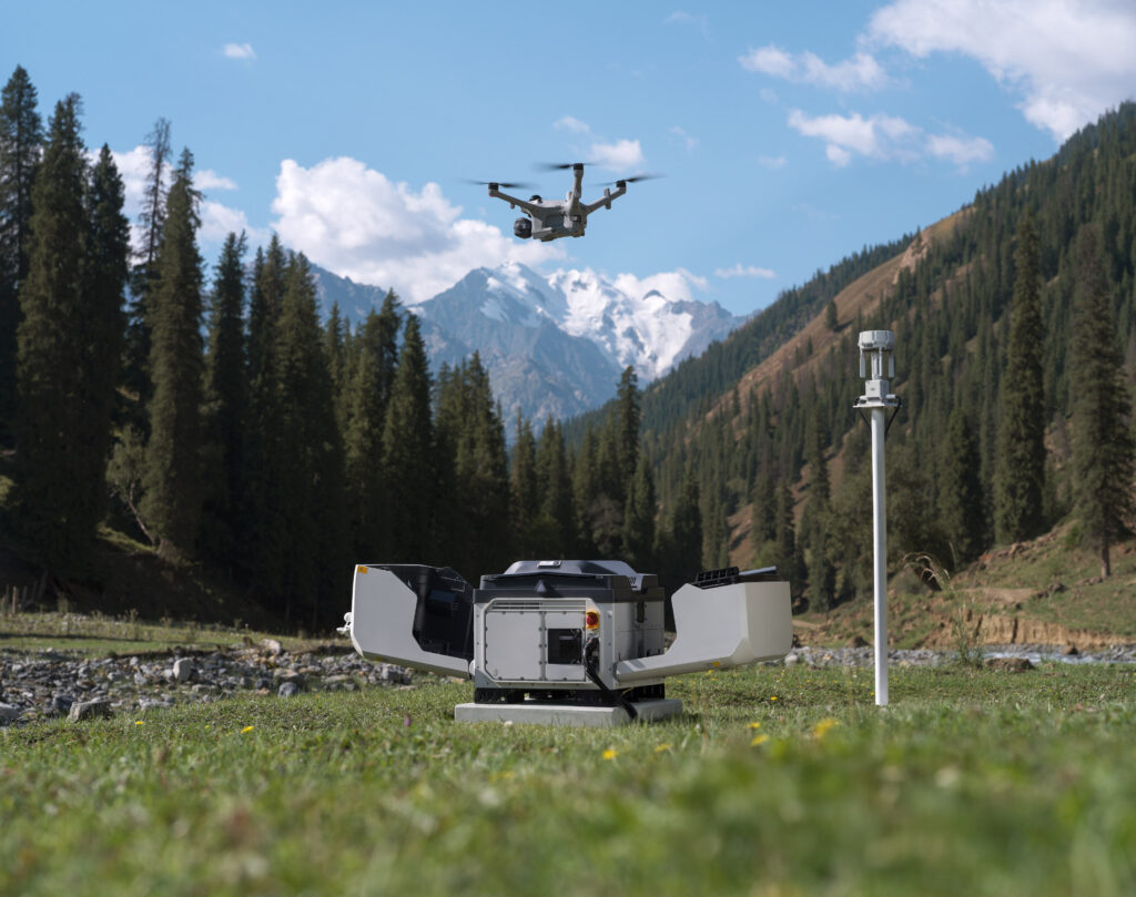
DJI Dock 4 swaps batteries in 25 seconds [1] for 24/7 automatic operations, urgent or continuous. Its DJI Matrice 5TD features wide-angle and infrared cameras, mmWave radar, LiDAR, and AI that detects 17 object types. The DJI O4 Ground Station [2] unlocks complex sites, while the AI-powered workflow from DJI FlightHub 2 [3] streamlines every operation.
Key Points:
- Ready in Seconds for Rapid Response
- Multi-Sensor Integration for Greater Versatility
- Built-In Radars for Reliable Flight
- AI-Powered Workflow [3] for Intelligent Operations
- Comprehensive Solutions With Integrated Software
- Secure and Compliant for Safer Operations
- Built for Diverse Industries and Scenarios
- DJI Care for Comprehensive Protection
Ready in Seconds for Rapid Response
Airborne on Alert, Ahead of Ground Crews
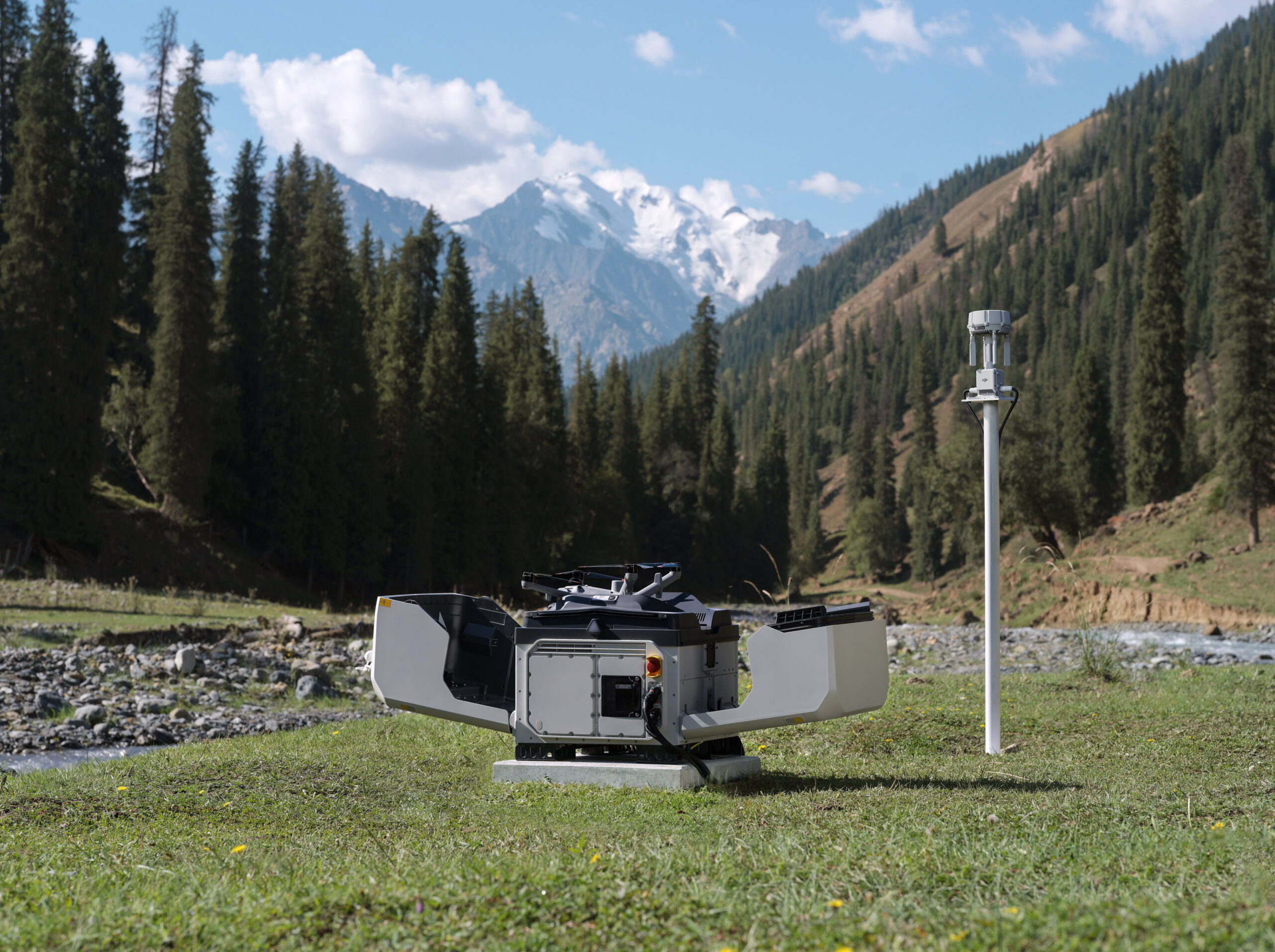
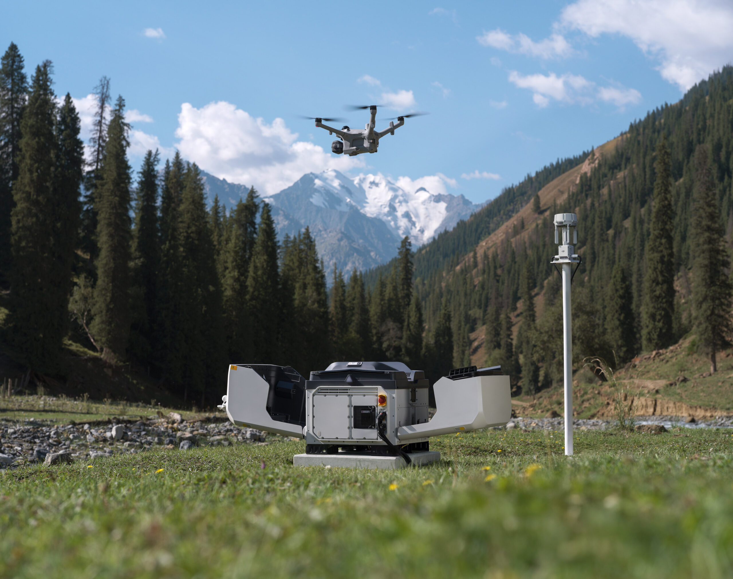
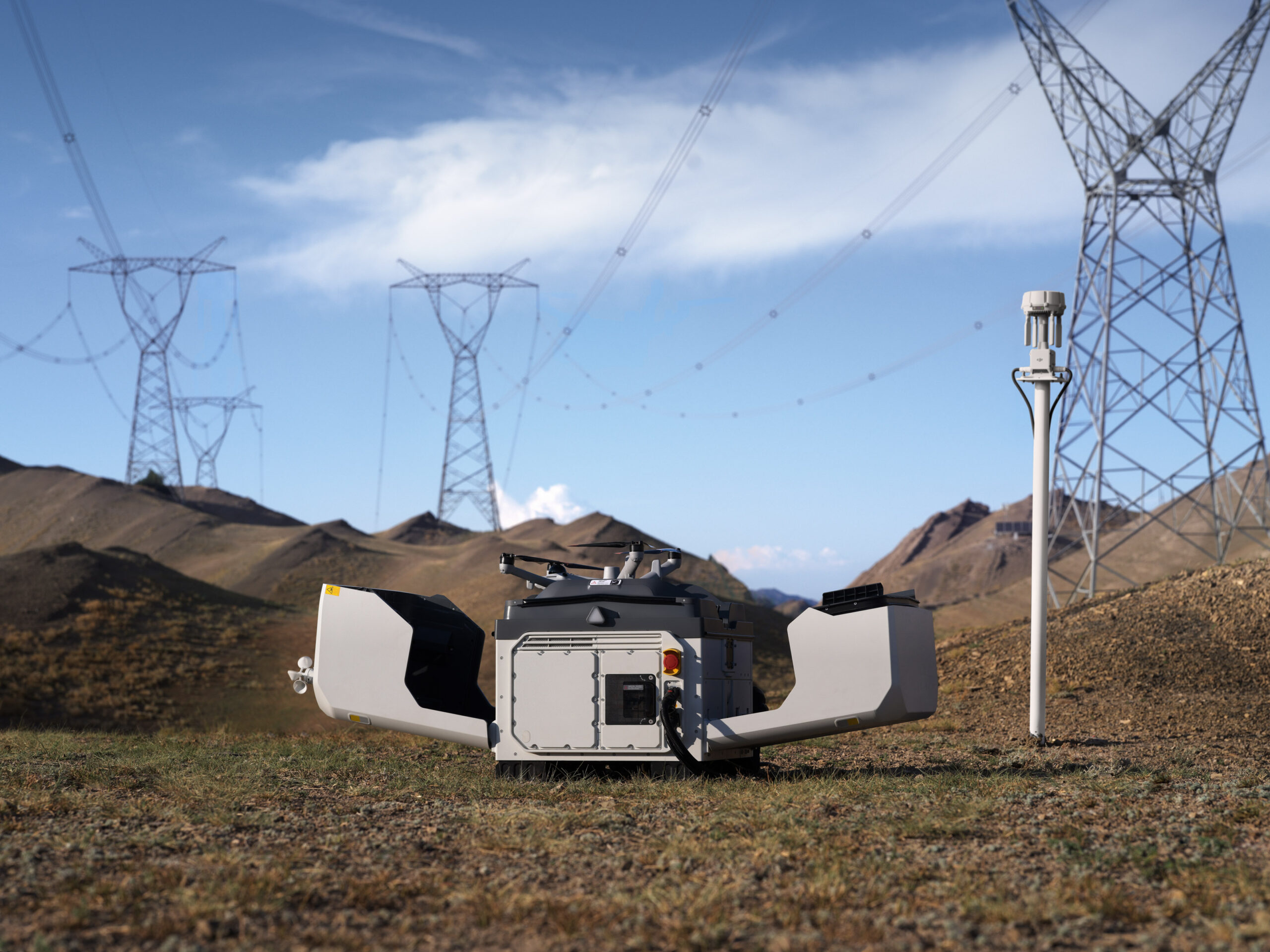
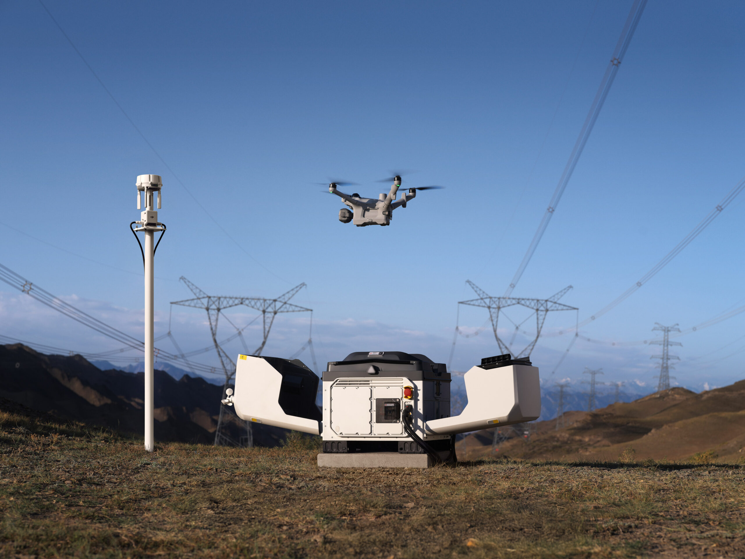
The drone launches as soon as the cover opens, flying to the scene at up to 21 m/s [4] to arrive ahead of ground crews and instantly stream the live video.
Instant Launch: Once a command is issued, the drone launches instantly with no pilot on site needed. Nighttime and holiday emergencies get a response in seconds.
21m/s Rapid Arrival [4]: At a top speed of 21 m/s [4], the drone flies directly to the scene regardless of traffic conditions, saving critical time when it matters most.
Swap, Relay, Sustain
For continuous tasks like emergency response, the dock completes a fully automatic battery swap in just 25 seconds [1], cutting the turnaround between flights from a 30-minute recharge to just seconds.
25-Second Battery Swap: Fully automatic battery swapping takes just 25 seconds [1]. The previous flight’s data transfers automatically during the swap.
Extended Endurance: A single flight lasts up to 59 minutes [5], covering more area in one takeoff.
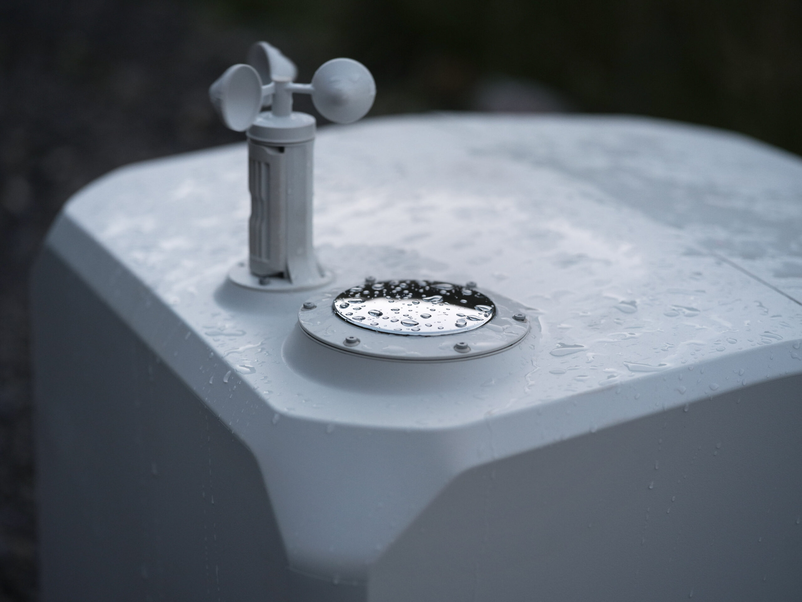
Wide Operating Temperature Range: Operating reliably from -40° to 50° C (-40° to 122° F), the dock auto-preheats the batteries in the cold, and uses air conditioning in high temperatures.
Task Relay: Any two aircraft in a project can auto-rotate across points, with one flying and the other on standby for uninterrupted situational awareness during emergency responses.
Live From the Scene, Remote Yet Accurate
With low-latency livestreams and high-speed data transfer, remote commanders can access the scene in real time and make decisions from off-site.
Low-Latency Livestream: A dedicated video transmission topology cuts drone-to-cloud latency to about 160 ms [6], down about 43% from the previous generation, for a smoother live view.
Anti-Interference Transmission: Dual 4G modules [7], sub2G transmission [8] and O4 Ground Station deployed at an elevated position deliver stability in obstructed environments.
Fast Data Transfer: During the battery swap, the drone sends flight data to the dock over a high-speed Wi-Fi channel at average speeds of 80MB/s [9].
Multi-Sensor Integration for Greater Versatility
Near and Far, Day and Night
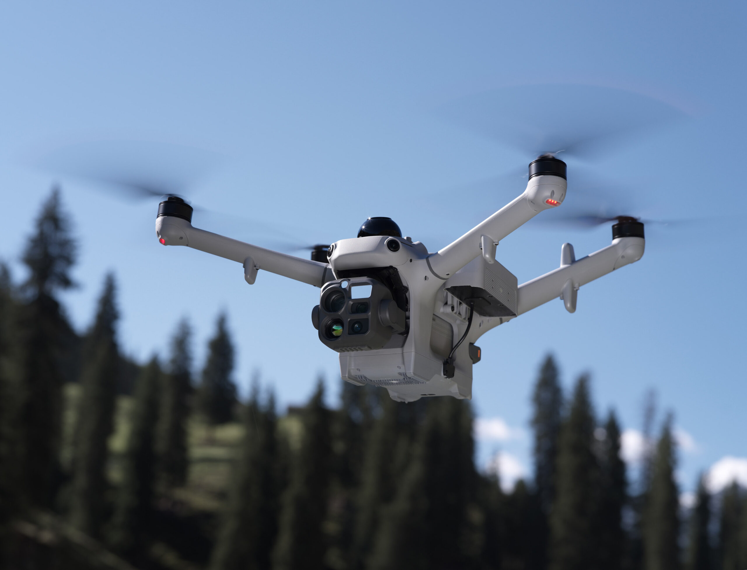
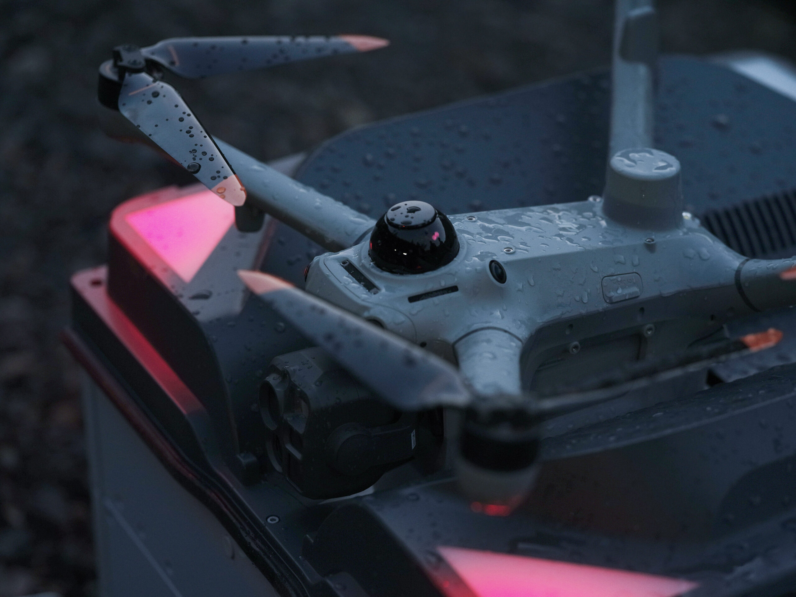
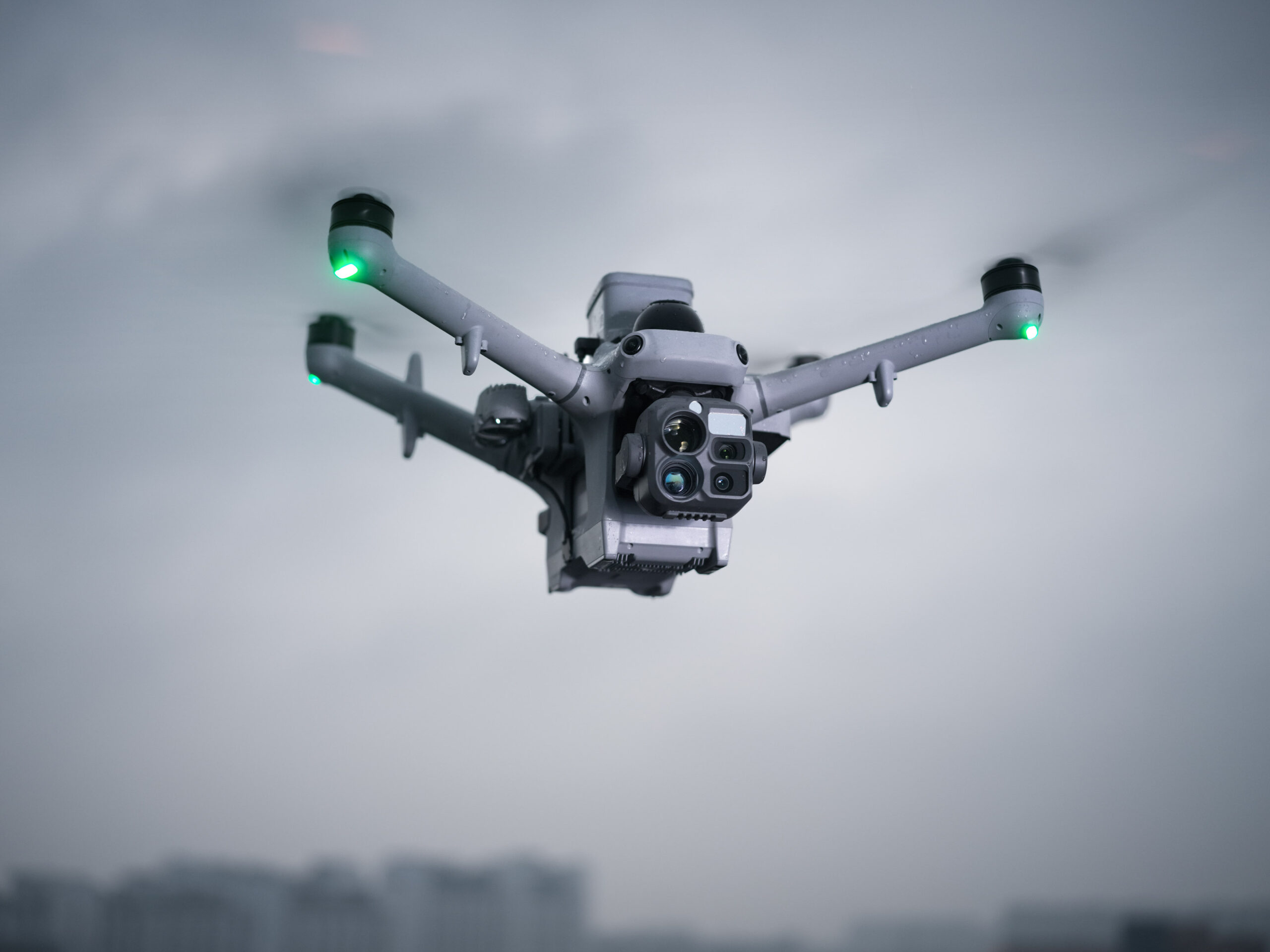
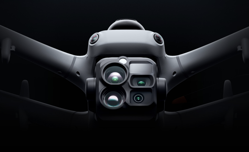
Matrice 5TD combines telephoto imaging, infrared imaging, laser ranging, and full-color night vision while delivering aerial survey accuracy up to 10 cm at 12MP [10]. Daytime inspections, nighttime security, and surveying are all handled by one drone, with no airframe swaps between scenarios, boosting equipment ROI by 50% [24].
11× Telephoto: With a 252 mm equivalent focal length, it captures detail from signs 400 m away [11] and spots bolt- and pin-level defects at 100 m for powerline inspection.
Infrared Camera: Resolution reaches 1280 × 1024, or 2560 × 2048 in UHR mode, revealing overheating and damaged insulators, with 2K recording and 32× zoom for night subjects.
Fusion Mode: Visible-light and infrared feeds fuse into one frame, with edge or overlay fusion modes, showing structure outlines and heat distribution without switching feeds.
Sharper Night Performance: Full-color 4K high-frame-rate night vision captures color images at night without switching on the spotlight. The camera also pairs with the NIR auxiliary light for black-and-white night vision.
3km Laser Ranging: Overlays range data and PinPoint coordinates on the feed for powerline inspections, rescue operations, or wildfire estimates.
More Payloads, More Flexibility
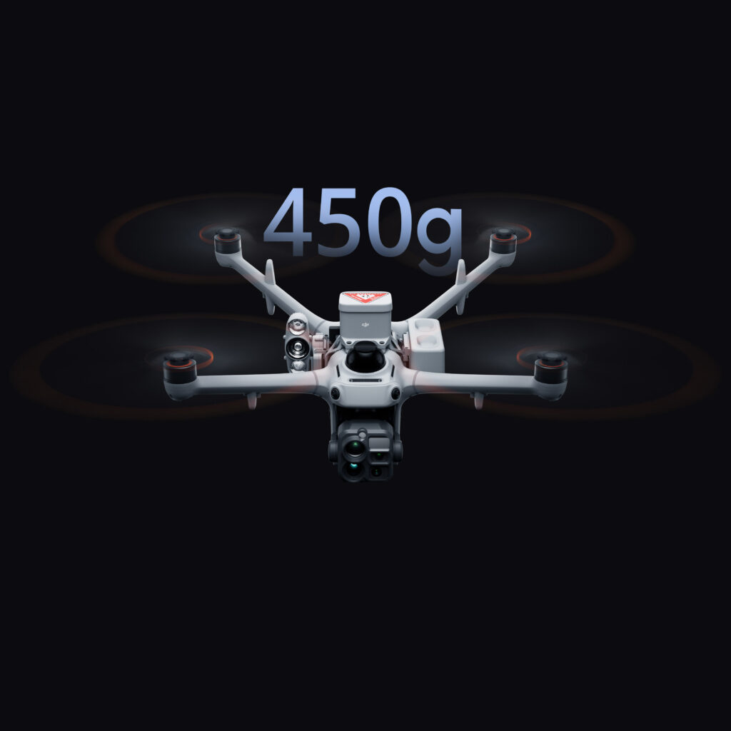
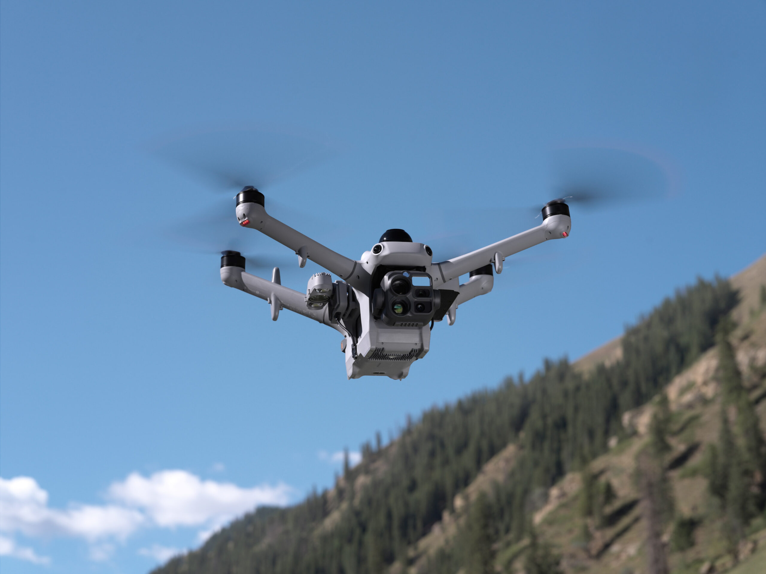
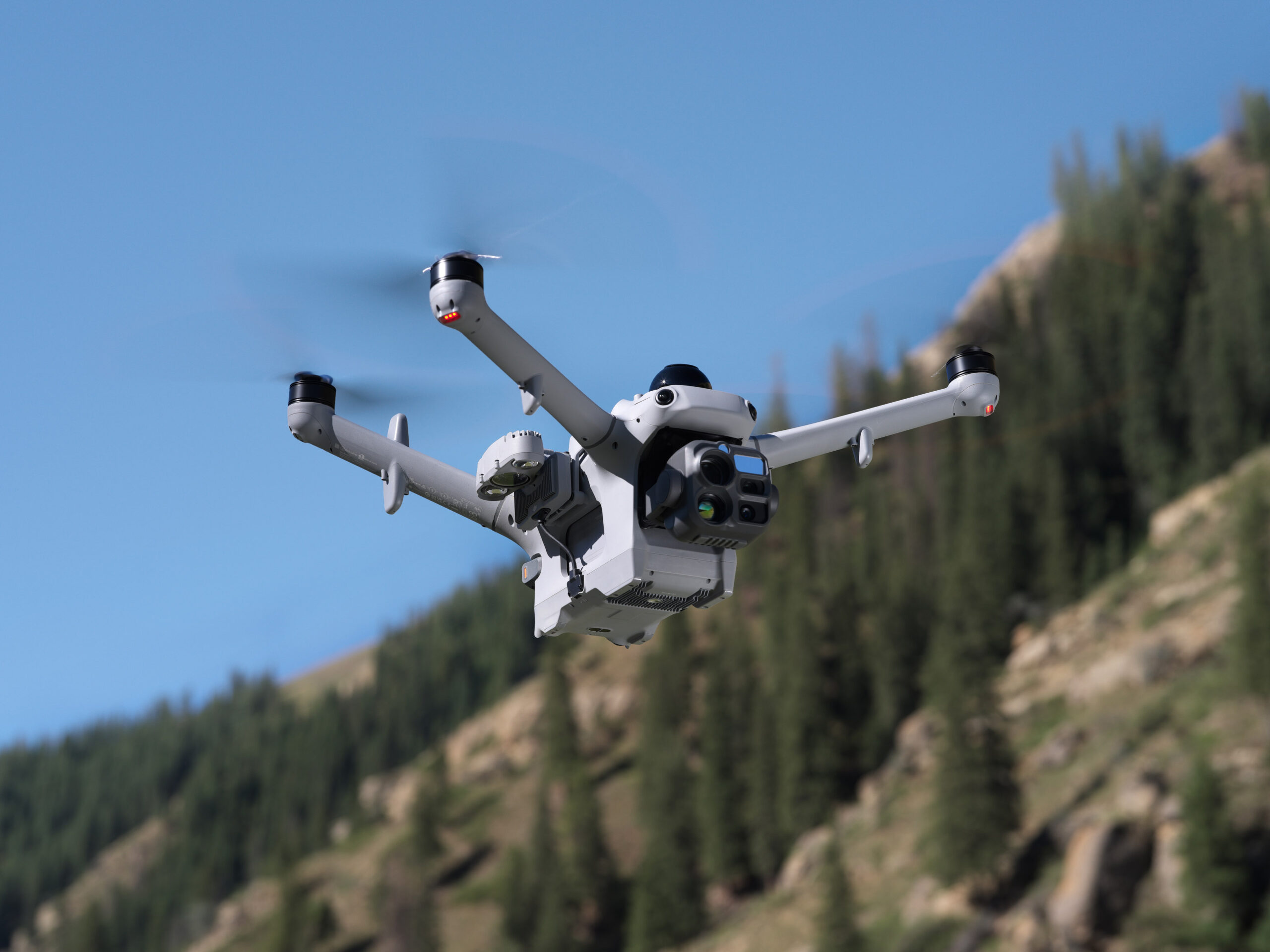
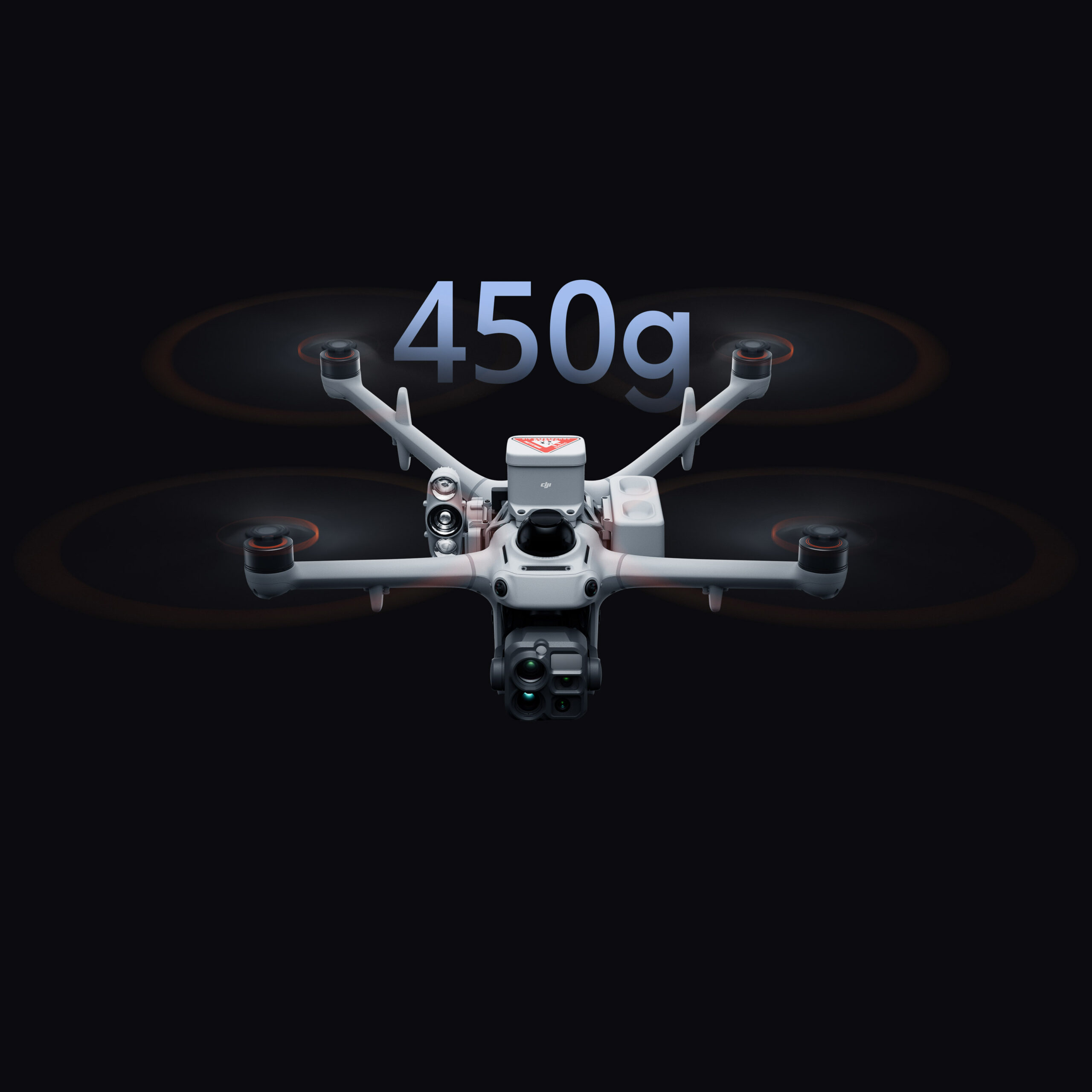
Matrice 5TD carries up to 450 g of payload, with side PSDK mounts and a top mount that can be used simultaneously. Mix and match accessories [12] to suit the task.
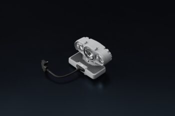
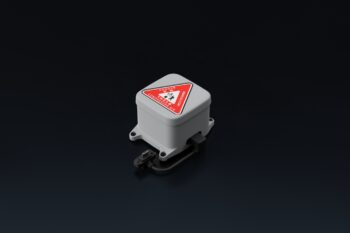
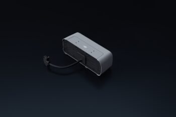
450g Max Payload: With three mounting positions [13] and an effective payload capacity of up to 450 g, the drone can provide lighting, broadcasting, and ground safety in a single flight.
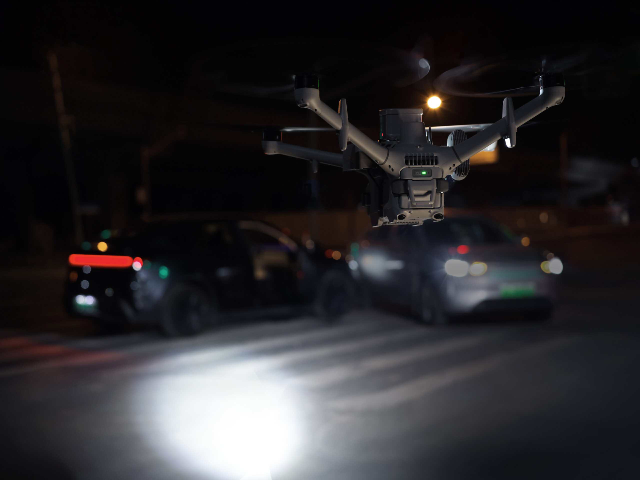
Speaker/Spotlight [25]/Parachute Combo: Mount a speaker, spotlight [25], and parachute together to provide aerial voice guidance and layered lighting during nighttime search operations, keeping ground crews safe.
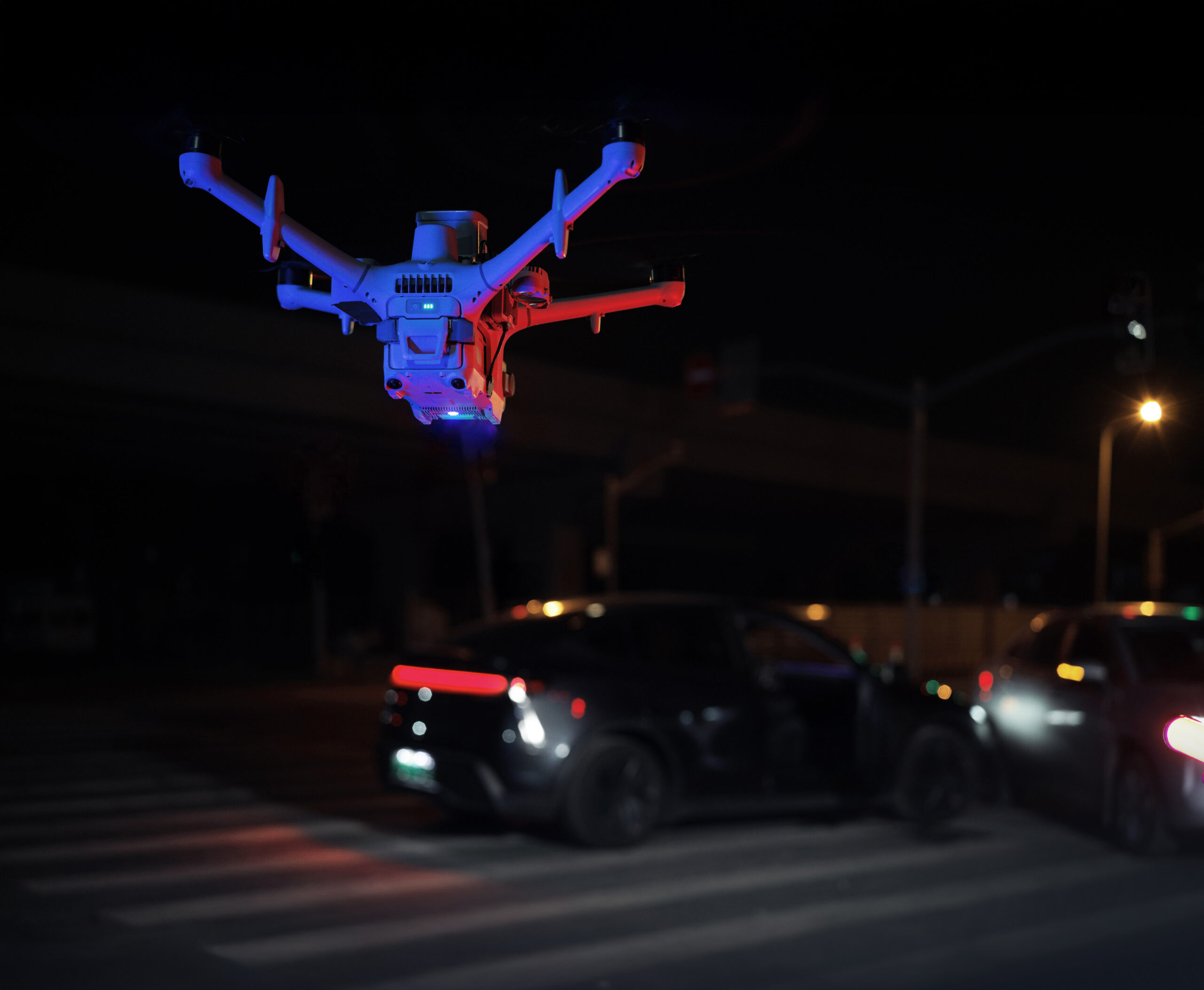
Built-In Customizable Warning Light: A built-in Customizable Warning Light supports custom colors and flash patterns, requiring no additional installation.
Robust Protection for Reliable Flight
Safe Flight, Even in Complex Environments
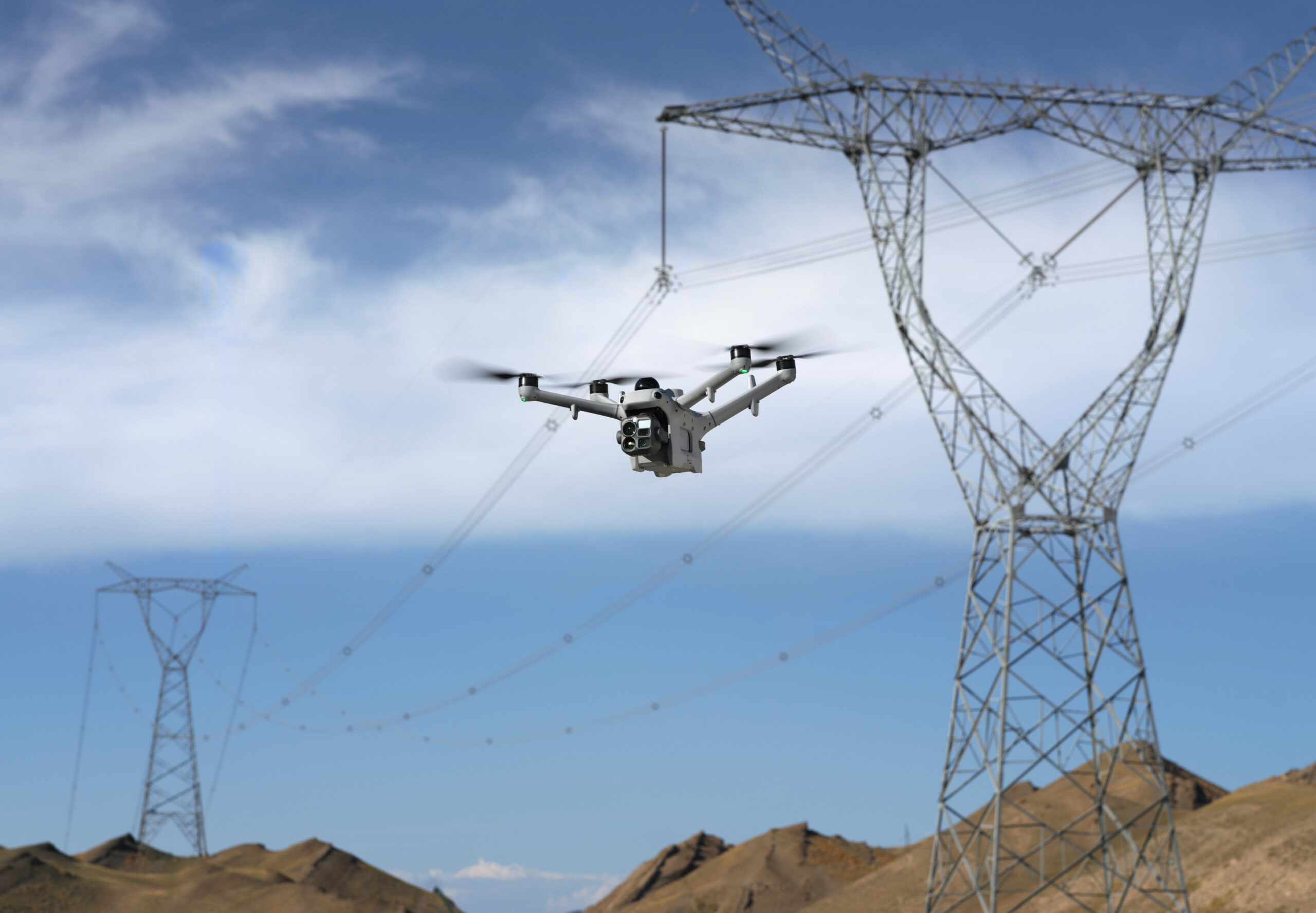
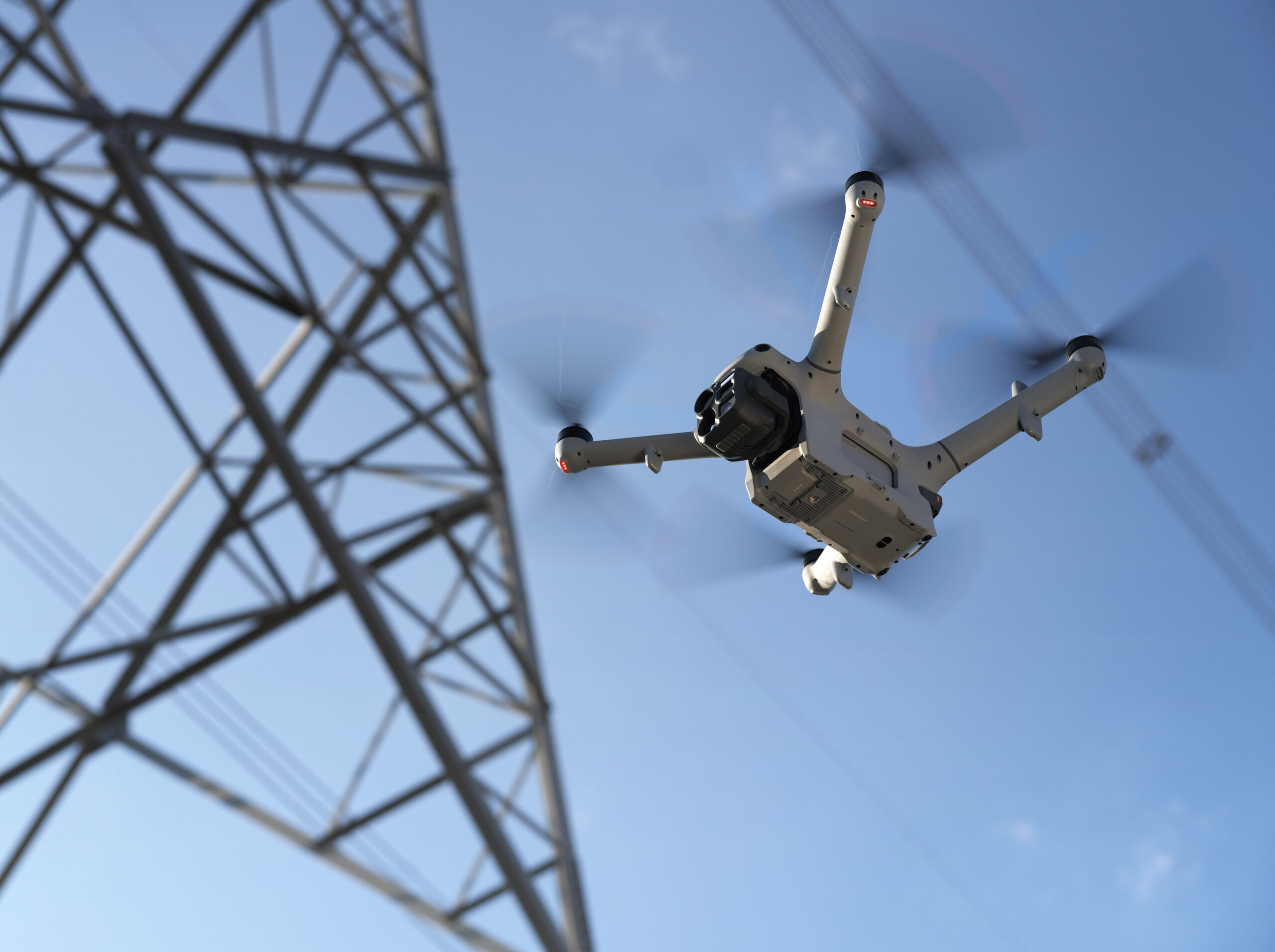
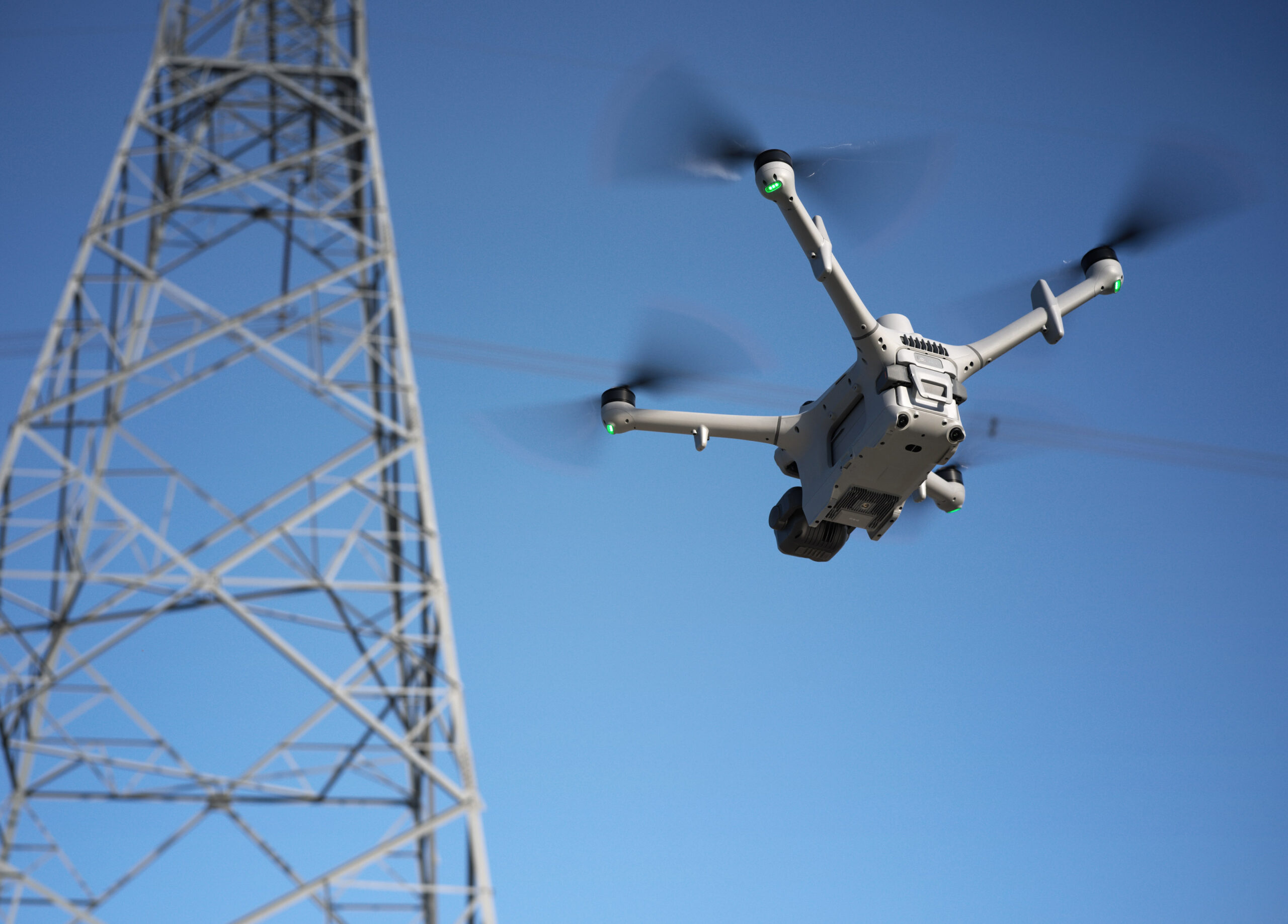
With three-directional mmWave radar, a rotating LiDAR, and a six-directional vision sensing system working together, Matrice 5TD achieves precise obstacle sensing [15], even inside a substation packed with live equipment or around crossing distribution lines.
Wire-Level Obstacle Sensing [15]: Combining a rotating LiDAR, mmWave radar [14], and full-color low-light fisheye sensors, this system detects thin obstacles, including powerlines, even at night.
Full-Color Six-Directional Sensing: Six-directional sensing works with six high-res low-light fisheye sensors to maintain obstacle sensing [15][16] even under city lights at night.
Flexible Deployment for Complex Sites
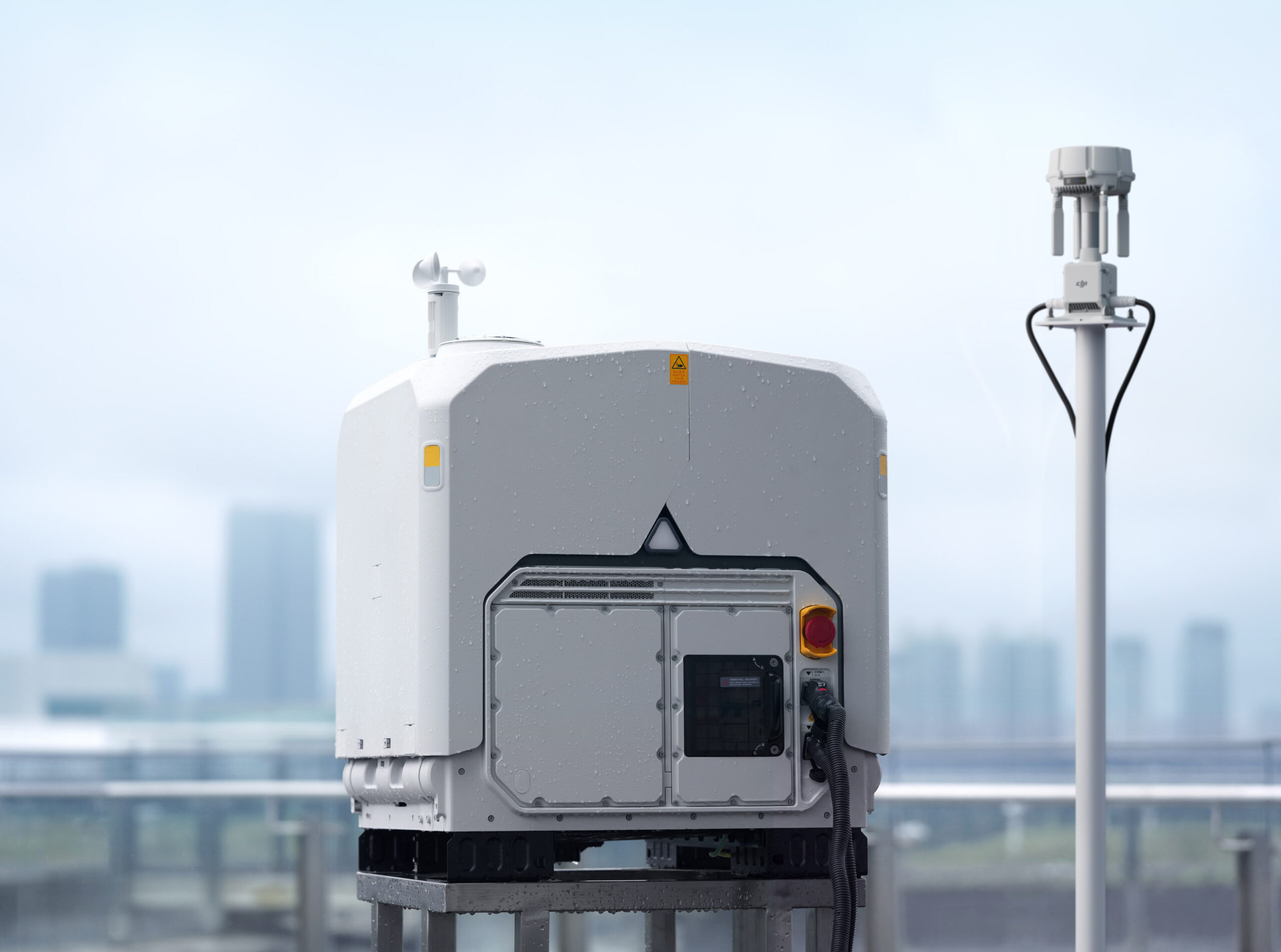
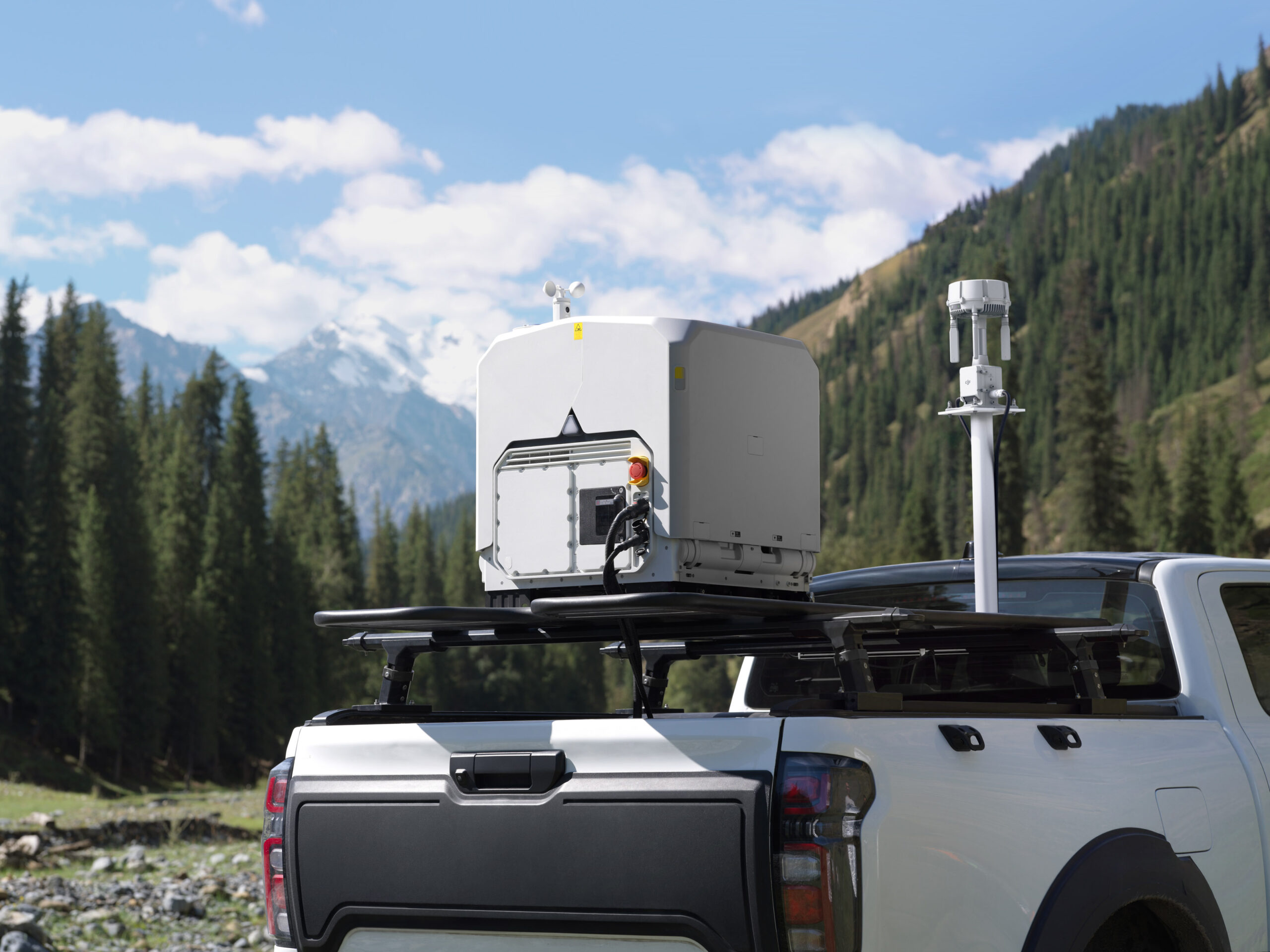
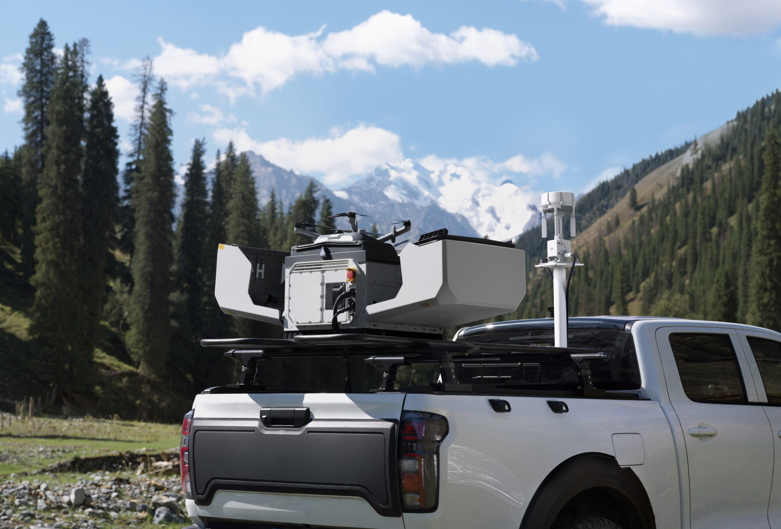
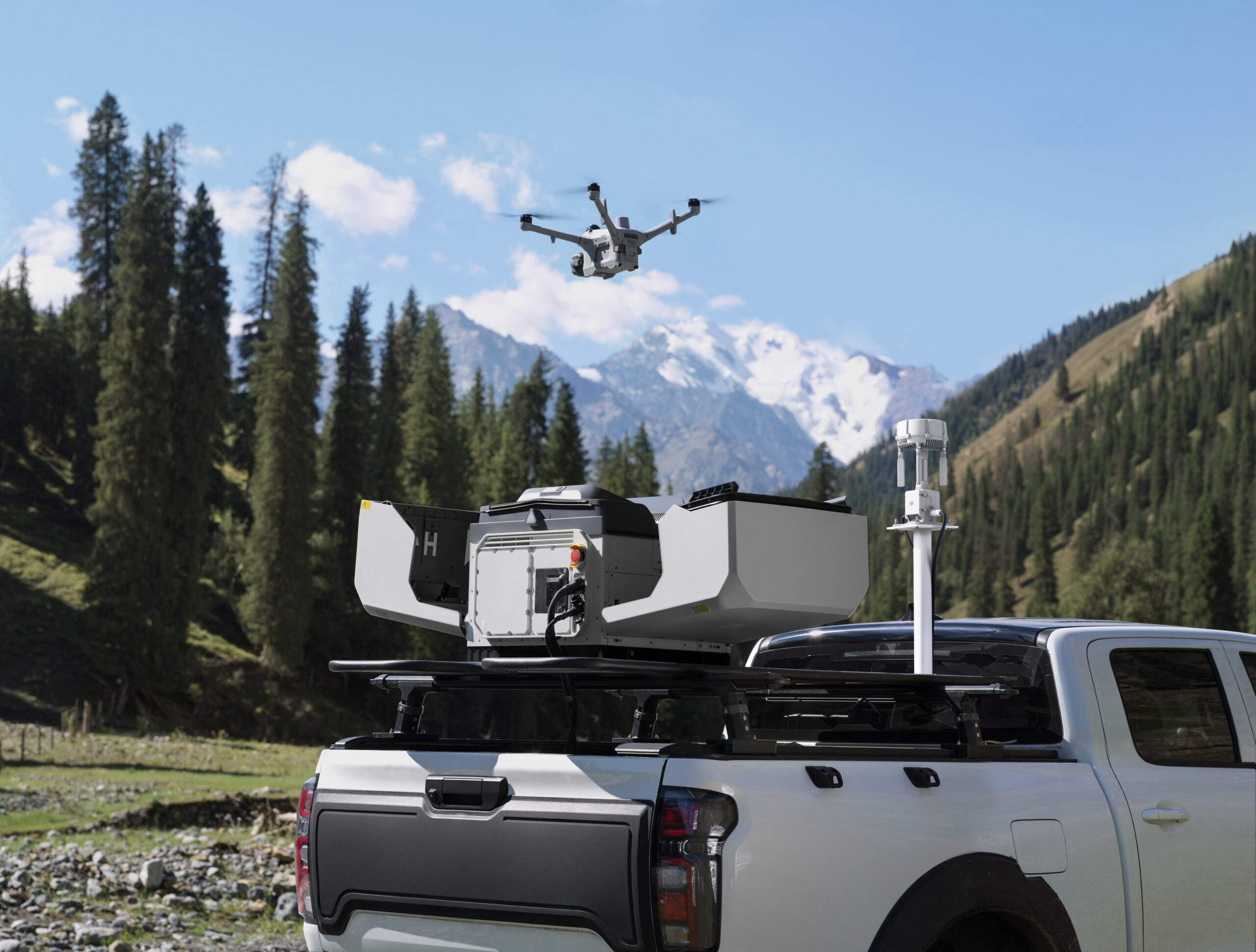
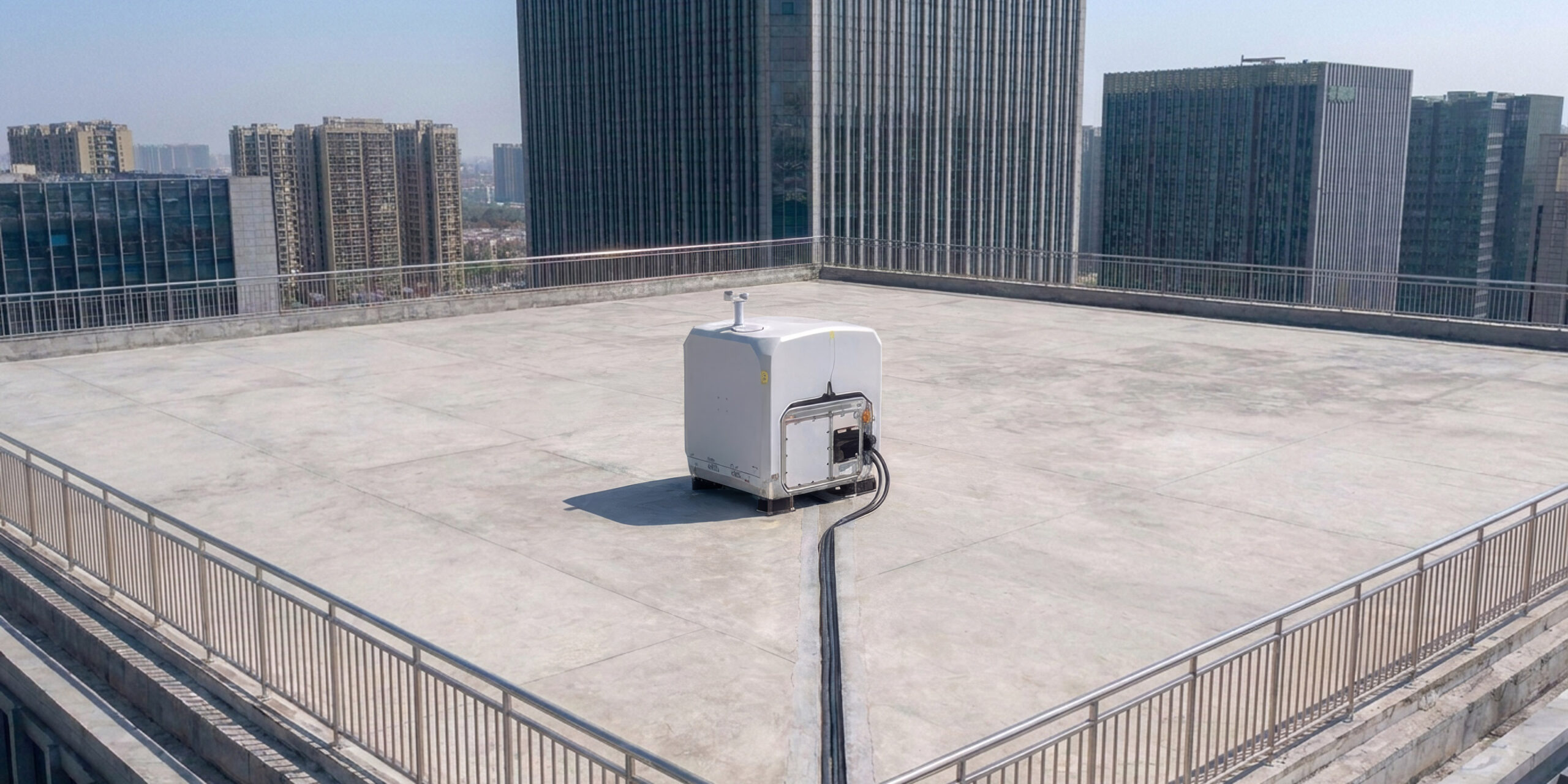
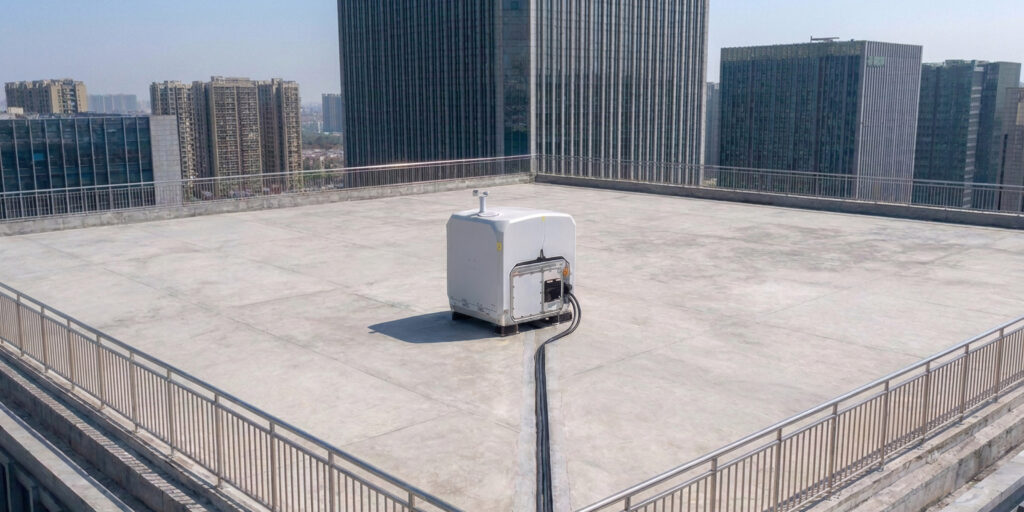
Powered by Matrice 5TD’s LiDAR and visual SLAM, anti-interference and anti-spoofing algorithms, plus the DJI O4 Ground Station [2], DJI Dock 4 can be deployed alongside high-rises [17] or on a mobile vehicle-mounted platform (coming soon) [18].
Near High-Rise Buildings [17]: Installing O4 Ground Station [2] on rooftops improves signal quality, allowing Dock 4 to be deployed near high-rise buildings or along substation walls.
On Vehicles (Coming Soon): The drone can take off while the vehicle is parked and land at the new stop after the vehicle reaches a new location [18].
Multi-Station Roaming: The O4 Ground Station supports multi-station roaming, enabling the drone to seamlessly switch between multiple ground stations to eliminate coverage blind spots.
Safe, Even When the Unexpected Hits
From multi-drone sensing and warning to emergency landing, Matrice 5TD is ready for the unexpected. A parachute cushions descent to protect people and gear on the ground, multi-drone sensing and warning helps keep the skies safe, and High-Wind Descent RTH brings the drone back safely in extreme weather.
Parachute: Top-mounted on Matrice 5TD, featuring independent power, full-link redundancy, auto/manual deployment, and an FTS compliant with EU C5/C6 and UK5/UK6 [19].
Multi-Drone Sensing and Warning: Matrice 5TD’s built-in ADS-B and RID receiver helps warn of nearby aircraft and RID-enabled DJI drones [20], overlaying tracks on the map for safer flight.
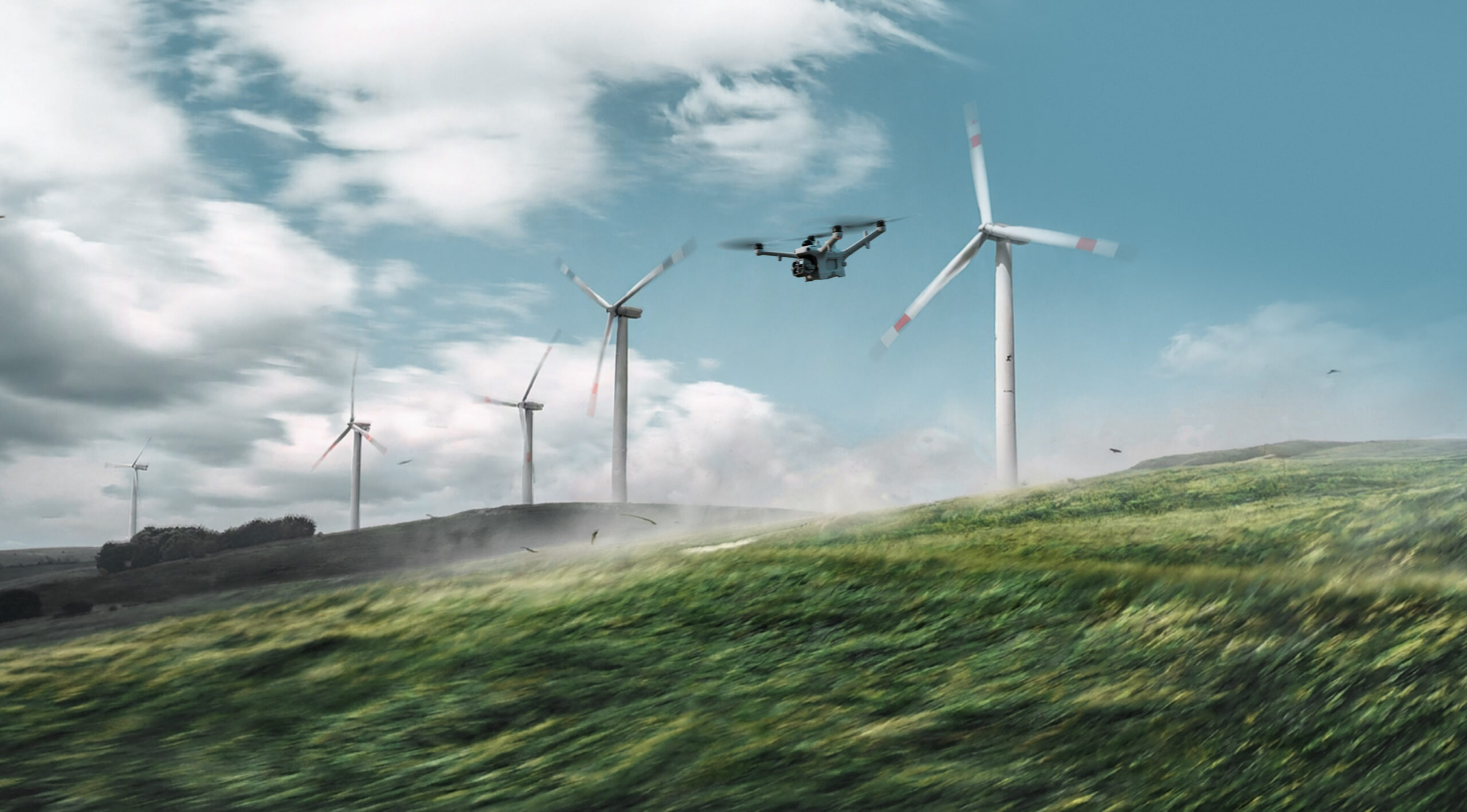
High-Wind Descent RTH: Matrice 5TD takes off, lands, and operates in winds up to 12 m/s. When winds spike during return, it descends and heads home safely, even over mountains and forests.
AI-Powered Workflow [3] for Intelligent Operations
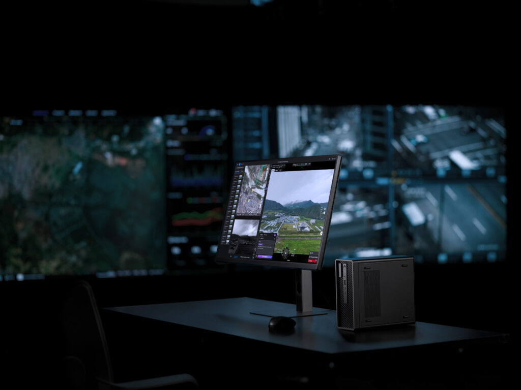
Sees More, Understands More
Onboard AI on Matrice 5TD now detects 17 object types in real time, while the Virtual Cockpit allows users to search almost any object type via text or image.
Onboard Detection: Matrice 5TD runs real-time AI detection on the live feed, covering 17 object types, plus infrared hotspot detection and support for third-party AI models.
Generalized Intelligent Detection: Within the Virtual Cockpit, object searches work via text or image. The Multimodal LLM interprets prompts, detects objects, and triggers alerts for situational awareness.
From Alert to Action, Automatically
Once an anomaly is detected, the system can send SMS, email, or platform alerts and trigger actions such as snapshots, recording, tracking, or hovering actions, completing the cycle from detection to response.
FlightHub 2 Copilot: From drone control to flight commands, routes, and scheduled tasks, just describe it in natural language. FlightHub 2 Copilot turns your intent into drone commands.
Automated Workflows: Triggered workflows dispatch drones on third-party alerts such as DFR calls. Periodic workflows automatically handle collection, modeling, analysis, and reporting.
AI Post-Processing: Reports in Minutes
After each operation, the system uses AI to compare the latest data with historical aerial photos or 3D models, automatically annotates the results, and exports a report.
Post-Processing Smart Detection: Compares historical aerial photos to automatically flag facility damage, ground changes, and new unauthorized structures.
Change Detection Pro: AI compares historical aerial photos, marks changed areas, and generates a change report, compressing hours of work into minutes and eliminating frame-by-frame review.
Comprehensive Solutions With Integrated Software
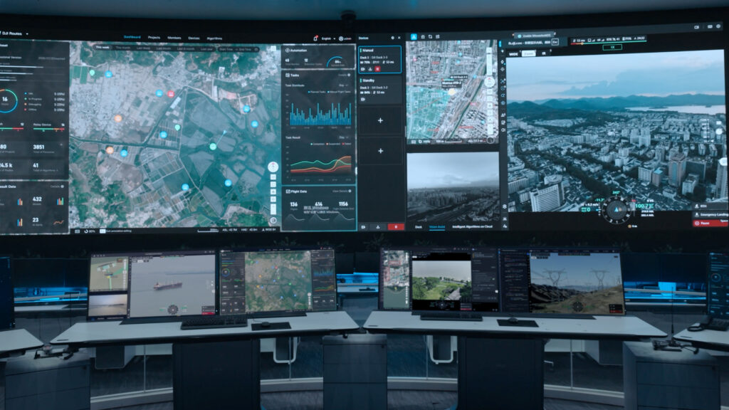
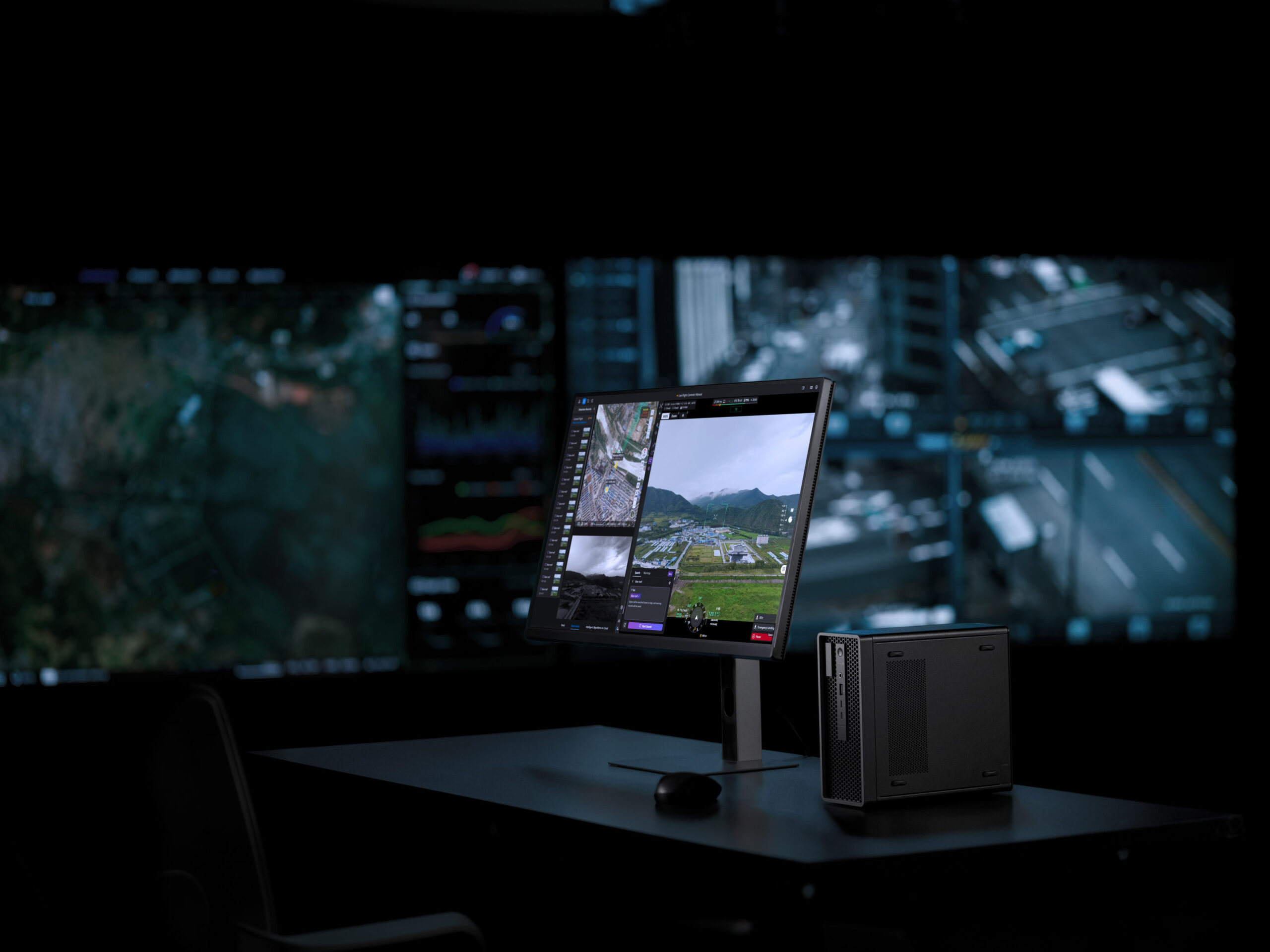
DJI FlightHub 2, The All-in-One Cloud Platform
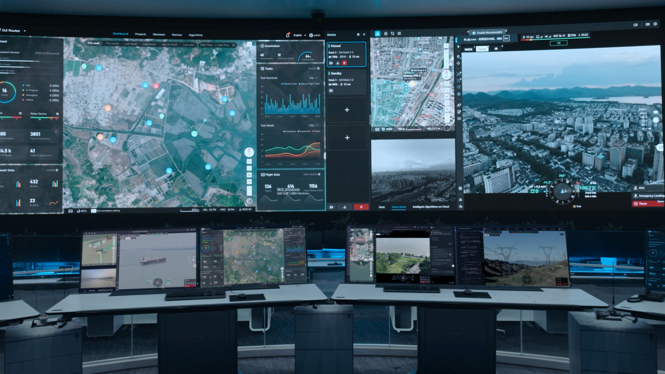
DJI FlightHub 2 combines rapid deployment, low-latency remote control, automated route tasks, real-time cloud detection, multimodal AI detection, post-processing, anomaly alerting, and OTA maintenance into one platform, covering every stage of operations from deployment and operations to air-ground coordination and long-term upkeep.
Cockpit, Routes & Dashboard: Virtual Cockpit remote control, route editing, timeline task management, multi-channel live streams, and a unified dashboard bring the command center closer to the field.
Multiple Deployment Options (Public Cloud/On-Premises/All-in-One): DJI FlightHub 2 is available as a public-cloud SaaS, an all-in-one appliance, or an On-Premises Version [21], meeting a range of deployment and data security needs.
OpenAPI & FlightHub Sync: FlightHub 2 connects with cloud platforms via FlightHub Sync’s code-free integration. Developers can use OpenAPI* to integrate functions and 2D/3D modeling, cutting cost.
* The OpenAPI support scope differs between the FlightHub 2 public cloud and On-Premises Version. See the DJI FlightHub 2 User Guide for details.
DJI Enterprise App, Control in Your Pocket
The DJI Enterprise app handles on-site setup while serving as a hub for remote operations entry point. Beyond dock configuration and debugging, it supports task triggering and remote viewing.
One-Tap Drone Dispatch: Send a task from the app to wake the drone and dispatch it to the location in seconds for rapid emergency response.
Remote Control: Low-latency livestreams [6] give remote crews a real-time view of the scene, enabling informed decision-making off-site.
Secure and Compliant for Safer Operations
Ground Risk Mitigation
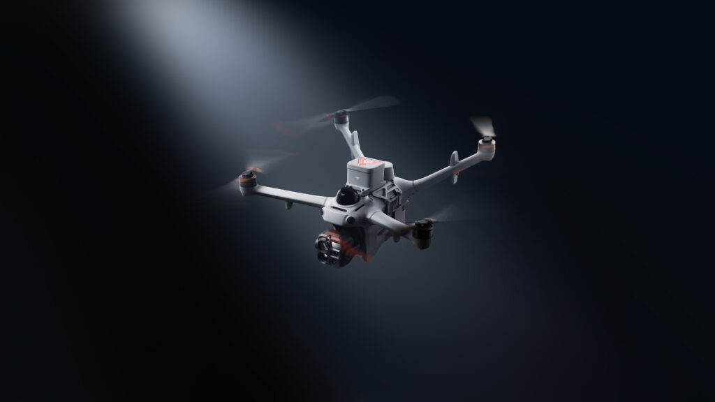
With a DJI-designed parachute, custom flight zones, and compliance-by-design flight control, DJI Dock 4 helps reduce flight risk and supports compliant operations in urban and complex environments.
DJI Parachute System: A parachute by DJI reduces the impact in the event of a sudden system failure.
Custom Flight Zones: Enforced directly by the flight controller, custom flight zones keep the drone within its preset area, lowering the risk of straying beyond authorized boundaries.
Airspace Risk Mitigation
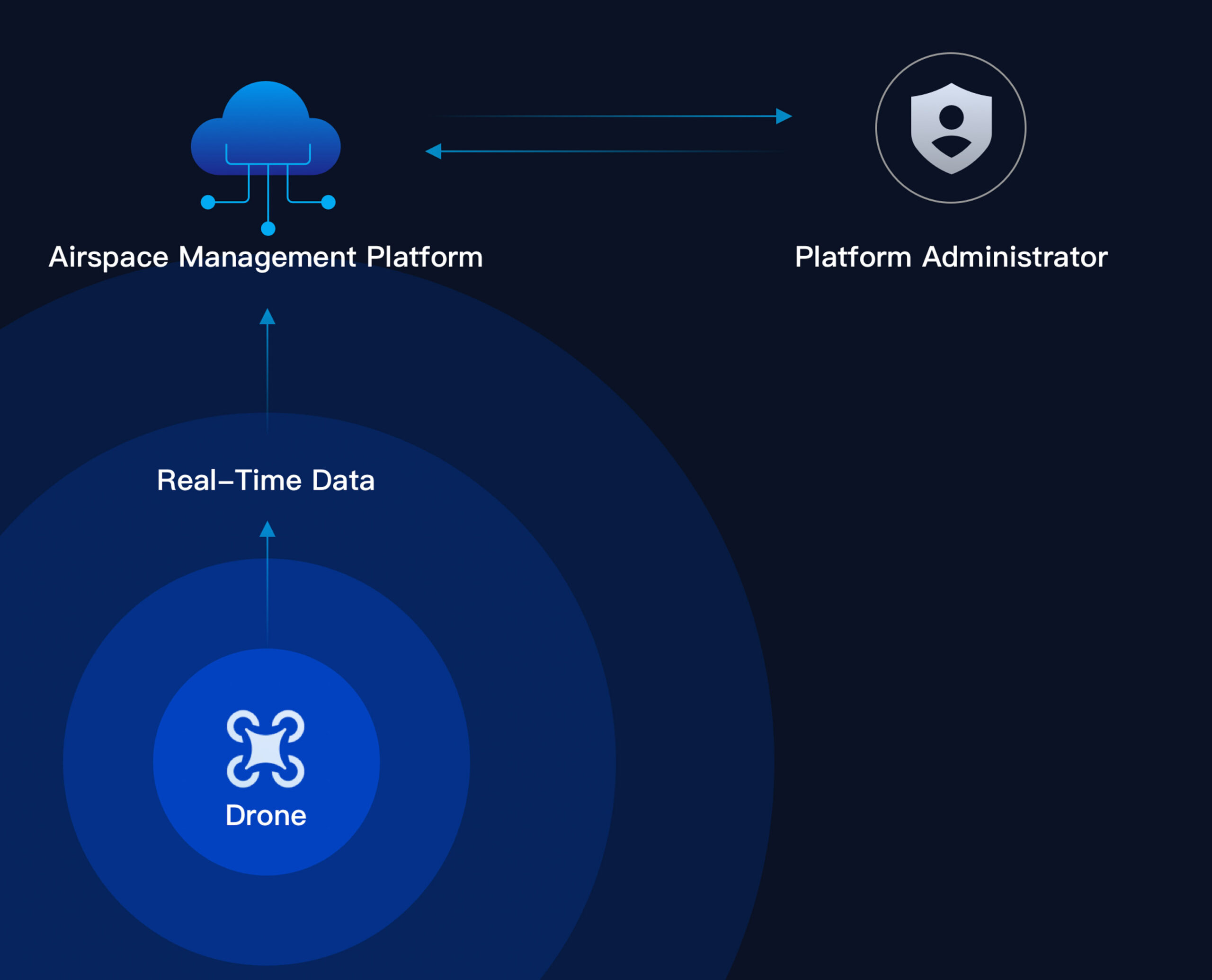
Remote ID sensing [20], AirSense, and third-party airspace data give operators real-time situational awareness, helping them assess risk before each task and make informed decisions during flight.
Drone Airspace Sensing: Matrice 5TD receives ADS-B signals from nearby aircraft and senses nearby drones [20], showing status on FlightHub 2 to help operators detect risks.
Third-Party Airspace Sensing: Connecting to third-party airspace info services, the platform shows conditions, restrictions, and risk tips near the task area, aiding pre-task and in-flight decisions.
O4 Ground Station Airspace Sensing: The DJI O4 Ground Station can connect a third party Remote ID receiver via MQTT to sense nearby drones or crewed aircraft in real time, safeguarding the airspace.
Data Protection
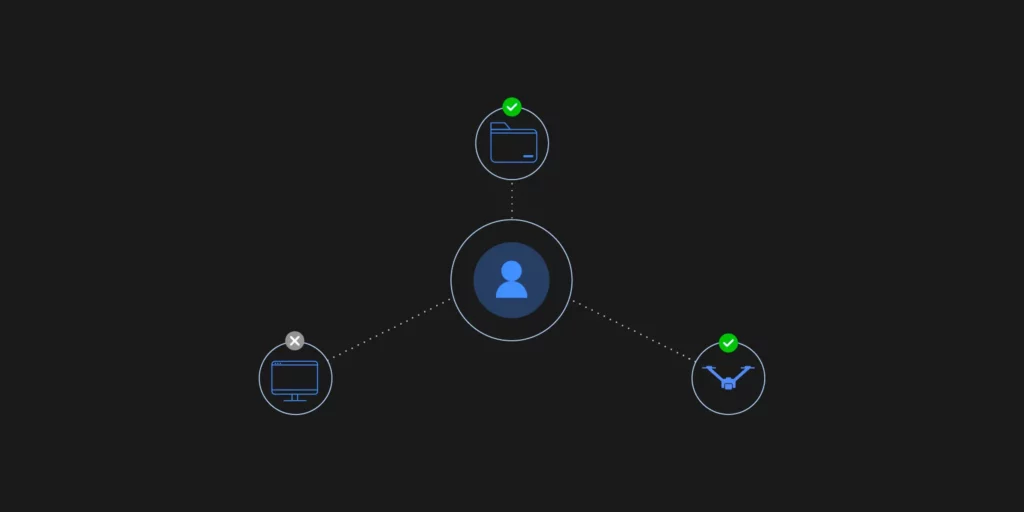
Data Collection Stage: Drone operations generate business, flight, and device data. Once generated, this data immediately enters an encrypted channel to prevent eavesdropping, hijacking, and man-in-the-middle attacks. This secures your data from the very first second.
Data Transmission Stage: DJI enforces strict encryption across all transmission nodes. Drone-to-Dock transmission uses TLS 1.2+ and AES-256 encryption. Dock-to-Cloud uploads use HTTPS, WSS, and TLS protocols. These measures prevent data from being intercepted or tampered with in transit.
Data Storage Stage: For stored data, DJI provides AES-256-CBC encryption for sensitive information like emails, phone numbers, and locations. Beyond encryption, strict access controls ensure users can access only authorized data. Meanwhile, all access activity is fully logged, providing a complete audit trail.
Data Deletion Stage: DJI supports data deletion at three levels: account, organization, and device. Deleting an account removes only that user’s data. Deleting an organization wipes all associated organizational data. At the device level, local logs and cache can be cleared through the DJI Pilot app, or a full factory reset can be run to erase all device data. Whatever the situation, data can be effectively cleaned.
Global Compliance References & Document Downloads
DJI Dock 4 follows strict safety standards and has secured compliance certifications across multiple countries and regions.
Open Ecosystem, Breaking Boundaries
Intelligent Computing Open Platform
An AI Inside feature upgrade introduces an all-new model architecture that supports dual-stream encoding, with model quantization tools and deployment channels for onboard algorithms, helping unlock new intelligent drone applications.
Third-Party Payloads
The aircraft features three E-Port interfaces and supports up to 450 g of payload, accommodating gas detectors, current-flow meters, and more, enabling a wider range of scenarios.
TerraGS-CesiumJS Web Plugin
Built on the CesiumJS engine, the plugin enables third-party software platforms to load, interact with, and visualize large-scale, high-precision 3DGS data in real time. It is widely used for city-scale 3D reconstruction, mixed reality, and digital twin applications.
PSDK V4
PSDK has been upgraded to PSDK V4, supporting MQTT-based communication and control between payload and aircraft to streamline hardware payload development and support more innovative use scenarios.
Cloud-to-Cloud Coordinated Operation
With DJI FlightHub 2’s Open API, users can quickly connect FlightHub 2 to a third-party cloud platform, making it easy to manage operational data.
Service and Support
DJI Dock 4: DJI Care Enterprise Plus
First Year Free
|
Free Parts for Repairing [22] Unlimited number of times within coverage |
Coverage for Your Whole Fleet Shared coverage for maximum protection |
Expert Service Swift response from DJI technical experts |
DJI Matrice 5TD: DJI Care Enterprise Plus [23]
First Year Free
|
Free Repairs Unlimited number of free repairs within coverage |
Coverage for Your Whole Fleet Shared coverage for maximum protection |
Battery Replacement 1 free battery replacement per year |
|
Flyaway Coverage 1 time/year, worry-free operation |
Free Two-Way Shipping Hassle-free repair with free shipping both ways |
Expert Service Swift response from DJI technical experts |
DJI Matrice 5TD: Official Extended Warranty Service [26]
First Year Free
|
Official Service Support provided by a professional engineering team |
Quality Repair Original parts, quality assurance |
Specifications:
| Dock – General | Product Name | DJI Dock 4 | |
| Dock – General | Total Weight | 66 kg (without batteries in the battery compartment, aircraft not included) | The actual product weight may vary due to differences in batch materials and external factors. |
| Dock – General | Dimensions | Dock Cover Opened: 1750×640×550 mm (L×W×H)
Dock Cover Closed: 639×640×836 mm (L×W×H) |
All data includes the wind speed gauge height (145 mm) and mounting base brackets (69 mm). |
| Dock – General | Input Voltage | 100-240 V (AC), 50/60 Hz | |
| Dock – General | Input Power | Max 2000 W | |
| Dock – General | Operating Temperature | -40° to 50° C (-40° to 122° F) | |
| Dock – General | Ingress Protection Rating | IP56 | |
| Dock – General | Max Operating Altitude | 5000 m | |
| Dock – General | Number of Drones Accommodated | 1 | |
| Dock – General | Max Allowable Landing Wind Speed | 12 m/s | |
| Dock – General | RTK Base Station | Supported via DJI O4 Ground Station | |
| Dock – General | Receiving Frequency of RTK Base Station Satellite | Supported via DJI O4 Ground Station | |
| Dock – Charging Performance | Charging Method | Battery Swapping + Wireless Charging | |
| Dock – Charging Performance | Battery Swap Time | < 25 s | Time elapsed from when the Dock Cover is fully closed to the completion of the battery swap. Measured in a controlled test environment and is for reference only. |
| Dock – Charging Performance | Operational Turnaround Time | < 45 s | Time elapsed from when the aircraft lands from the previous flight to when it completes the battery swap and takes off again. Measured in a controlled test environment and is for reference only. |
| Dock – Charging Performance | Max Number of Batteries Stored Across All Battery Compartments | 3 | The dock has four battery compartments, each designed to hold one battery. To ensure proper operation of the battery-swapping mechanism, no more than three of the four compartments may contain a battery at any given time. |
| Dock – Charging Performance | Max Number of Parallel Charging Channels | 2 | |
| Dock – Charging Performance | Output Voltage | Per-channel output voltage: 15-25.8 V DC | |
| Dock – Charging Performance | Charging Time | Per-battery charging time: 27 minutes | Time required to charge the battery in the battery compartment from 15% to 95% level in a 25° C (77° F) environment. |
| Dock – Video Transmission | Operating Frequency | High-speed Wi-Fi connection:
2.4000-2.4835 GHz: < 23 dBm (IC), < 20 dBm (CE/SRRC/MIC) 5.7250-5.8500 GHz: < 23 dBm (IC/SRRC), < 14 dBm (CE) DJI O4 Enterprise Enhanced Video Transmission System: Supported via DJI O4 Ground Station |
The supported operating frequency bands and their corresponding availability vary by country/region. For details, please refer to local laws and regulations. |
| Dock – Video Transmission | Antenna | High-speed Wi-Fi connection: Single antenna
DJI O4 Enterprise Enhanced Video Transmission System: Integrated into the O4 Ground Station |
|
| Dock – Air Conditioning System | Air Conditioning Type | Compressor-based air conditioning | |
| Dock – Air Conditioning System | Operating Voltage | 48 V DC | |
| Dock – Backup Battery | Backup Power Supply Method | Backup power is supplied by the aircraft battery housed in the dock battery compartment. | |
| Dock – Backup Battery | Battery Capacity | 12138 mAh | |
| Dock – Backup Battery | Output Voltage | 21.42 V | |
| Dock – Backup Battery | Battery Type | LiNiMnCoO2 | |
| Dock – Backup Battery | Battery Life | Operating time per battery: approx. 4.5 hours
Supports sequential power supply across three batteries |
Measured in a 25° C (77° F) environment with the backup battery discharged from 90% to 10%. After a power outage, the dock does not support functions like aircraft charging, air conditioning operation, and wind speed gauge heating. Please restore power promptly. |
| Dock – Network Access | Ethernet Access | Supported (requires connection to DJI O4 Ground Station) | |
| Dock – Network Access | 4G Access | Requires use with DJI Cellular Dongle 2 (installed on DJI O4 Ground Station). | |
| Dock – Sensor | Wind Speed Sensor | Supported | |
| Dock – Sensor | Rainfall Sensor | Supported | |
| Dock – Sensor | Ambient Temperature Sensor | Supported | |
| Dock – Sensor | In-Cabin Temperature Sensor | Supported | |
| Dock – Sensor | In-Cabin Humidity Sensor | Supported | |
| Dock – Security Camera (External) | Resolution | 1920×1080 | |
| Dock – Security Camera (External) | Field of View (FOV) | 151° | |
| Dock – Security Camera (External) | Auxiliary Light | Auxiliary White Light | |
| Dock – Security Camera (Internal) | Resolution | 1920×1080 | |
| Dock – Security Camera (Internal) | FOV | 151° | |
| Dock – Security Camera (Internal) | Auxiliary Light | Auxiliary White Light | |
| Dock – Lightning Protection | AC Power Port | 20 kA (rated value), meets EN 61643-11 Type 2 and IEC 61643-1 Class Ⅱ protection level requirements | |
| Dock – Lightning Protection | Ethernet Port | 10 kA (Itotal), meets EN/IEC 61643-21 Category C protection level requirements | |
| Dock – Supported Software | Applications | DJI Enterprise App (for on-site setup, testing, remote operations, live viewing, and one-tap drone dispatch) | |
| Dock – Supported Software | Cloud Platform | FlightHub 2
FlightHub 2 On-Premises Version FlightHub 2 FlightHub Sync DJI Cloud API |
|
| O4 Ground Station – General | Dimensions | 170×170×352 mm | |
| O4 Ground Station – General | Weight | 2.68 kg | |
| O4 Ground Station – General | Operating Temperature | Direct connection to DJI Dock power supply: -40° to 55° C (-40° to 131° F) | The 55° C (131° F) upper limit accounts for solar radiation. At -40° C (-40° F), the device requires a windless environment; auto-restart after shutdown is not supported in windy conditions. After storage or operation in extreme temperatures, allow the internal backup battery to return to between 0° and 45° C (32° and 113° F) before charging. |
| O4 Ground Station – General | PoE Auto Wake-Up | When connected to the DJI Dock 4 PoE port, the device automatically wakes up when plugged in or when power is restored. | |
| O4 Ground Station – General | Cold-Weather Heating Startup | Supported | |
| O4 Ground Station – General | Ingress Protection Rating | IP67 | Please follow the requirements stated in the IP67 protection rating instructions. Measured in a controlled environment. The IP rating is not permanently effective and may decrease due to product wear and tear.
When the O4 Ground Station is installed close to the dock, use the Ethernet cable included in the package. When it is installed farther away, use the included waterproof Ethernet port connector. The cable must be Cat 6 or above outdoor-rated, waterproof twisted-pair cable with an outer diameter of 5.5 to 6.5 mm. Install the corrugated tubing and corrugated tubing plug, crimp the RJ45 connector, and tighten the connector nut. Ensure all rubber port covers and the DJI Cellular Dongle 2 heat sink are properly installed. Unused WAN/LAN port screws must be fully tightened. |
| O4 Ground Station – GNSS Receiver | GNSS Frequency | GPS: L1C/A, L2C, L5
BDS: B1I, B2I, B3I, B1C, B2a, B2b GALILEO: E1, E5a, E5b, E6 GLONASS: L1, L2 QZSS: L1C/A, L2C, L5 L-Band |
|
| O4 Ground Station – GNSS Receiver | System Accuracy | Horizontal: 1.0 cm (RMS) + 1 ppm
Vertical: 3.0 cm (RMS) + 1 ppm |
RTK calibration is required. Measurement accuracy depends on various factors. This value is obtained under normal conditions with an unobstructed view, good satellite distribution, low ionospheric activity, and no electromagnetic interference or multipath effects. |
| O4 Ground Station – Video Transmission | Video Transmission | DJI O4 Enterprise Enhanced Video Transmission System | |
| O4 Ground Station – Video Transmission | Operating Frequency and Transmitter Power (EIRP) | 902 MHz to 928 MHz: < 30 dBm (IC), < 16 dBm (MIC)
2.400 GHz to 2.4835 GHz: < 33 dBm (IC), < 20 dBm (CE/SRRC/MIC) 5.150 GHz to 5.250 GHz: < 21 dBm (IC) 5.170 GHz to 5.250 GHz: < 23 dBm (CE) 5.725 GHz to 5.850 GHz: < 33 dBm (IC), < 14 dBm (CE), < 30 dBm (SRRC) |
Operating frequency allowed varies among countries and regions. Refer to local laws and regulations for more information. |
| O4 Ground Station – Video Transmission | Antenna | OcuSync 4 Pro external directional antenna × 4
OcuSync 4 Pro internal directional antenna × 8 2.4G/5.2G/5.8G: 2T4R sub2G: 2T2R 4G Antenna × 2 |
Operating frequency allowed varies among countries and regions. Refer to local laws and regulations for more information. |
| O4 Ground Station – Video Transmission | Network Access | Ethernet Access: Adaptive Ethernet port; Gigabit network is recommended, with both uplink and downlink bandwidth > 20 Mbps, preferably > 40 Mbps (when no other peripherals are connected), and network latency ≤ 100 ms for a better user experience*
4G Access: Requires the DJI Cellular Dongle 2** |
* If these requirements are not met, the device may go offline or experience video stuttering.
** Sold separately. This service is not available in some countries and regions. Please consult your local dealer for details. |
| O4 Ground Station – Electrical Properties | Power Interface | Ethernet Port (PoE)
WAN: PoE-in LAN: PoE-in |
|
| O4 Ground Station – Electrical Properties | Ethernet Cable Requirements | Cat 6 or above outdoor-rated, waterproof twisted-pair cable; max length 80 m; outer diameter 5.5 to 6.5 mm | To reduce the risk of waterproofing failure and other reliability issues, use the Ethernet cable included with the DJI Dock for cable runs of less than 5 m from the Dock. |
| O4 Ground Station – Electrical Properties | Power Consumption* | With DJI Dock 4:
Max Power Consumption (Including Heating): 65 W Typical Power Consumption (Without Heating): 17.1 W Low-Power Mode: 7 W** |
* Measured in a controlled test environment and should be used for reference only. Actual power draw may be higher when accounting for losses in the power supply.
** Low-power mode is not recommended for use at temperatures of -40° to -20° C (-40° to -4° F). |
| O4 Ground Station – Electrical Properties | Backup Battery | Li-ion
Capacity: 3250 mAh Energy: 23.4 Wh |
|
| O4 Ground Station – Electrical Properties | Backup Battery Operating Time (at room temperature) | Battery preservation mode is enabled by default when powered via PoE. In the event of a sudden power loss, estimated runtime is 45 minutes. | Battery preservation mode: when powered via PoE, the system keeps battery voltage between 7.0 V and 7.4 V. If the battery voltage at insertion exceeds 7.5 V, the system will discharge it to the safe threshold before entering preservation mode; the battery will not charge to full capacity.
Battery discharge performance may decrease in low temperatures, reducing actual operating time. |
| O4 Ground Station – Electrical Properties | Backup Battery Charging | Supports 9V or 12V PD charging. DJI 65W Portable Charger is recommended before deployment. When fully charged, estimated runtime is approx. 2 hours.
Charge time (65W PD): approx. 2.5 hours |
Charging with a 5V charger is only supported when the device is powered off.
Charging is only supported when the battery cell temperature is between 0° and 55° C (32° and 131° F). |
| O4 Ground Station – Electrical Properties | Ethernet Port Surge Protection | WAN/LAN Ports: Ethernet interface supports up to 10 kA (total discharge current) surge protection, meeting EN/IEC 61643-21 Category C. | Surge protection capability depends on the capacity and reliability of grounding. To minimize the risk of surges, please make sure that grounding is done properly during installation. |
| O4 Ground Station – Supported Software | Supported Software | DJI Enterprise App (for on-site setup, testing, remote operations, live viewing, and one-tap drone dispatch) | |
| O4 Ground Station – Supported Software | Cloud Platform | FlightHub 2
FlightHub 2 On-Premises Version FlightHub 2 FlightHub Sync Third-party cloud platform developed based on DJI Cloud API |
|
| O4 Ground Station – Supported Software | External Device Support | Supports cameras using ONVIF and GB/T 28181 protocols
Supports up to 4 simultaneous 1080p H.264 video streams |
The camera and the WAN port of the DJI O4 Ground Station must be connected to the same upstream switch. For details, see the DJI O4 Ground Station – IP Camera Configuration Guide. |
| O4 Ground Station – Supported Software | Open Ecosystem | ESDK 2.0 | |
| Aircraft – General | Product Name | DJI Matrice 5TD | |
| Aircraft – General | Weight | 2600 g | This value includes the weight of the battery, propellers, and a microSD card, but does not include third-party payloads. The actual weight may vary due to differences in batch materials and external factors. |
| Aircraft – General | Max Takeoff Weight | 3050 g | |
| Aircraft – General | Dimensions | 393×477×230 mm (L×W×H, without propellers) | |
| Aircraft – General | Wheelbase | Diagonal Wheelbase: 549 mm | |
| Aircraft – General | Max Ascent Speed | 6 m/s | |
| Aircraft – General | Max Descent Speed | 6 m/s | |
| Aircraft – General | Max Horizontal Speed (at sea level, no wind) | 21 m/s | Currently, only FlyTo Tasks (Fly to a Target Point) support flight speeds of up to 21 m/s. In other modes, the maximum flight speed is 15 m/s. |
| Aircraft – General | Max Wind Speed Resistance | 12 m/s | |
| Aircraft – General | Max Takeoff Altitude | 6500 m | Aircraft without payload. |
| Aircraft – General | Max Takeoff Altitude at Full Load | 4500 m | |
| Aircraft – General | Max Flight Time | 59 minutes | Measured under the following conditions: in a windless laboratory environment at 20 meters above sea level, with the aircraft flying forward without payload at a constant speed of 15 m/s from 100% battery level until 0%. Results may vary depending on the environment, actual use, and firmware version. |
| Aircraft – General | Max Hovering Time | 55 minutes | Measured with the aircraft hovering in a windless environment at 20 meters above sea level and from 100% battery level until 0%. Results may vary depending on the environment, actual use, and firmware version. |
| Aircraft – General | Max Operating Radius | 10 km | Measured in an environment of approximately 25° C (77° F) with a safe battery level of 15%, windless environment, round-trip flight speed of approximately 15 m/s, and hovering operation without payload of 25 minutes. Results may vary depending on the environment, actual use, and firmware version. |
| Aircraft – General | Max Flight Distance | 53 km | Measured with the aircraft flying at a constant speed of 15 m/s in a windless environment at 20 meters above sea level and from 100% battery level until 0%. Results may vary depending on the environment, actual use, and firmware version. |
| Aircraft – General | Max Pitch Angle | 25° | Currently supported in Normal Mode only. |
| Aircraft – General | Max Angular Velocity | 75°/s | Currently supported in Normal Mode only. |
| Aircraft – General | Global Navigation Satellite System | GPS + Galileo + BeiDou + QZSS + GLONASS | |
| Aircraft – General | Hovering Accuracy Range (windless or breezy) | Vertical:
±0.1 m (with vision positioning) ±0.04 m (with RTK positioning) Horizontal: ±0.3 m (with vision positioning) ±0.02 m (with RTK positioning) |
|
| Aircraft – General | Operating Temperature | -40° to 50° C (-40° to 122° F) | |
| Aircraft – General | Ingress Protection Rating | IP55 | |
| Aircraft – General | Motor Model | 3409,6 | |
| Aircraft – General | Propeller Model | 1564F foldable low-noise anti-ice propellers | |
| Aircraft – General | RTK Module | Integrated on the aircraft | |
| Aircraft – General | Beacon | Integrated on the aircraft | |
| Aircraft – General | Warning Light | A customizable multicolor warning light, integrated into the bottom of the aircraft | |
| Aircraft – General | Accessory Mounting Points | Two on the sides and one on the top | Requires the Matrice 5TD Accessory Mount. |
| Aircraft – Sensing | Sensing Type | Omnidirectional binocular color vision system; horizontal rotating LiDAR; downward 3D infrared ranging sensor; and forward, upward, and downward mmWave radars | |
| Aircraft – Sensing | Forward | Measurement Range: 0.5 m to 25 m
Detection Range: 0.5 m to 200 m Effective Sensing Speed: Flight Speed ≤ 15 m/s FOV: Horizontal 95°, Vertical 90° |
|
| Aircraft – Sensing | Backward | Measurement Range: 0.5 m to 25 m
Effective Sensing Speed: Flight Speed ≤ 15 m/s FOV: Horizontal 95°, Vertical 90° |
|
| Aircraft – Sensing | Lateral | Measurement Range: 0.5 m to 25 m
Effective Sensing Speed: Flight Speed ≤ 15 m/s FOV: Horizontal 90°, Vertical 90° |
|
| Aircraft – Sensing | Upward | Measurement Range: 0.5 m to 20 m
Effective Sensing Speed: Flight Speed ≤ 10 m/s FOV: Front and Back 95°, Left and Right 90° |
|
| Aircraft – Sensing | Downward | Measurement Range: 0.5 m to 20 m
Effective Sensing Speed: Flight Speed ≤ 8 m/s FOV: Front and Back 90°, Left and Right 95° |
|
| Aircraft – Sensing | Operating Environment | Forward, Backward, Left, Right, and Upward: Surfaces with discernible patterns and adequate lighting (lux > 0.1)
Downward: Diffuse reflective surface with discernible patterns, diffuse reflectivity > 20% (e.g. walls, trees, people), and adequate lighting (lux > 0.1) |
|
| Aircraft – Sensing | Rotating LiDAR | Standard Measurement Range: 110 m @ 100,000 lux with 10% reflectivity target
Measurement Range for Power Line: 32 m @ 30° @ 35,000 lux for 21.6 mm steel-core aluminum stranded wire with a relative body tilt angle of 30° to the left and right 19 m @ 30° @ 35,000 lux for 11 mm black rubber cable (with surface soiling) with a relative body tilt angle of 30° to the left and right Field of View (FOV): 360° (horizontal), 59° (vertical) Point-Frequency: 250,000-460,000 points/second Laser Wavelength: 940 nm Safety Classification: Class 1 (IEC 60825-1:2014) |
|
| Aircraft – Sensing | Downward 3D Infrared Sensor | Measurement Range: 0.3-8 m (reflectivity > 10%)
FOV: Front and Rear 60°, Left and Right 60° |
|
| Aircraft – Sensing | Millimeter-Wave Radar | FOV: Vertical 90°, Horizontal 90°
Front Millimeter-Wave Radar: 40 m measurement range for a 12 mm black rubber cable directly ahead Upper and Lower Millimeter-Wave Radars: 20 m measurement range for a 12 mm black rubber cable directly ahead |
The mmWave radar function may be unavailable or restricted in some countries or regions. Refer to local laws and regulations for more information. |
| Aircraft – Video Transmission | Video Transmission System | DJI O4 Enterprise Enhanced Video Transmission System | |
| Aircraft – Video Transmission | Live View Quality | 1080p/30fps (with DJI Dock 4) | |
| Aircraft – Video Transmission | Video Transmission Transmitter Power (EIRP) | DJI O4 Enterprise Enhanced Video Transmission System:
902-928 MHz: < 30 dBm (IC), < 16 dBm (MIC) 1.430-1.444 GHz: < 35 dBm (SRRC) 2.400-2.4835 GHz: < 33 dBm (IC), < 20 dBm (CE/SRRC/MIC) 5.150-5.250 GHz: < 21 dBm (IC) 5.170-5.250 GHz: < 23 dBm (CE) 5.725-5.850 GHz: < 33 dBm (IC), < 14 dBm (CE), < 30 dBm (SRRC) High-speed Wi-Fi connection (802.11a/b/g/n/ac/ax): 2.4000-2.4835 GHz: < 23 dBm (IC), < 20 dBm (CE/SRRC/MIC) 5.7250-5.8500 GHz: < 23 dBm (IC/SRRC), < 14 dBm (CE) |
The supported operating frequency bands and their corresponding availability vary by country/region. For details, please refer to local laws and regulations. |
| Aircraft – Video Transmission | Max Transmission Distance (unobstructed, free of interference) | IC: 40 km
SRRC: 25 km CE/MIC: 12 km |
Measured in an unobstructed outdoor environment free of interference. The above data shows the farthest communication range for one-way, non-return flights under each standard. Always pay attention to RTH reminders in DJI FlightHub 2 during your flight. |
| Aircraft – Video Transmission | Max Transmission Distance (unobstructed, with interference) | Strong Interference (downtown areas): 2.5-5 km
Medium Interference (suburban counties): 5-15 km Low Interference (remote suburbs/coastal areas): 15-32 km |
Data is tested under IC standard in unobstructed environments of typical interference. Only to serve as a reference and provides no guarantee as to the actual flight distance. |
| Aircraft – Video Transmission | Max Transmission Distance (obstructed, with interference) | Low interference with building obstruction: approx. 0-1 km
Low interference with vegetation obstruction: approx. 1-5 km |
Data is tested under IC standard in obstructed environments of typical interference. Only to serve as a reference and provides no guarantee as to the actual flight distance. |
| Aircraft – Video Transmission | Max Download Speed | 20MB/s (with DJI O4 Enterprise Enhanced Video Transmission System)
80MB/s (via high-speed Wi-Fi connection) |
Measured in a near-field, interference-free lab in countries/regions that support 2.4 GHz/5.8 GHz dual-band. Download speeds may vary; refer to actual experience. The Wi-Fi high-speed channel download starts automatically after the drone lands at the dock and requires the included SD card. 80 MB/s is the maximum transfer rate for large files like video; the transfer rate may decrease when transferring small files such as photos. |
| Aircraft – Video Transmission | Lowest Latency | The latency from the aircraft to the FlightHub 2 cloud platform is 160 milliseconds. | Data is for reference only. Actual latency depends on network conditions and computer specs. |
| Aircraft – Video Transmission | Antenna | 8 antennas
2.4G/5.2G/5.8G: 2T4R sub2G: 2T2R |
Operating frequency allowed varies among countries and regions. Refer to local laws and regulations for more information. |
| Aircraft – Video Transmission | Others | Built-in dual 4G modules
Data usage: ≤ 2.25 GB/30 minutes (dual-SIM dual-active backup transmission) |
4G is not supported in some countries or regions. Please contact your local dealer for details. |
| Aircraft – Storage | Supported Memory Cards | U3/Class10/V30 or above is supported. A list of recommended microSD cards can be found below. | |
| Aircraft – Storage | Recommended microSD Cards | Lexar SILVER PLUS 64GB U3 A2 V30 microSDXC
Lexar SILVER PLUS 128GB U3 A2 V30 microSDXC Lexar SILVER PLUS 256GB U3 A2 V30 microSDXC Lexar SILVER PLUS 512GB U3 A2 V30 microSDXC |
|
| Aircraft – Battery | Capacity | 12138 mAh | |
| Aircraft – Battery | Voltage | 21.42 V | |
| Aircraft – Battery | Max Charging Voltage | 25.8 V | |
| Aircraft – Battery | Cell Type | Li-ion 6S | |
| Aircraft – Battery | Chemical System | LiNiMnCoO2 | |
| Aircraft – Battery | Energy | 260 Wh | |
| Aircraft – Battery | Weight | 925 g | |
| Aircraft – Battery | Cycle Count | 400 | Storage at high temperatures will shorten the battery’s lifespan. If the cumulative storage duration at temperatures above 35° C (95° F) does not exceed 100 days within a 12-month period, the battery can support up to 400 cycles. |
| Aircraft – Battery | Charging Temperature | 10° to 55° C (50° to 131° F) | |
| Aircraft – Battery | Discharge Rate | 3C | |
| Aircraft – Battery | Max Charging Power | 1.8C | |
| Aircraft – Battery | Low-Temperature Charging | Supports low-temperature self-heating charging | |
| Aircraft – Gimbal | Stabilization | 3-axis mechanical gimbal (tilt, roll, pan) | |
| Aircraft – Gimbal | Mechanical Range | Tilt: -140° to +113°
Roll: -52° to +52° Pan: -75° to +75° |
Soft limits: tilt -130° to +90°, roll -47° to +47°, pan -70° to +70°. |
| Aircraft – Gimbal | Controllable Range | Tilt: -90° to +90°
Pan: Not controllable |
|
| Aircraft – Gimbal | Angular Vibration Range | ±0.005° | |
| Aircraft – Gimbal | Max Control Speed (tilt) | 100°/s | |
| Aircraft – Camera | Image Sensor | Wide-Angle Camera: 1/0.98-inch CMOS, Effective Pixels: 50 MP
Medium Tele Camera: 1/1.28-inch CMOS, Effective Pixels: 50 MP Tele Camera: 1/1.5-inch CMOS, Effective Pixels: 50 MP |
|
| Aircraft – Camera | Lens | Wide-Angle Camera
FOV: 85.7° Format Equivalent: 23.5 mm Aperture: f/1.8 Focus: 0.6 m to ∞ Medium Tele Camera FOV: 35° Format Equivalent: 70 mm Aperture: f/2.88 Focus: 3 m to ∞ Tele Camera FOV: 9.7° Format Equivalent: 252 mm Aperture: f/2.8 Focus: 5 m to ∞ |
|
| Aircraft – Camera | Lens Defogging | Wide-angle, medium tele, and tele cameras all support lens defogging. | |
| Aircraft – Camera | ISO Range | Normal Mode: ISO 100 to ISO 25600
Night Scene Mode: Wide-Angle Camera: ISO 100 to ISO 1638400 Medium Tele Camera: ISO 100 to ISO 1638400 Tele Camera: ISO 100 to ISO 1638400 |
|
| Aircraft – Camera | Shutter Speed | Wide-Angle Camera: 2-1/8000 s
Medium Tele Camera: 2-1/8000 s Tele Camera: 2-1/8000 s |
|
| Aircraft – Camera | Max Image Size | Wide-Angle Camera: 8192×6144
Medium Tele Camera: 8192×6144 Tele Camera: 8192×6144 |
|
| Aircraft – Camera | Minimum Photo Interval | 0.5 s | |
| Aircraft – Camera | Still Photography Modes | Wide-Angle Camera:
Single: 12 MP / 50 MP Timed: 12 MP / 50 MP JPEG: 0.5/0.7/1/2/3/5/7/10/15/20/30/60 s Smart Capture: 12 MP Panorama: Approx. 110 MP (stitched image) Medium Tele Camera: Single: 12 MP / 50 MP Timed: 12 MP / 50 MP JPEG: 0.5/0.7/1/2/3/5/7/10/15/20/30/60 s Smart Capture: 12 MP Tele Camera: Single: 12 MP / 50 MP Timed: 12 MP / 50 MP JPEG: 0.5/0.7/1/2/3/5/7/10/15/20/30/60 s Smart Capture: 12 MP |
|
| Aircraft – Camera | Video Codec and Resolution | Video Codec: H.265
Encoding Strategy: CBR, VBR Resolution: 4K: 3840×2160@30fps FHD: 1920×1080@30fps |
|
| Aircraft – Camera | Video Bitrate | H.265: 40 Mbps | |
| Aircraft – Camera | Supported File System | exFAT | |
| Aircraft – Camera | Photo Format | JPEG | |
| Aircraft – Camera | Video Format | MP4, TS | |
| Aircraft – Camera | Digital Zoom | Tele Camera:
16× (176× hybrid zoom) |
|
| Aircraft – NIR Auxiliary Light | Infrared Illumination | FOV: 5.2° to 6.6° | |
| Aircraft – Laser Module | Laser Rangefinding | Normal Incidence Range: 3000 m (1 Hz, @25% reflectivity target*, 8000 m visibility)
Oblique Incidence Range: 1200 m (1 Hz, 1:10 Oblique Distance) Blind Zone: 1 m Ranging Accuracy: (@ 20%-90% reflectivity, 1-10 Hz) Systematic Error: Within 12 m: < 0.1 m 12 m to 100 m: < 0.3 m 100 m to 3000 m: < 1 m Random Error: < 0.1 m (1σ) Safety Classification: Class 1 (IEC 60825-1:2014) |
* Performance degradation may occur in rainy or foggy conditions. |
| Aircraft – Infrared Thermal Camera (DJI Matrice 5TD) | Thermal Imager | Uncooled VOx Microbolometer | DO NOT expose the infrared camera lenses to strong sources of energy such as the sun, lava, or a laser beam. Otherwise, the camera sensor may be burned, leading to permanent damage. |
| Aircraft – Infrared Thermal Camera (DJI Matrice 5TD) | Resolution | 1280×1024 | |
| Aircraft – Infrared Thermal Camera (DJI Matrice 5TD) | Pixel Pitch | 8 μm | |
| Aircraft – Infrared Thermal Camera (DJI Matrice 5TD) | Frame Rate | 30 Hz | |
| Aircraft – Infrared Thermal Camera (DJI Matrice 5TD) | Lens | DFOV: 45°
Format Equivalent: 53 mm Aperture: f/0.85 Focus: 10 m to ∞ |
|
| Aircraft – Infrared Thermal Camera (DJI Matrice 5TD) | Sensitivity | ≤ 50 mK@f/1.0, at an ambient temperature of 25° C (77° F) | |
| Aircraft – Infrared Thermal Camera (DJI Matrice 5TD) | Temperature Measurement Method | Spot Measurement, Area Measurement | |
| Aircraft – Infrared Thermal Camera (DJI Matrice 5TD) | Temperature Measurement Range | High Gain Mode: -40° to 150° C (-40° to 302° F)
Low Gain Mode: 0° to 550° C (32° to 1022° F) |
|
| Aircraft – Infrared Thermal Camera (DJI Matrice 5TD) | Visible-Thermal Fusion | Supported | |
| Aircraft – Infrared Thermal Camera (DJI Matrice 5TD) | Palette | White Hot/Black Hot/Tint/Iron Red/Hot Iron/Arctic/Medical/Fusion/Rainbow 1/Rainbow 2 | |
| Aircraft – Infrared Thermal Camera (DJI Matrice 5TD) | Photo Format | JPEG (8-bit)
R-JPEG (16-bit) DLT-664 |
|
| Aircraft – Infrared Thermal Camera (DJI Matrice 5TD) | Video Resolution | UHR Infrared Image Mode: 2560×2048@30fps
Normal Mode: 1280×1024@30fps |
|
| Aircraft – Infrared Thermal Camera (DJI Matrice 5TD) | Video Bitrate | 12 Mbps (H.265, 1280×1024@30fps)
24 Mbps (H.265, 2560×2048@30fps) |
|
| Aircraft – Infrared Thermal Camera (DJI Matrice 5TD) | Video Format | MP4 | |
| Aircraft – Infrared Thermal Camera (DJI Matrice 5TD) | Still Photography Modes | Single
Normal Mode: 1280×1024 UHR Infrared Image Mode: 2560×2048 Timed Normal Mode: 1280×1024, 0.7/1/2/3/5/7/10/15/20/30/60 s UHR Infrared Image Mode: 2560×2048, 0.7/1/2/3/5/7/10/15/20/30/60 s |
|
| Aircraft – Infrared Thermal Camera (DJI Matrice 5TD) | Digital Zoom | 32× | |
| Aircraft – Infrared Thermal Camera (DJI Matrice 5TD) | Infrared Wavelength | 8-14 μm | |
| Aircraft – Infrared Thermal Camera (DJI Matrice 5TD) | Infrared Temperature Measurement Accuracy | High Gain: ±2° C or ±2%, whichever is greater
Low Gain: ±5° C or ±3%, whichever is greater |
|
| Aircraft – Infrared Thermal Camera (DJI Matrice 5TD) | Temperature Alert | Supported | |
| Aircraft – Infrared Thermal Camera (DJI Matrice 5TD) | Sun Burn Protection | Supported | |
| AL2D Spotlight | Weight | 115 g (excluding bracket) | |
| AL2D Spotlight | Dimensions | 91×54×60 mm (L×W×H, excluding bracket) | |
| AL2D Spotlight | Max Power | Spotlight: 40 W
Floodlight: 18 W Both On: 48 W |
|
| AL2D Spotlight | Illuminance | Spotlight: 11.2±0.5 lux @ 100 meters
Floodlight: 2.7±0.2 lux @ 100 meters |
This data was measured with the aircraft hovering in a laboratory environment at an ambient temperature of 25° C (77° F). |
| AL2D Spotlight | Effective Illumination Angle | Spotlight: 14.5° (10% center illuminance)
Floodlight: 23° (10% center illuminance) |
|
| AL2D Spotlight | Effective Illumination Area | Spotlight: 500 square meters @ 100 meters (10% center illuminance)
Floodlight: 1,300 square meters @ 100 meters (10% center illuminance) |
|
| AL2D Spotlight | Operating Mode | Always-On Mode: Spotlight, Floodlight, Both On, and Auto (automatically switches lighting modes based on the zoom level)
Strobe Mode: Slow, Fast |
When the spotlight is turned on, visual obstacle sensing is disabled and only the mmWave radar and LiDAR remain active, reducing omnidirectional obstacle sensing performance. Fly with caution. |
| AL2D Spotlight | Gimbal Mechanical Range | Tilt: -135° to +135° | |
| AL2D Spotlight | Gimbal Controllable Range | Tilt: -90° to +90° | |
| AL2D Spotlight | Gimbal Max Control Speed (tilt) | 120°/s | |
| AL2D Spotlight | Gimbal Alignment Accuracy | ±0.1° | |
| AL2D Spotlight | Operating Temperature | -40° to 50° C (-40° to 122° F) | |
| AL2D Spotlight | Ingress Protection Rating | IP55 | |
| AL2D Spotlight | Mounting | Mounted on the right side of the aircraft using the Matrice 5TD Accessory Mount. Make sure to tighten the mounting screws during installation. | |
| AS2D Loudspeaker | Weight | 188 g (excluding bracket) | |
| AS2D Loudspeaker | Dimensions | 132×47×54 mm (L×W×H, excluding bracket) | |
| AS2D Loudspeaker | Max Power | 30 W | |
| AS2D Loudspeaker | Max Volume | 120.5 dB @ 1m | Data measured in a laboratory environment at 25° C (77° F). Actual conditions may vary slightly due to software version, audio source, specific environment, and other factors. The final effect is subject to actual use. |
| AS2D Loudspeaker | Effective Broadcast Distance | 400 m | Data measured in a laboratory environment at 25° C (77° F). Actual conditions may vary slightly due to software version, audio source, specific environment, and other factors. The final effect is subject to actual use. |
| AS2D Loudspeaker | Broadcast Mode | Real-time broadcasting, record & broadcast, file import (supports playback during transfer), text-to-speech | |
| AS2D Loudspeaker | Text-to-Speech Language | Chinese, English, Japanese, Korean, French, Spanish, German | Only Chinese and English support both male and female voices; other languages support female voices only. |
| AS2D Loudspeaker | Operating Temperature | -40° to 50° C (-40° to 122° F) | |
| AS2D Loudspeaker | Ingress Protection Rating | IP55 | |
| AS2D Loudspeaker | Mounting | Mounted on the left side of the aircraft using the Matrice 5TD Accessory Mount. Make sure to tighten the mounting screws during installation. | |
| AP1 Parachute | Weight | 107 g (excluding bracket) | |
| AP1 Parachute | Dimensions | 92×70×56 mm (L×W×H, excluding bracket) | |
| AP1 Parachute | Max Supported Takeoff Weight | 3050 g | |
| AP1 Parachute | Operating Altitude | 0-5000 m | |
| AP1 Parachute | Stabilized Descent Speed | < 6 m/s | Measured in a windless environment at 25° C (77° F), at an altitude between 30 m and 500 m, with DJI Matrice 5TD taking off at the max takeoff weight of 3050 g. Data is for reference only. Actual experience may vary depending on the environment, usage, and firmware version. |
| AP1 Parachute | Effective Deployment Altitude | ≥ 35 m | The minimum effective deployment altitude of DJI AP1 Parachute is 35 m (the minimum vertical altitude required for the parachute to stabilize the aircraft’s descent below 6 m/s). If deployed below 35 m, the parachute will still eject, but may not fully inflate to adequately slow the descent. Additionally, in some cases, auto-deployment may not trigger, requiring manual operation. Please fly with caution. For detailed features and trigger conditions, visit the official product page.
The 35 m data was measured in a windless environment at 25° C (77° F), at an altitude below 500 m, with DJI Matrice 5TD taking off at the max takeoff weight of 3050 g. Data is for reference only. Actual experience may vary depending on the environment, usage, and firmware version. |
| AP1 Parachute | Automatic Deployment Response Time | 600 ms | Measured in a controlled laboratory environment. With DJI Matrice 5TD hovering and propellers spinning, this is the total time interval recorded from the triggering of the Flight Termination System (FTS) signal, through the confirmation of a complete rotor stop, to the triggering of the gas generator’s electrical signal. Data is for reference only. Actual experience may vary depending on the environment, usage, and firmware version. |
| AP1 Parachute | Deployment Method | Manual/Automatic | |
| AP1 Parachute | Operating Temperature | -40° to 50° C (-40° to 122° F) | |
| AP1 Parachute | Ingress Protection Rating | IP55 | |
| AP1 Parachute | Mounting | Mounted on top of the aircraft using the Matrice 5TD Accessory Mount. Make sure to tighten the mounting screws during installation. | |
| AP1 Parachute | Audible and Visual Alarms | Aircraft beeping and indicator flashing | |
| AP1 Parachute | Backup Power Duration | 30 s | Measured at 25° C (77° F) with the parachute in its factory state, or when the parachute is connected to the aircraft for over 10 minutes of flight time each month. Data is for reference only. Actual experience may vary depending on the environment, usage, and firmware version. |
| AP1 Parachute | Self-Check | Continuously checks the status of the gas generator and communication links, displaying alerts via the DJI FlightHub 2 Health Management System (HMS) interface. | |
| AP1 Parachute | Independent FTS Link | Supported | |
| Matrice 5TD Accessory Mount | Weight | 40 g | |
| Matrice 5TD Accessory Mount | Dimensions | 117×126×70 mm (L×W×H) | |
| Matrice 5TD Accessory Mount | Number of Supported Mounting Points | 3 |
──────────────────────────────────────────────────
* The data listed on this page was measured for the mass-production DJI Dock 4 and DJI Matrice 5TD in a controlled test environment. Results may vary under different external conditions, usage, and firmware versions. Please refer to actual experience.
** All videos and images on this page were captured in strict compliance with applicable local laws and regulations. Samples are for illustration only; refer to actual shooting results. Know the relevant local laws and regulations and ensure the aircraft has the relevant certifications before flying.
*** DJI Matrice 5TD must be activated via the DJI Enterprise app before use.
**** To keep the device working reliably, perform regular maintenance.
1. Time elapsed from when the Dock Cover is fully closed to the completion of the battery swap. Measured in a controlled test environment and is for reference only.
2. DJI Dock 4 must be used with the DJI O4 Ground Station. In Gateway Mode, the O4 Ground Station can connect to the DJI FlightHub 2 public cloud, On-Premises Version, all-in-one appliance, and third-party cloud platforms built on the DJI Cloud API or FlightHub Sync, via Ethernet or the DJI Cellular Dongle 2.
3. ‘AI-Powered Workflow’ means AI is involved in the key stages of the drone operation workflow, including task breakdown, flight route planning, drone deployment, object detection, data analysis, and report generation.
4. Currently, only FlyTo Tasks support flight speeds of up to 21 m/s. In other modes, the maximum flight speed is 15 m/s.
5. Measured in a lab with no wind, with the aircraft carrying no payload, at 20 m altitude, flying forward at a constant 15 m/s until 0% battery remains. Results may vary under different external conditions, usage, and firmware versions. Refer to actual experience.
6. Data is for reference only. Actual latency depends on network conditions and computer specs.
7. Some countries and regions do not support 4G, consult your local dealer for details.
8. Operating frequency allowed varies among countries and regions. Refer to local laws and regulations for more information.
9. Measured in a near-field, interference-free lab in countries/regions that support 2.4 GHz/5.8 GHz dual-band. Download speeds may vary; refer to actual experience. The Wi-Fi high-speed channel download starts automatically after the drone lands at the dock and requires the included SD card. 80MB/s is the maximum transfer rate for large files like video; the transfer rate may decrease when transferring small files such as photos.
10. At an altitude of 120 m in classic route aerial photography (orthographic or oblique area routes, non-Terrain-Follow) at 12MP, Matrice 5TD achieves an aerial-triangulation checkpoint accuracy of 10 cm. This data was measured at a DJI official test facility. Specific test conditions: (1) In a well-lit environment with clearly defined angular surface features, using an O4 Ground Station calibrated via custom network RTK, planning non-Terrain-Follow area routes in FlightHub 2 at default speed, 70% side overlap, and 80% frontal overlap, capturing 12MP wide-angle images; (2) Reference markers were bare, hard materials conforming to a diffuse reflection model; (3) Post-processing and modeling using DJI Terra or FlightHub 2.
11. Measured with the telephoto camera aimed straight at the object. Measured in a controlled test environment and is for reference only.
12. Some accessories are sold separately. Accessories mounted on the drone may affect obstacle-sensing safety or flight performance; follow the accessory instructions.
13. Requires the Matrice 5TD Accessory Mount.
14. The mmWave radar function may be unavailable or restricted in some countries or regions. Refer to local laws and regulations for more information.
15. Supports obstacle sensing for 11 mm black rubber-insulated wires. Sensing and bypass performance varies with environment (cloud, fog, rain, snow) and the obstacle’s material, position, and shape. Due to safety-system limits, the drone cannot actively avoid fast-moving objects; fly with caution in such conditions. See the user manual for details. In some countries/regions, the mmWave radar may be disabled or only partially functional; refer to local laws and regulations.
16. Switches to black-and-white mode when light drops below 12 lux.
17. Deployment near high-rise buildings depends on satellite positioning system coverage, currently supporting most regions in the Asia Pacific. When deploying the dock, install the O4 Ground Station in an open area. Before deployment, conduct an on-site survey of the O4 Ground Station installation location using a Matrice 4 Series or Matrice 4D aircraft. For coverage details and deployment instructions, refer to the Installation and Setup Manual.
18. This feature is expected to be available in H1 2027. Refer to the follow-up firmware update information. It does not support takeoff or landing while the vehicle is moving; wait until the vehicle is parked before landing. Mobile vehicle-mounted deployment requires the Vehicle-Mounted Gimbal Mount and must comply with local regulations. Mind road safety and height limits while driving; see the Installation and Setup Manual.
19. With the DJI AP1 parachute installed, DJI Matrice 5TD meets EU C5 and UK5 operational requirements (STS-01), and EU C6 and UK6 operational requirements (STS-02).
20. Currently, this feature is active only for crewed aircraft equipped with an ADS-B Out transmitter, and select DJI models that support RID and OID.
21. FlightHub 2 supports secondary development in different integration forms and scales through three channels: OpenAPI (atomic-level function APIs), independent front-end components (embeddable complex interactive UI components), and MQTT Bridge (device attribute data forwarding).
22. Free Parts for Repairing: Within the coverage scope and limit, only the cost of parts required for repair is covered.
23. DJI Care Enterprise service may vary by country/region. For details, please consult your local dealer. Unlimited Number of Free Repairs: Get free repairs within the coverage scope and amount. Shared Coverage: DJI Enterprise products that activate and bind DJI Care Enterprise Plus within the same period (30 calendar days) can share coverage limits. Flyaway Coverage: After linking your account and binding the gateway device (dock/O4 Ground Station) via the DJI Enterprise app, your device is covered for flyaway incidents. Free Two-Way Shipping: Available in regions covered by DJI Care Enterprise. Users are responsible for additional costs including logistics and customs duties incurred beyond the scope of coverage.
24. This refers to Matrice 5TD’s compatibility with the operational capabilities of both the Matrice 4TD and Matrice 4D.
25. When the spotlight is turned on, obstacle sensing will be automatically disabled. Fly with caution.
26. Official Extended Warranty Service: Includes the aircraft body, gimbal camera, and O4 Ground Station. In addition to the standard warranty, an extra one-year extended warranty service is provided. During the service period, the main parts remain covered by the official warranty, with support from professional engineers.