
Beskrivelse
Ready in Seconds for Rapid Response
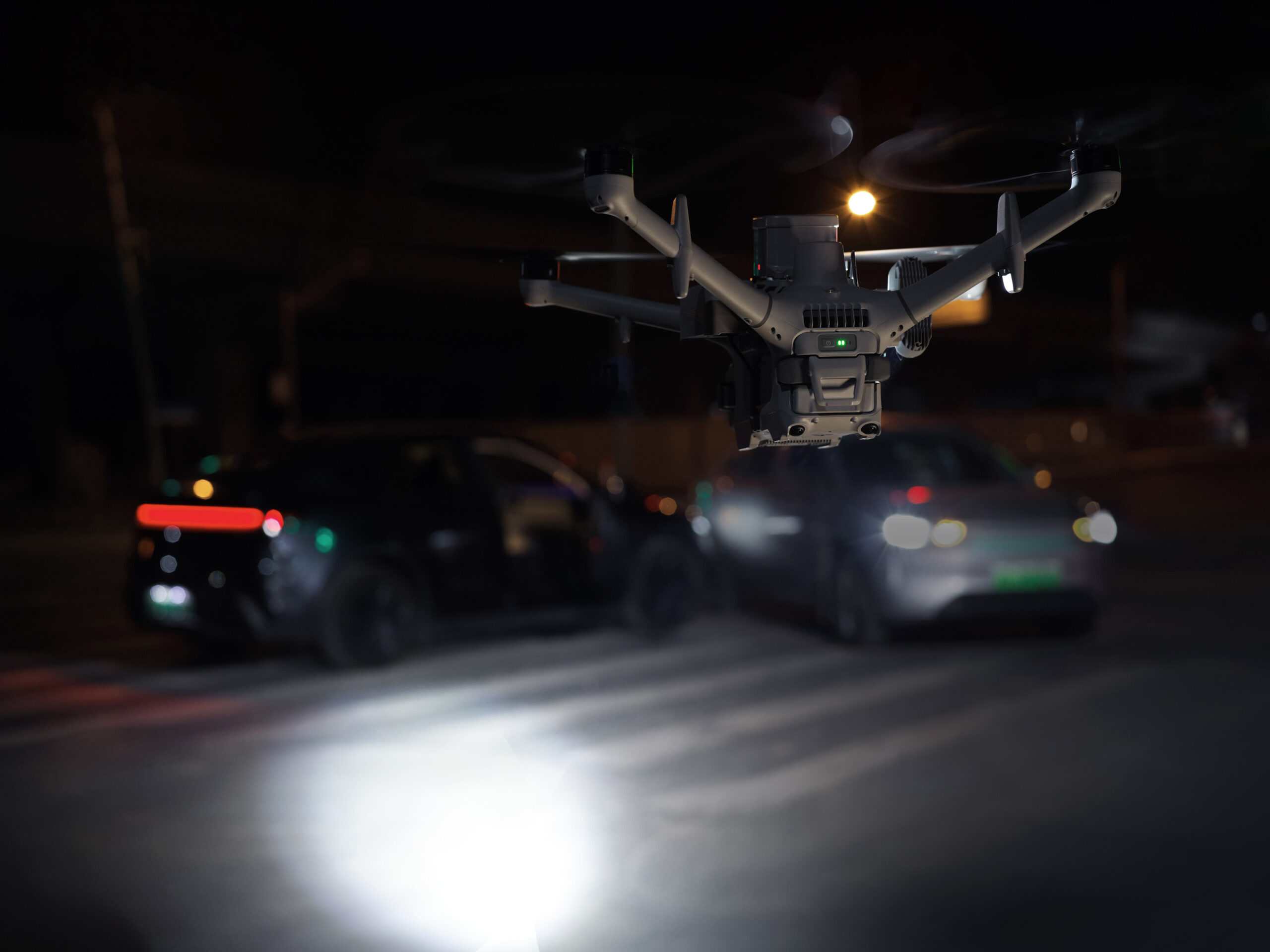
Airborne on Alert, Ahead of Ground Crews
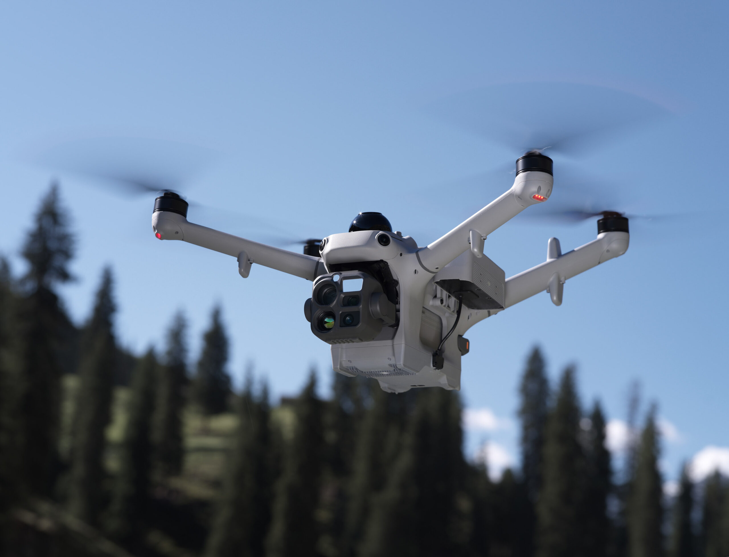
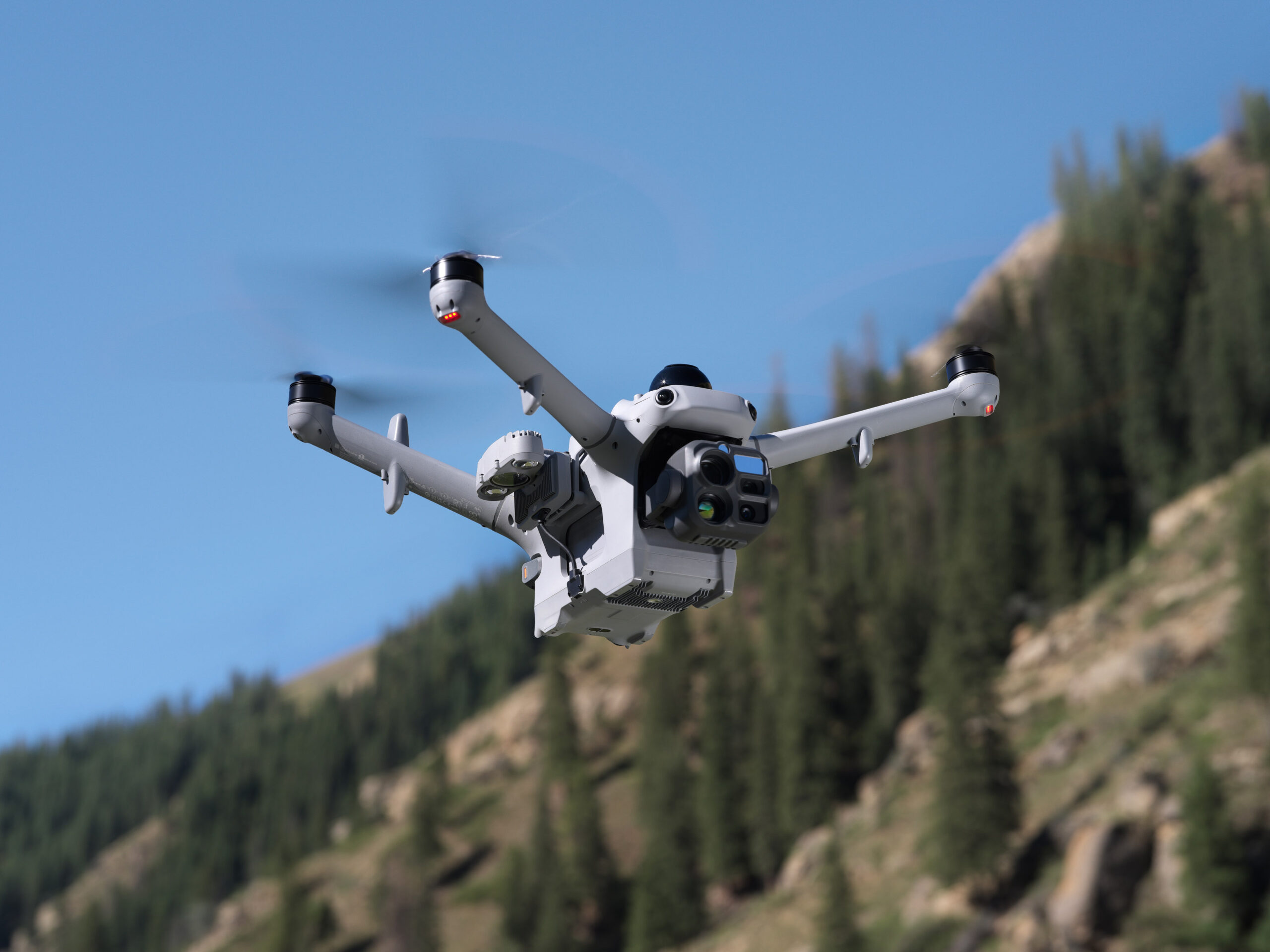
The drone launches as soon as the cover opens, flying to the scene at up to 21 m/s [4] to arrive ahead of ground crews and instantly stream the live video.
Instant Launch: Once a command is issued, the drone launches instantly with no pilot on site needed. Nighttime and holiday emergencies get a response in seconds.
21m/s Rapid Arrival [4]: At a top speed of 21 m/s [4], the drone flies directly to the scene regardless of traffic conditions, saving critical time when it matters most.
Swap, Relay, Sustain
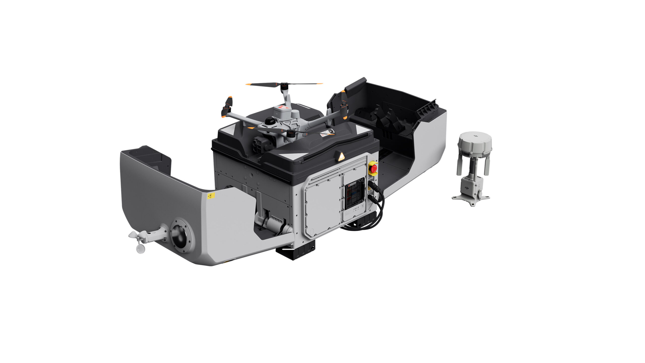
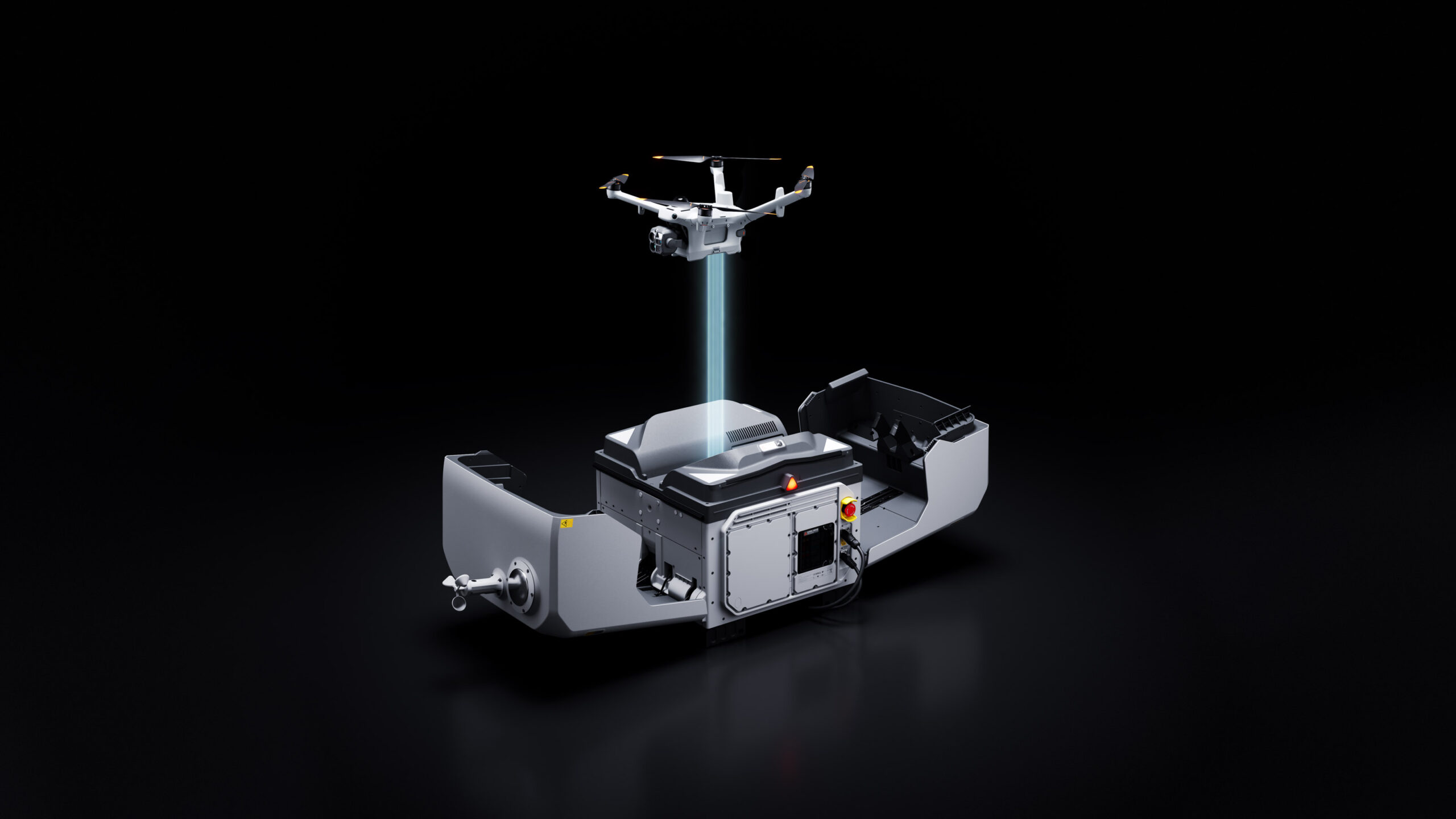
For continuous tasks like emergency response, the dock completes a fully automatic battery swap in just 25 seconds [1], cutting the turnaround between flights from a 30-minute recharge to just seconds.
25-Second Battery Swap: Fully automatic battery swapping takes just 25 seconds [1]. The previous flight’s data transfers automatically during the swap.
Extended Endurance: A single flight lasts up to 59 minutes [5], covering more area in one takeoff.
Wide Operating Temperature Range: Operating reliably from -40° to 50° C (-40° to 122° F), the dock auto-preheats the batteries in the cold, and uses air conditioning in high temperatures.
Task Relay: Any two aircraft in a project can auto-rotate across points, with one flying and the other on standby for uninterrupted situational awareness during emergency responses.
Live From the Scene, Remote Yet Accurate
With low-latency livestreams and high-speed data transfer, remote commanders can access the scene in real time and make decisions from off-site.
Low-Latency Livestream: A dedicated video transmission topology cuts drone-to-cloud latency to about 160 ms [6], down about 43% from the previous generation, for a smoother live view.
Anti-Interference Transmission: Dual 4G modules [7], sub2G transmission [8] and O4 Ground Station deployed at an elevated position deliver stability in obstructed environments.
Fast Data Transfer: During the battery swap, the drone sends flight data to the dock over a high-speed Wi-Fi channel at average speeds of 80MB/s [9].
Multi-Sensor Integration for Greater Versatility
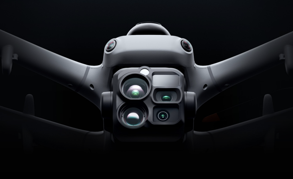
Near and Far, Day and Night
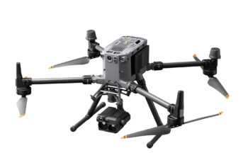
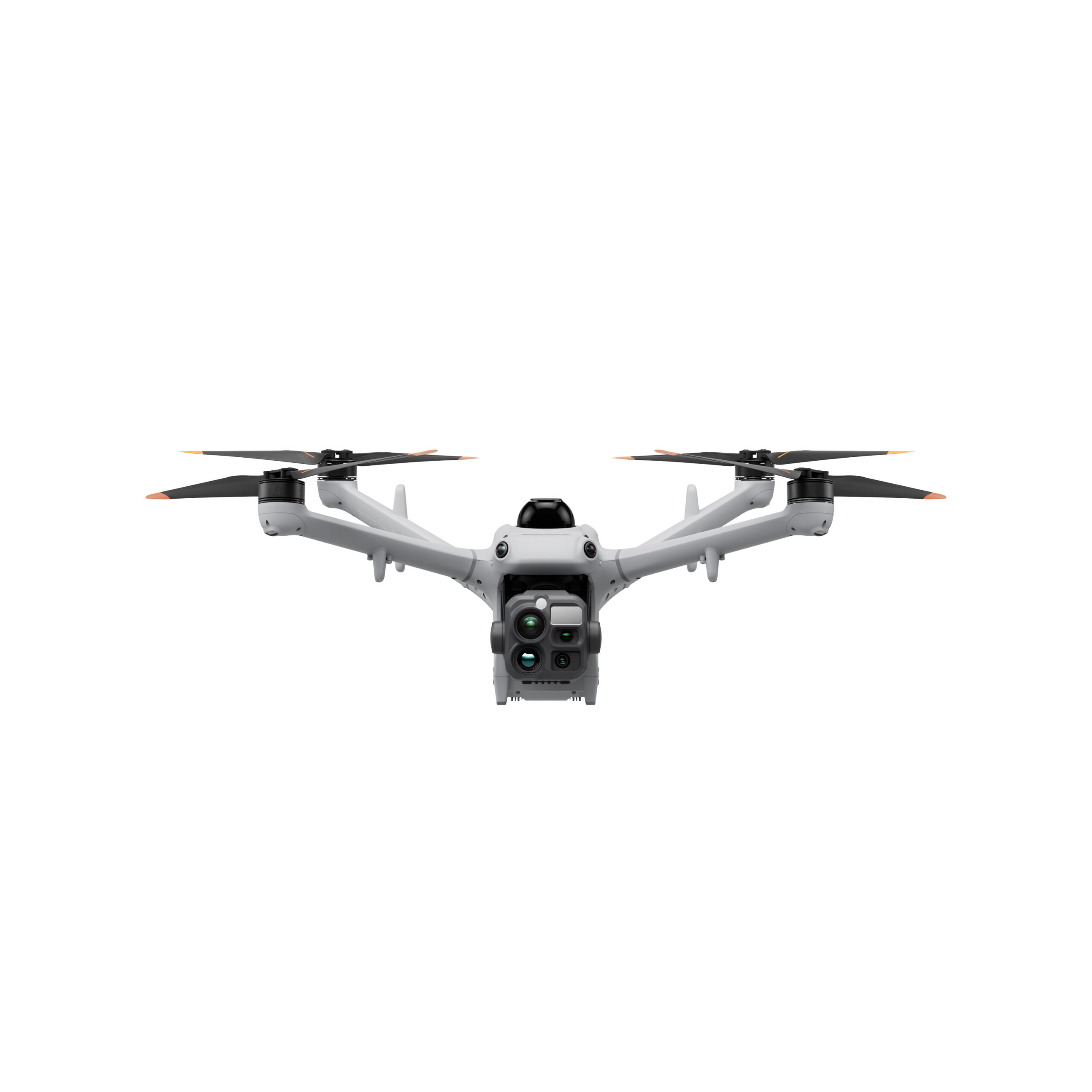
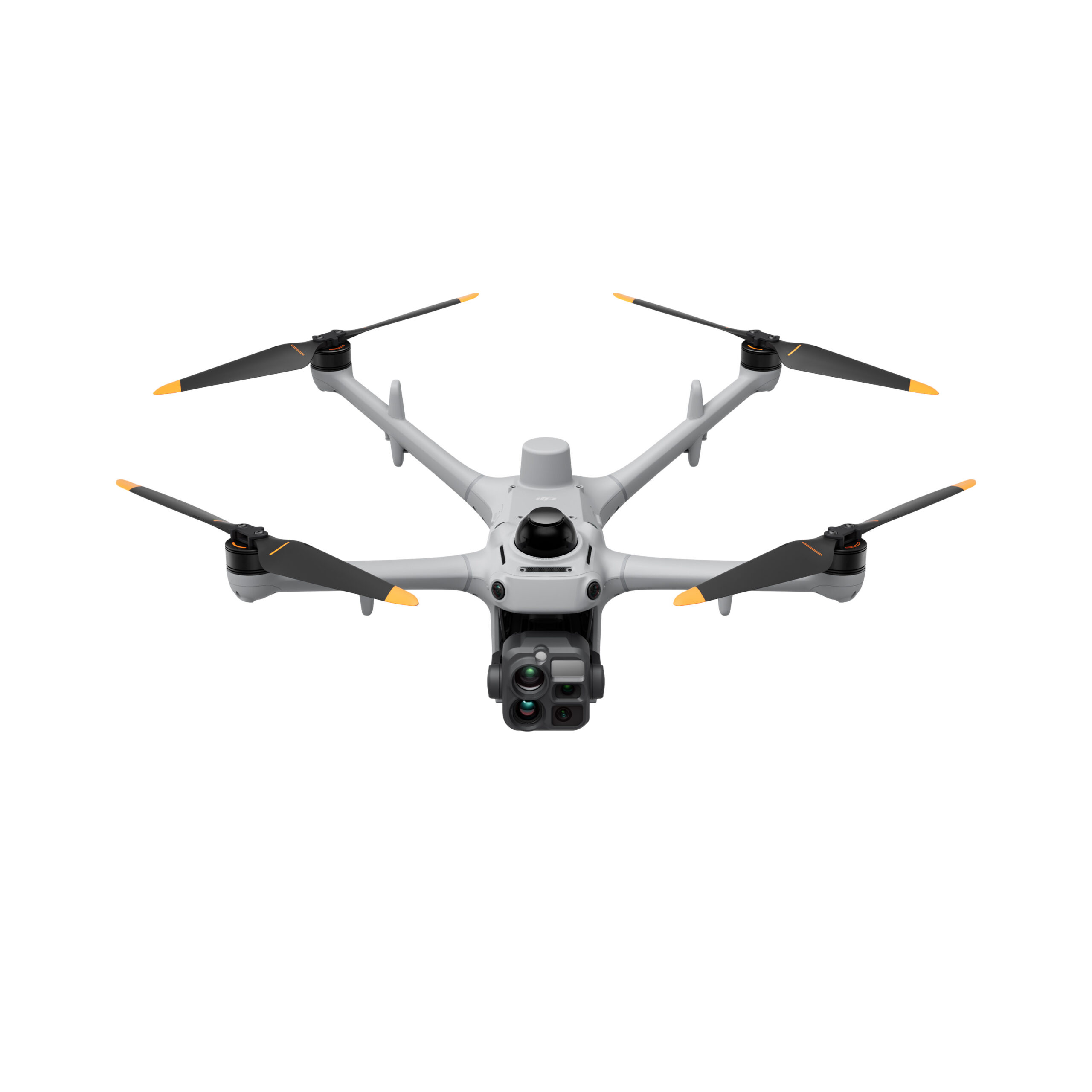
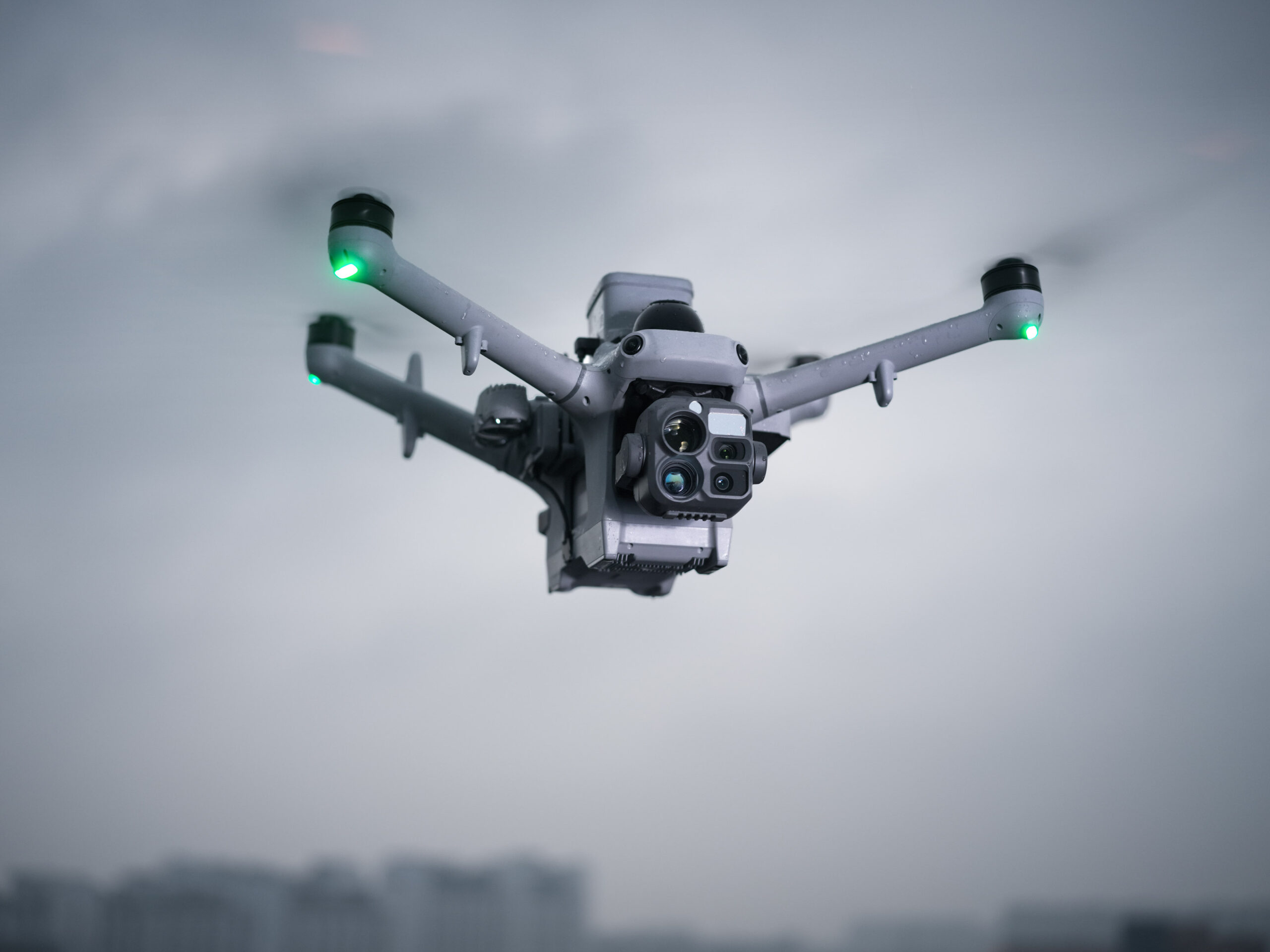
Matrice 5TD combines telephoto imaging, infrared imaging, laser ranging, and full-color night vision while delivering aerial survey accuracy up to 10 cm at 12MP [10]. Daytime inspections, nighttime security, and surveying are all handled by one drone, with no airframe swaps between scenarios, boosting equipment ROI by 50% [24].
11× Telephoto: With a 252 mm equivalent focal length, it captures detail from signs 400 m away [11] and spots bolt- and pin-level defects at 100 m for powerline inspection.
Infrared Camera: Resolution reaches 1280 × 1024, or 2560 × 2048 in UHR mode, revealing overheating and damaged insulators, with 2K recording and 32× zoom for night subjects.
Fusion Mode: Visible-light and infrared feeds fuse into one frame, with edge or overlay fusion modes, showing structure outlines and heat distribution without switching feeds.
Sharper Night Performance: Full-color 4K high-frame-rate night vision captures color images at night without switching on the spotlight. The camera also pairs with the NIR auxiliary light for black-and-white night vision.
3km Laser Ranging: Overlays range data and PinPoint coordinates on the feed for powerline inspections, rescue operations, or wildfire estimates.
More Payloads, More Flexibility
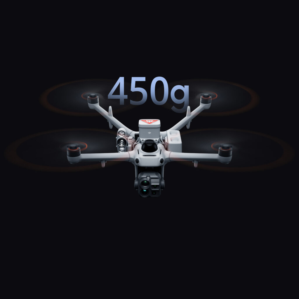
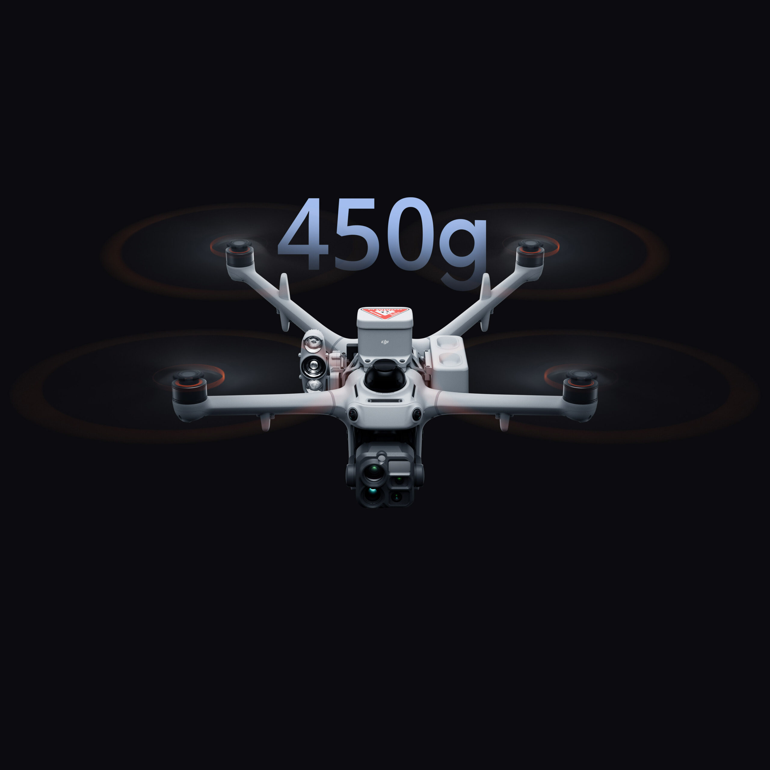
Matrice 5TD carries up to 450 g of payload, with side PSDK mounts and a top mount that can be used simultaneously. Mix and match accessories [12] to suit the task.
450g Max Payload: With three mounting positions [13] and an effective payload capacity of up to 450 g, the drone can provide lighting, broadcasting, and ground safety in a single flight.
Speaker/Spotlight [25]/Parachute Combo: Mount a speaker, spotlight [25], and parachute together to provide aerial voice guidance and layered lighting during nighttime search operations, keeping ground crews safe.
Built-In Customizable Warning Light: A built-in Customizable Warning Light supports custom colors and flash patterns, requiring no additional installation.
Robust Protection for Reliable Flight
Safe Flight, Even in Complex Environments
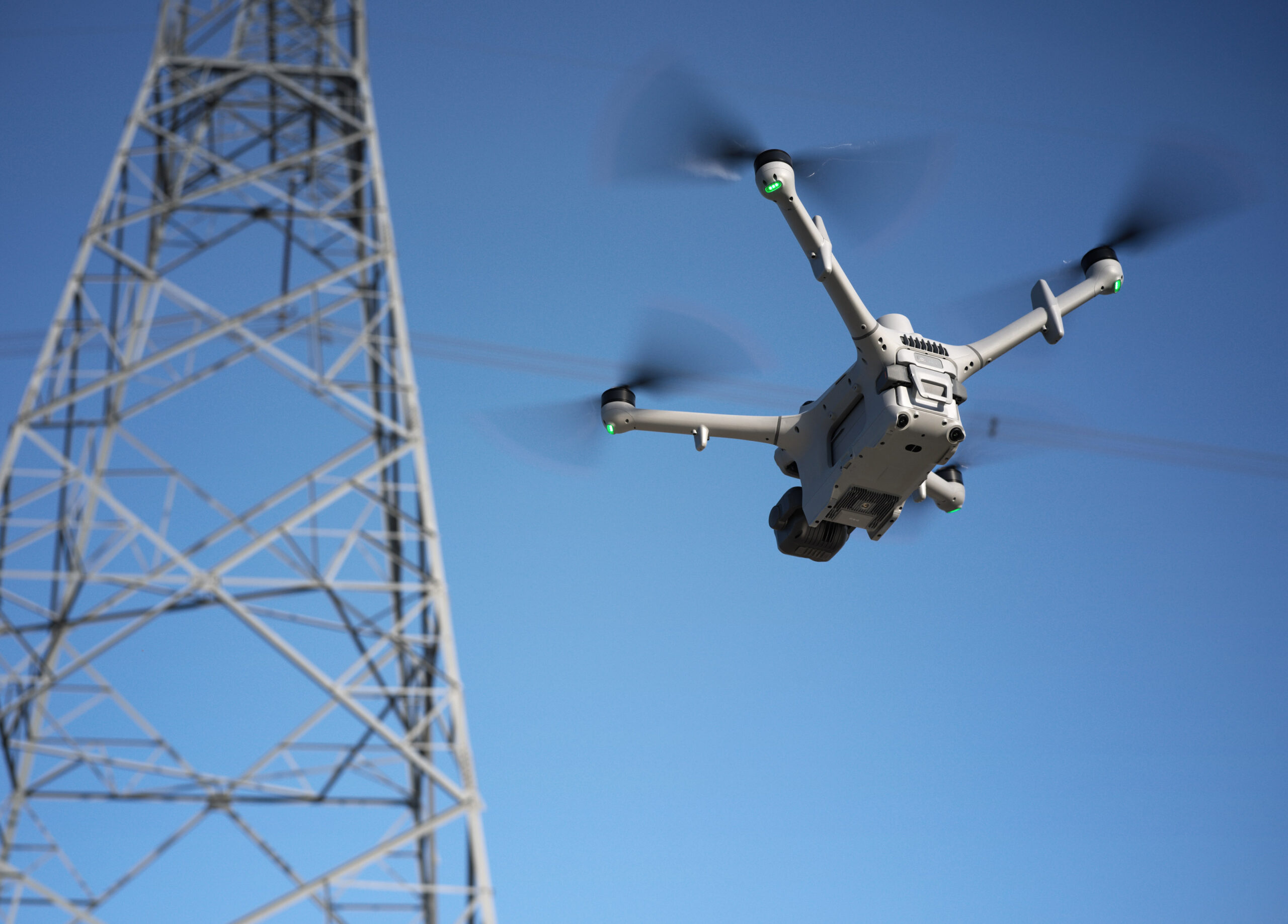
With three-directional mmWave radar, a rotating LiDAR, and a six-directional vision sensing system working together, Matrice 5TD achieves precise obstacle sensing [15], even inside a substation packed with live equipment or around crossing distribution lines.
Wire-Level Obstacle Sensing [15]: Combining a rotating LiDAR, mmWave radar [14], and full-color low-light fisheye sensors, this system detects thin obstacles, including powerlines, even at night.
Full-Color Six-Directional Sensing: Six-directional sensing works with six high-res low-light fisheye sensors to maintain obstacle sensing [15][16] even under city lights at night.
Flexible Deployment for Complex Sites
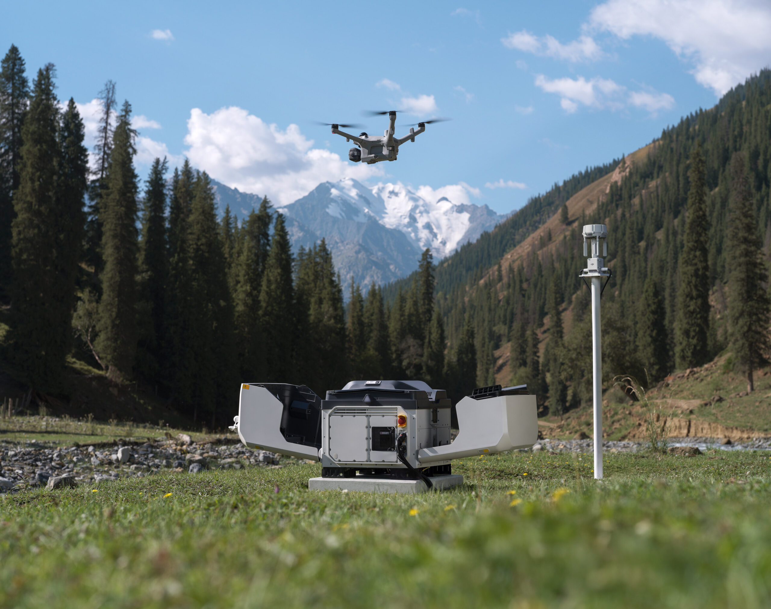
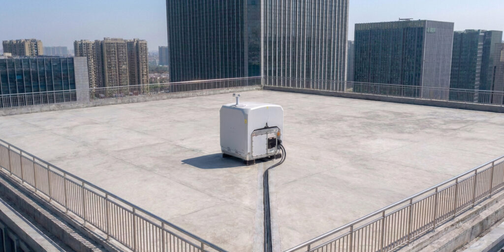
Powered by Matrice 5TD’s LiDAR and visual SLAM, anti-interference and anti-spoofing algorithms, plus the DJI O4 Ground Station [2], DJI Dock 4 can be deployed alongside high-rises [17] or on a mobile vehicle-mounted platform (coming soon) [18].
Near High-Rise Buildings [17]: Installing O4 Ground Station [2] on rooftops improves signal quality, allowing Dock 4 to be deployed near high-rise buildings or along substation walls.
On Vehicles (Coming Soon): The drone can take off while the vehicle is parked and land at the new stop after the vehicle reaches a new location [18].
Multi-Station Roaming: The O4 Ground Station supports multi-station roaming, enabling the drone to seamlessly switch between multiple ground stations to eliminate coverage blind spots.
Safe, Even When the Unexpected Hits
From multi-drone sensing and warning to emergency landing, Matrice 5TD is ready for the unexpected. A parachute cushions descent to protect people and gear on the ground, multi-drone sensing and warning helps keep the skies safe, and High-Wind Descent RTH brings the drone back safely in extreme weather.
Parachute: Top-mounted on Matrice 5TD, featuring independent power, full-link redundancy, auto/manual deployment, and an FTS compliant with EU C5/C6 and UK5/UK6 [19].
Multi-Drone Sensing and Warning: Matrice 5TD’s built-in ADS-B and RID receiver helps warn of nearby aircraft and RID-enabled DJI drones [20], overlaying tracks on the map for safer flight.
High-Wind Descent RTH: Matrice 5TD takes off, lands, and operates in winds up to 12 m/s. When winds spike during return, it descends and heads home safely, even over mountains and forests.
AI-Powered Workflow [3] for Intelligent Operations
Sees More, Understands More
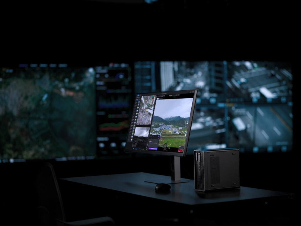
Onboard AI on Matrice 5TD now detects 17 object types in real time, while the Virtual Cockpit allows users to search almost any object type via text or image.
Onboard Detection: Matrice 5TD runs real-time AI detection on the live feed, covering 17 object types, plus infrared hotspot detection and support for third-party AI models.
Generalized Intelligent Detection: Within the Virtual Cockpit, object searches work via text or image. The Multimodal LLM interprets prompts, detects objects, and triggers alerts for situational awareness.
From Alert to Action, Automatically
Once an anomaly is detected, the system can send SMS, email, or platform alerts and trigger actions such as snapshots, recording, tracking, or hovering actions, completing the cycle from detection to response.
FlightHub 2 Copilot: From drone control to flight commands, routes, and scheduled tasks, just describe it in natural language. FlightHub 2 Copilot turns your intent into drone commands.
Automated Workflows: Triggered workflows dispatch drones on third-party alerts such as DFR calls. Periodic workflows automatically handle collection, modeling, analysis, and reporting.
AI Post-Processing: Reports in Minutes
After each operation, the system uses AI to compare the latest data with historical aerial photos or 3D models, automatically annotates the results, and exports a report.
Post-Processing Smart Detection: Compares historical aerial photos to automatically flag facility damage, ground changes, and new unauthorized structures.
Change Detection Pro: AI compares historical aerial photos, marks changed areas, and generates a change report, compressing hours of work into minutes and eliminating frame-by-frame review.
Specifications
| Aircraft – General | Product Name | DJI Matrice 5TD | |
| Aircraft – General | Weight | 2600 g | This value includes the weight of the battery, propellers, and a microSD card, but does not include third-party payloads. The actual weight may vary due to differences in batch materials and external factors. |
| Aircraft – General | Max Takeoff Weight | 3050 g | |
| Aircraft – General | Dimensions | 393×477×230 mm (L×W×H, without propellers) | |
| Aircraft – General | Wheelbase | Diagonal Wheelbase: 549 mm | |
| Aircraft – General | Max Ascent Speed | 6 m/s | |
| Aircraft – General | Max Descent Speed | 6 m/s | |
| Aircraft – General | Max Horizontal Speed (at sea level, no wind) | 21 m/s | Currently, only FlyTo Tasks (Fly to a Target Point) support flight speeds of up to 21 m/s. In other modes, the maximum flight speed is 15 m/s. |
| Aircraft – General | Max Wind Speed Resistance | 12 m/s | |
| Aircraft – General | Max Takeoff Altitude | 6500 m | Aircraft without payload. |
| Aircraft – General | Max Takeoff Altitude at Full Load | 4500 m | |
| Aircraft – General | Max Flight Time | 59 minutes | Measured under the following conditions: in a windless laboratory environment at 20 meters above sea level, with the aircraft flying forward without payload at a constant speed of 15 m/s from 100% battery level until 0%. Results may vary depending on the environment, actual use, and firmware version. |
| Aircraft – General | Max Hovering Time | 55 minutes | Measured with the aircraft hovering in a windless environment at 20 meters above sea level and from 100% battery level until 0%. Results may vary depending on the environment, actual use, and firmware version. |
| Aircraft – General | Max Operating Radius | 10 km | Measured in an environment of approximately 25° C (77° F) with a safe battery level of 15%, windless environment, round-trip flight speed of approximately 15 m/s, and hovering operation without payload of 25 minutes. Results may vary depending on the environment, actual use, and firmware version. |
| Aircraft – General | Max Flight Distance | 53 km | Measured with the aircraft flying at a constant speed of 15 m/s in a windless environment at 20 meters above sea level and from 100% battery level until 0%. Results may vary depending on the environment, actual use, and firmware version. |
| Aircraft – General | Max Pitch Angle | 25° | Currently supported in Normal Mode only. |
| Aircraft – General | Max Angular Velocity | 75°/s | Currently supported in Normal Mode only. |
| Aircraft – General | Global Navigation Satellite System | GPS + Galileo + BeiDou + QZSS + GLONASS | |
| Aircraft – General | Hovering Accuracy Range (windless or breezy) | Vertical:
±0.1 m (with vision positioning) ±0.04 m (with RTK positioning) Horizontal: ±0.3 m (with vision positioning) ±0.02 m (with RTK positioning) |
|
| Aircraft – General | Operating Temperature | -40° to 50° C (-40° to 122° F) | |
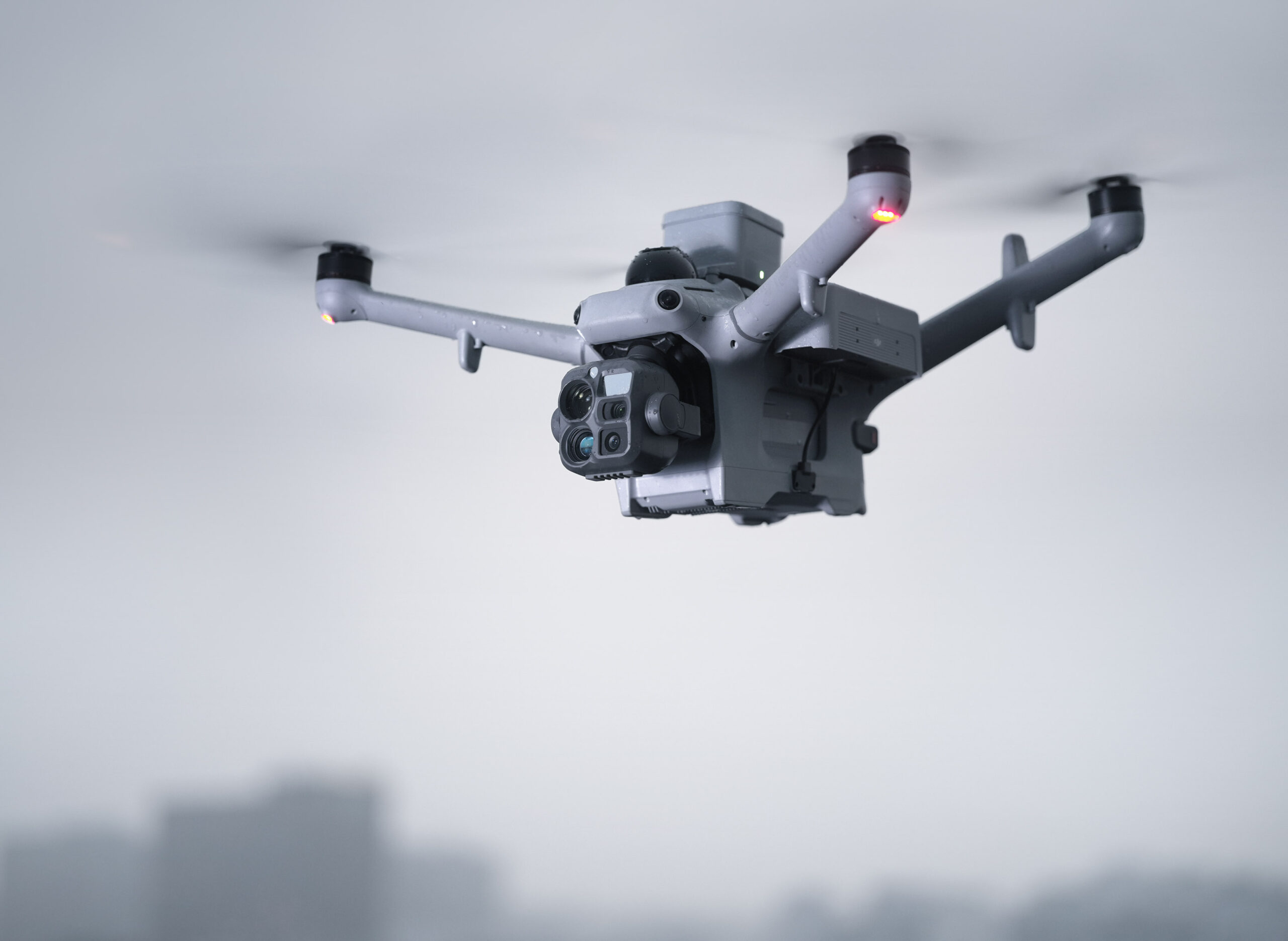
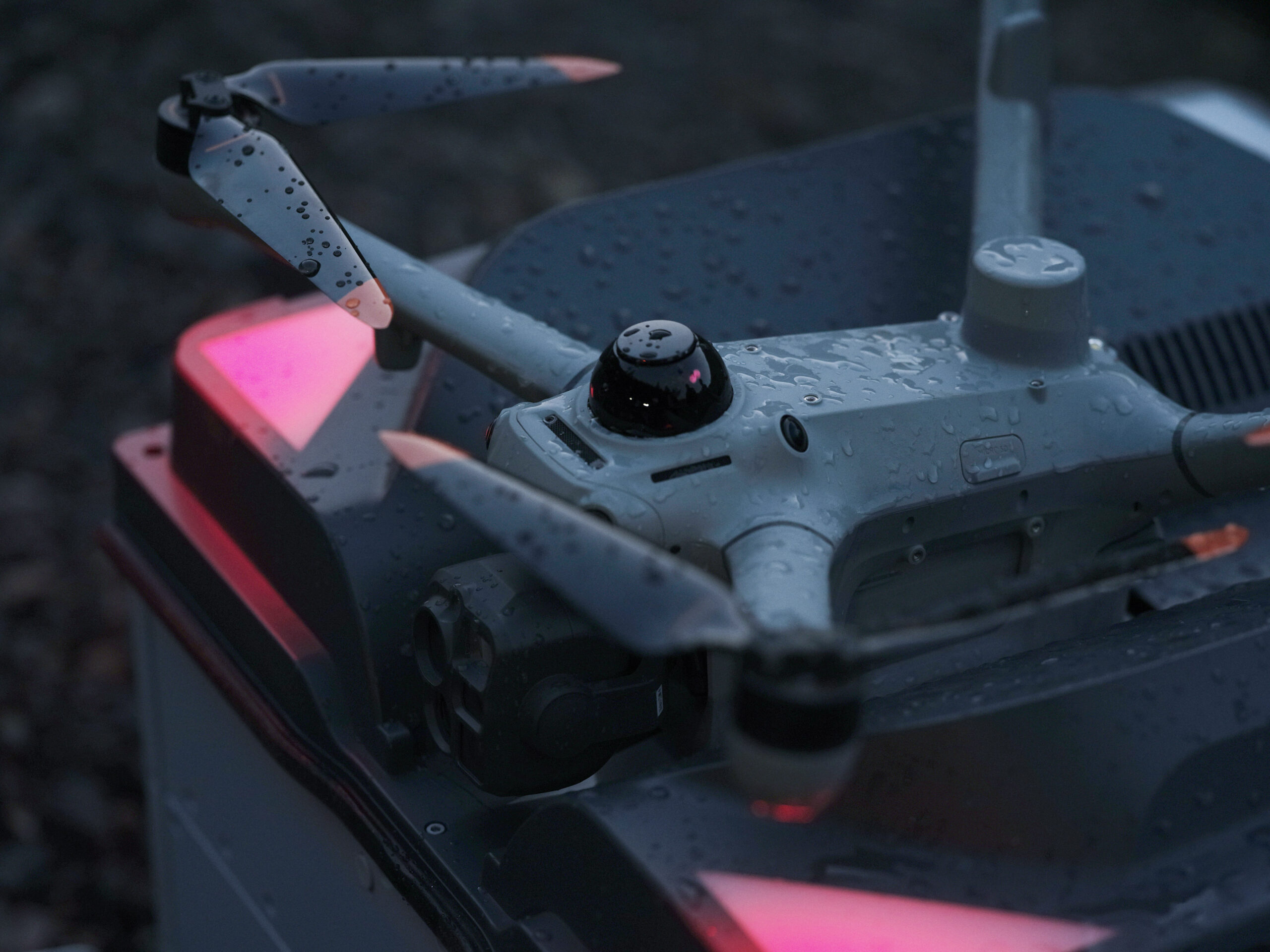
| Aircraft – General | Ingress Protection Rating | IP55 | |
| Aircraft – General | Motor Model | 3409,6 | |
| Aircraft – General | Propeller Model | 1564F foldable low-noise anti-ice propellers | |
| Aircraft – General | RTK Module | Integrated on the aircraft | |
| Aircraft – General | Beacon | Integrated on the aircraft | |
| Aircraft – General | Warning Light | A customizable multicolor warning light, integrated into the bottom of the aircraft | |
| Aircraft – General | Accessory Mounting Points | Two on the sides and one on the top | Requires the Matrice 5TD Accessory Mount. |
| Aircraft – Sensing | Sensing Type | Omnidirectional binocular color vision system; horizontal rotating LiDAR; downward 3D infrared ranging sensor; and forward, upward, and downward mmWave radars | |
| Aircraft – Sensing | Forward | Measurement Range: 0.5 m to 25 m
Detection Range: 0.5 m to 200 m Effective Sensing Speed: Flight Speed ≤ 15 m/s FOV: Horizontal 95°, Vertical 90° |
|
| Aircraft – Sensing | Backward | Measurement Range: 0.5 m to 25 m
Effective Sensing Speed: Flight Speed ≤ 15 m/s FOV: Horizontal 95°, Vertical 90° |
|
| Aircraft – Sensing | Lateral | Measurement Range: 0.5 m to 25 m
Effective Sensing Speed: Flight Speed ≤ 15 m/s FOV: Horizontal 90°, Vertical 90° |
|
| Aircraft – Sensing | Upward | Measurement Range: 0.5 m to 20 m
Effective Sensing Speed: Flight Speed ≤ 10 m/s FOV: Front and Back 95°, Left and Right 90° |
|
| Aircraft – Sensing | Downward | Measurement Range: 0.5 m to 20 m
Effective Sensing Speed: Flight Speed ≤ 8 m/s FOV: Front and Back 90°, Left and Right 95° |
|
| Aircraft – Sensing | Operating Environment | Forward, Backward, Left, Right, and Upward: Surfaces with discernible patterns and adequate lighting (lux > 0.1)
Downward: Diffuse reflective surface with discernible patterns, diffuse reflectivity > 20% (e.g. walls, trees, people), and adequate lighting (lux > 0.1) |
|
| Aircraft – Sensing | Rotating LiDAR | Standard Measurement Range: 110 m @ 100,000 lux with 10% reflectivity target
Measurement Range for Power Line: 32 m @ 30° @ 35,000 lux for 21.6 mm steel-core aluminum stranded wire with a relative body tilt angle of 30° to the left and right 19 m @ 30° @ 35,000 lux for 11 mm black rubber cable (with surface soiling) with a relative body tilt angle of 30° to the left and right Field of View (FOV): 360° (horizontal), 59° (vertical) Point-Frequency: 250,000-460,000 points/second Laser Wavelength: 940 nm Safety Classification: Class 1 (IEC 60825-1:2014) |
|
| Aircraft – Sensing | Downward 3D Infrared Sensor | Measurement Range: 0.3-8 m (reflectivity > 10%)
FOV: Front and Rear 60°, Left and Right 60° |
|
| Aircraft – Sensing | Millimeter-Wave Radar | FOV: Vertical 90°, Horizontal 90°
Front Millimeter-Wave Radar: 40 m measurement range for a 12 mm black rubber cable directly ahead Upper and Lower Millimeter-Wave Radars: 20 m measurement range for a 12 mm black rubber cable directly ahead |
The mmWave radar function may be unavailable or restricted in some countries or regions. Refer to local laws and regulations for more information. |
| Aircraft – Video Transmission | Video Transmission System | DJI O4 Enterprise Enhanced Video Transmission System | |
| Aircraft – Video Transmission | Live View Quality | 1080p/30fps (with DJI Dock 4) | |
| Aircraft – Video Transmission | Video Transmission Transmitter Power (EIRP) | DJI O4 Enterprise Enhanced Video Transmission System:
902-928 MHz: < 30 dBm (IC), < 16 dBm (MIC) 1.430-1.444 GHz: < 35 dBm (SRRC) 2.400-2.4835 GHz: < 33 dBm (IC), < 20 dBm (CE/SRRC/MIC) 5.150-5.250 GHz: < 21 dBm (IC) 5.170-5.250 GHz: < 23 dBm (CE) 5.725-5.850 GHz: < 33 dBm (IC), < 14 dBm (CE), < 30 dBm (SRRC) High-speed Wi-Fi connection (802.11a/b/g/n/ac/ax): 2.4000-2.4835 GHz: < 23 dBm (IC), < 20 dBm (CE/SRRC/MIC) 5.7250-5.8500 GHz: < 23 dBm (IC/SRRC), < 14 dBm (CE) |
The supported operating frequency bands and their corresponding availability vary by country/region. For details, please refer to local laws and regulations. |
| Aircraft – Video Transmission | Max Transmission Distance (unobstructed, free of interference) | IC: 40 km
SRRC: 25 km CE/MIC: 12 km |
Measured in an unobstructed outdoor environment free of interference. The above data shows the farthest communication range for one-way, non-return flights under each standard. Always pay attention to RTH reminders in DJI FlightHub 2 during your flight. |
| Aircraft – Video Transmission | Max Transmission Distance (unobstructed, with interference) | Strong Interference (downtown areas): 2.5-5 km
Medium Interference (suburban counties): 5-15 km Low Interference (remote suburbs/coastal areas): 15-32 km |
Data is tested under IC standard in unobstructed environments of typical interference. Only to serve as a reference and provides no guarantee as to the actual flight distance. |
| Aircraft – Video Transmission | Max Transmission Distance (obstructed, with interference) | Low interference with building obstruction: approx. 0-1 km
Low interference with vegetation obstruction: approx. 1-5 km |
Data is tested under IC standard in obstructed environments of typical interference. Only to serve as a reference and provides no guarantee as to the actual flight distance. |
| Aircraft – Video Transmission | Max Download Speed | 20MB/s (with DJI O4 Enterprise Enhanced Video Transmission System)
80MB/s (via high-speed Wi-Fi connection) |
Measured in a near-field, interference-free lab in countries/regions that support 2.4 GHz/5.8 GHz dual-band. Download speeds may vary; refer to actual experience. The Wi-Fi high-speed channel download starts automatically after the drone lands at the dock and requires the included SD card. 80 MB/s is the maximum transfer rate for large files like video; the transfer rate may decrease when transferring small files such as photos. |
| Aircraft – Video Transmission | Lowest Latency | The latency from the aircraft to the FlightHub 2 cloud platform is 160 milliseconds. | Data is for reference only. Actual latency depends on network conditions and computer specs. |
| Aircraft – Video Transmission | Antenna | 8 antennas
2.4G/5.2G/5.8G: 2T4R sub2G: 2T2R |
Operating frequency allowed varies among countries and regions. Refer to local laws and regulations for more information. |
| Aircraft – Video Transmission | Others | Built-in dual 4G modules
Data usage: ≤ 2.25 GB/30 minutes (dual-SIM dual-active backup transmission) |
4G is not supported in some countries or regions. Please contact your local dealer for details. |
| Aircraft – Storage | Supported Memory Cards | U3/Class10/V30 or above is supported. A list of recommended microSD cards can be found below. | |
| Aircraft – Storage | Recommended microSD Cards | Lexar SILVER PLUS 64GB U3 A2 V30 microSDXC
Lexar SILVER PLUS 128GB U3 A2 V30 microSDXC Lexar SILVER PLUS 256GB U3 A2 V30 microSDXC Lexar SILVER PLUS 512GB U3 A2 V30 microSDXC |
|
| Aircraft – Battery | Capacity | 12138 mAh | |
| Aircraft – Battery | Voltage | 21.42 V | |
| Aircraft – Battery | Max Charging Voltage | 25.8 V | |
| Aircraft – Battery | Cell Type | Li-ion 6S | |
| Aircraft – Battery | Chemical System | LiNiMnCoO2 | |
| Aircraft – Battery | Energy | 260 Wh | |
| Aircraft – Battery | Weight | 925 g | |
| Aircraft – Battery | Cycle Count | 400 | Storage at high temperatures will shorten the battery’s lifespan. If the cumulative storage duration at temperatures above 35° C (95° F) does not exceed 100 days within a 12-month period, the battery can support up to 400 cycles. |
| Aircraft – Battery | Charging Temperature | 10° to 55° C (50° to 131° F) | |
| Aircraft – Battery | Discharge Rate | 3C | |
| Aircraft – Battery | Max Charging Power | 1.8C | |
| Aircraft – Battery | Low-Temperature Charging | Supports low-temperature self-heating charging | |
| Aircraft – Gimbal | Stabilization | 3-axis mechanical gimbal (tilt, roll, pan) | |
| Aircraft – Gimbal | Mechanical Range | Tilt: -140° to +113°
Roll: -52° to +52° Pan: -75° to +75° |
Soft limits: tilt -130° to +90°, roll -47° to +47°, pan -70° to +70°. |
| Aircraft – Gimbal | Controllable Range | Tilt: -90° to +90°
Pan: Not controllable |
|
| Aircraft – Gimbal | Angular Vibration Range | ±0.005° | |
| Aircraft – Gimbal | Max Control Speed (tilt) | 100°/s | |
| Aircraft – Camera | Image Sensor | Wide-Angle Camera: 1/0.98-inch CMOS, Effective Pixels: 50 MP
Medium Tele Camera: 1/1.28-inch CMOS, Effective Pixels: 50 MP Tele Camera: 1/1.5-inch CMOS, Effective Pixels: 50 MP |
|
| Aircraft – Camera | Lens | Wide-Angle Camera
FOV: 85.7° Format Equivalent: 23.5 mm Aperture: f/1.8 Focus: 0.6 m to ∞ Medium Tele Camera FOV: 35° Format Equivalent: 70 mm Aperture: f/2.88 Focus: 3 m to ∞ Tele Camera FOV: 9.7° Format Equivalent: 252 mm Aperture: f/2.8 Focus: 5 m to ∞ |
|
| Aircraft – Camera | Lens Defogging | Wide-angle, medium tele, and tele cameras all support lens defogging. | |
| Aircraft – Camera | ISO Range | Normal Mode: ISO 100 to ISO 25600
Night Scene Mode: Wide-Angle Camera: ISO 100 to ISO 1638400 Medium Tele Camera: ISO 100 to ISO 1638400 Tele Camera: ISO 100 to ISO 1638400 |
|
| Aircraft – Camera | Shutter Speed | Wide-Angle Camera: 2-1/8000 s
Medium Tele Camera: 2-1/8000 s Tele Camera: 2-1/8000 s |
|
| Aircraft – Camera | Max Image Size | Wide-Angle Camera: 8192×6144
Medium Tele Camera: 8192×6144 Tele Camera: 8192×6144 |
|
| Aircraft – Camera | Minimum Photo Interval | 0.5 s | |
| Aircraft – Camera | Still Photography Modes | Wide-Angle Camera:
Single: 12 MP / 50 MP Timed: 12 MP / 50 MP JPEG: 0.5/0.7/1/2/3/5/7/10/15/20/30/60 s Smart Capture: 12 MP Panorama: Approx. 110 MP (stitched image) Medium Tele Camera: Single: 12 MP / 50 MP Timed: 12 MP / 50 MP JPEG: 0.5/0.7/1/2/3/5/7/10/15/20/30/60 s Smart Capture: 12 MP Tele Camera: Single: 12 MP / 50 MP Timed: 12 MP / 50 MP JPEG: 0.5/0.7/1/2/3/5/7/10/15/20/30/60 s Smart Capture: 12 MP |
|
| Aircraft – Camera | Video Codec and Resolution | Video Codec: H.265
Encoding Strategy: CBR, VBR Resolution: 4K: 3840×2160@30fps FHD: 1920×1080@30fps |
|
| Aircraft – Camera | Video Bitrate | H.265: 40 Mbps | |
| Aircraft – Camera | Supported File System | exFAT | |
| Aircraft – Camera | Photo Format | JPEG | |
| Aircraft – Camera | Video Format | MP4, TS | |
| Aircraft – Camera | Digital Zoom | Tele Camera:
16× (176× hybrid zoom) |
|
| Aircraft – NIR Auxiliary Light | Infrared Illumination | FOV: 5.2° to 6.6° | |
| Aircraft – Laser Module | Laser Rangefinding | Normal Incidence Range: 3000 m (1 Hz, @25% reflectivity target*, 8000 m visibility)
Oblique Incidence Range: 1200 m (1 Hz, 1:10 Oblique Distance) Blind Zone: 1 m Ranging Accuracy: (@ 20%-90% reflectivity, 1-10 Hz) Systematic Error: Within 12 m: < 0.1 m 12 m to 100 m: < 0.3 m 100 m to 3000 m: < 1 m Random Error: < 0.1 m (1σ) Safety Classification: Class 1 (IEC 60825-1:2014) |
* Performance degradation may occur in rainy or foggy conditions. |
| Aircraft – Infrared Thermal Camera (DJI Matrice 5TD) | Thermal Imager | Uncooled VOx Microbolometer | DO NOT expose the infrared camera lenses to strong sources of energy such as the sun, lava, or a laser beam. Otherwise, the camera sensor may be burned, leading to permanent damage. |
| Aircraft – Infrared Thermal Camera (DJI Matrice 5TD) | Resolution | 1280×1024 | |
| Aircraft – Infrared Thermal Camera (DJI Matrice 5TD) | Pixel Pitch | 8 μm | |
| Aircraft – Infrared Thermal Camera (DJI Matrice 5TD) | Frame Rate | 30 Hz | |
| Aircraft – Infrared Thermal Camera (DJI Matrice 5TD) | Lens | DFOV: 45°
Format Equivalent: 53 mm Aperture: f/0.85 Focus: 10 m to ∞ |
|
| Aircraft – Infrared Thermal Camera (DJI Matrice 5TD) | Sensitivity | ≤ 50 mK@f/1.0, at an ambient temperature of 25° C (77° F) | |
| Aircraft – Infrared Thermal Camera (DJI Matrice 5TD) | Temperature Measurement Method | Spot Measurement, Area Measurement | |
| Aircraft – Infrared Thermal Camera (DJI Matrice 5TD) | Temperature Measurement Range | High Gain Mode: -40° to 150° C (-40° to 302° F)
Low Gain Mode: 0° to 550° C (32° to 1022° F) |
|
| Aircraft – Infrared Thermal Camera (DJI Matrice 5TD) | Visible-Thermal Fusion | Supported | |
| Aircraft – Infrared Thermal Camera (DJI Matrice 5TD) | Palette | White Hot/Black Hot/Tint/Iron Red/Hot Iron/Arctic/Medical/Fusion/Rainbow 1/Rainbow 2 | |
| Aircraft – Infrared Thermal Camera (DJI Matrice 5TD) | Photo Format | JPEG (8-bit)
R-JPEG (16-bit) DLT-664 |
|
| Aircraft – Infrared Thermal Camera (DJI Matrice 5TD) | Video Resolution | UHR Infrared Image Mode: 2560×2048@30fps
Normal Mode: 1280×1024@30fps |
|
| Aircraft – Infrared Thermal Camera (DJI Matrice 5TD) | Video Bitrate | 12 Mbps (H.265, 1280×1024@30fps)
24 Mbps (H.265, 2560×2048@30fps) |
|
| Aircraft – Infrared Thermal Camera (DJI Matrice 5TD) | Video Format | MP4 | |
| Aircraft – Infrared Thermal Camera (DJI Matrice 5TD) | Still Photography Modes | Single
Normal Mode: 1280×1024 UHR Infrared Image Mode: 2560×2048 Timed Normal Mode: 1280×1024, 0.7/1/2/3/5/7/10/15/20/30/60 s UHR Infrared Image Mode: 2560×2048, 0.7/1/2/3/5/7/10/15/20/30/60 s |
|
| Aircraft – Infrared Thermal Camera (DJI Matrice 5TD) | Digital Zoom | 32× | |
| Aircraft – Infrared Thermal Camera (DJI Matrice 5TD) | Infrared Wavelength | 8-14 μm | |
| Aircraft – Infrared Thermal Camera (DJI Matrice 5TD) | Infrared Temperature Measurement Accuracy | High Gain: ±2° C or ±2%, whichever is greater
Low Gain: ±5° C or ±3%, whichever is greater |
|
| Aircraft – Infrared Thermal Camera (DJI Matrice 5TD) | Temperature Alert | Supported | |
| Aircraft – Infrared Thermal Camera (DJI Matrice 5TD) | Sun Burn Protection | Supported |