What are you looking for?
kr 3 890 – kr 151 200 eks. MVA
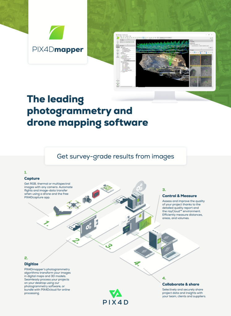
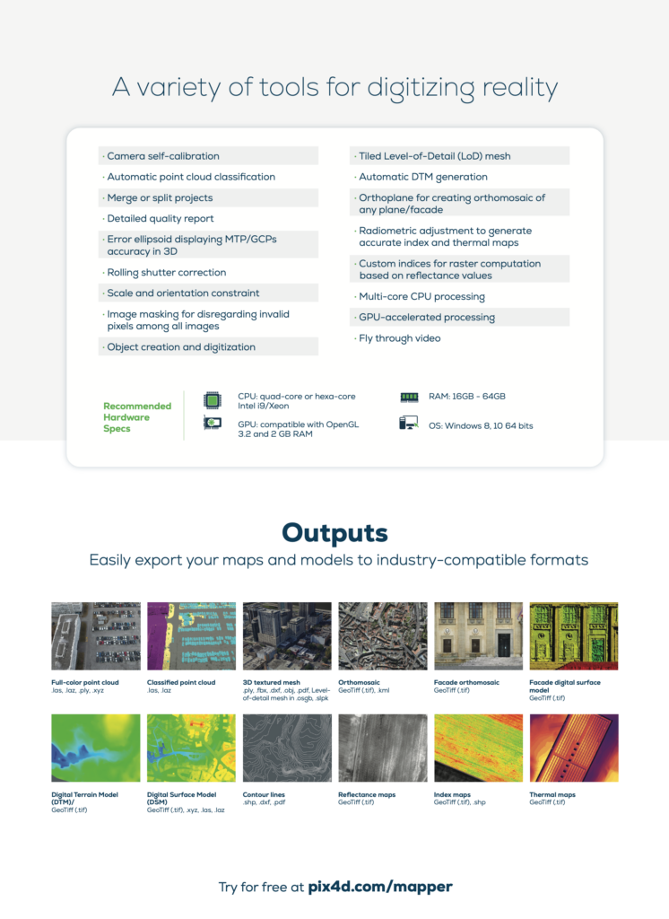
Reliable photogrammetry software for classic drone mapping.
Transform your images into survey-grade accurate and georeferenced orthomosaics, points clouds, 2D maps, and 3D models for analysis, inspections, and measurements.
Månedlig, Årlig, One-Time Charge Commercial, One-Time Charge Non-Commercial