Beskrivelse
![]()

Prisområde: kr 990 til kr 21 340 eks. MVA
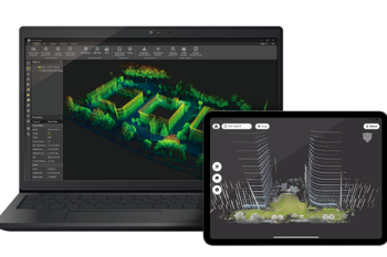
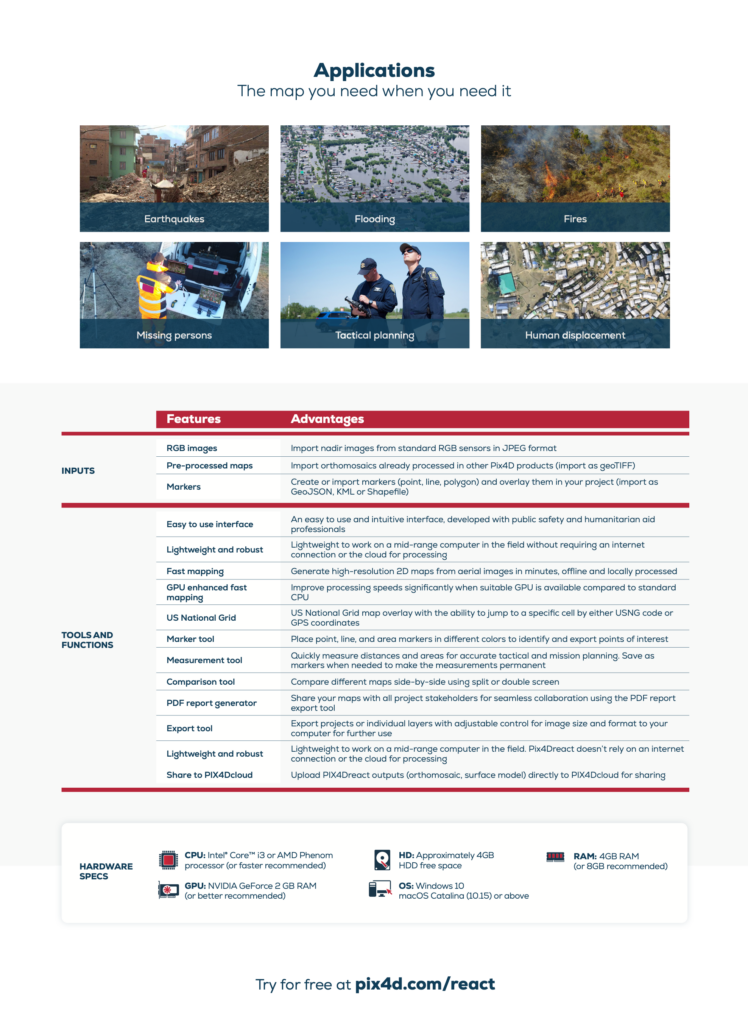
Accurate 2D maps from aerial imagery for reliable situational awareness, processed in minutes.
Mark, measure, and document points of interest on your maps while on the ground and easily share them to provide powerful data for when every second counts.
![]()
| Lisens varighet | Månedlig, Årlig, 3-år, One Time Charge Non-Commercial |
|---|